Religionsgeschichtliche Karte
Iudaea seu Palaestina ob sacratissima Redemtoris vestigia hodie dicta Terra Sancta. Mit einer Nebenkarte: Populi Israelitici ex Aegypto per Desertum in Terram Promissionis Canaan quadraginta annorum Iter. Stat. et Profectio.
- Alternative title
-
IVDAEA SEV PALAESTINA / ob sacratissima Redemtoris vestigia hodie dicta / TERRA SANCTA / prout olim
- Location
-
Deutsches Historisches Museum, Berlin
- Inventory number
-
Do 2006/181
- Measurements
-
Höhe x Breite: 55,5 x 64,3 cm (Blatt)
Höhe x Breite: 46,3 x 54,4 cm (Karte)
Höhe x Breite: 49,2 x 56,8 cm (Platte)
- Material/Technique
-
Druckfarbe, Papier, Kupferstich, koloriert
- Classification
-
Kartografie (Gattung)
- Subject (what)
-
Palästina
Israel
- Event
-
Herstellung
- (who)
-
Kartograf: Guillaume Sanson
Kartograf, Geograph, Verleger: Johann Baptist Homann
- (where)
-
Nürnberg, Deutschland [historisch: Heiliges Römisches Reich]
- (when)
-
zwischen 1702 und 1707
- Rights
-
Deutsches Historisches Museum
- Last update
-
24.03.2023, 9:31 AM CET
Data provider
This object is provided by:
Stiftung Deutsches Historisches Museum. If you have any questions about the object, please contact the data provider.
Stiftung Deutsches Historisches Museum. If you have any questions about the object, please contact the data provider.
Object type
- Religionsgeschichtliche Karte
Associated
- Kartograf: Guillaume Sanson
- Kartograf, Geograph, Verleger: Johann Baptist Homann
Time of origin
- zwischen 1702 und 1707
Other Objects (12)
Diss. acad. sistens iter Israelitarum ex Aegypto ad terram Canaan
Diss. acad. sistens iter Israelitarum ex Aegypto ad terram Canaan

In sacratissima nocte
Canaán
Canaan.
Canaan
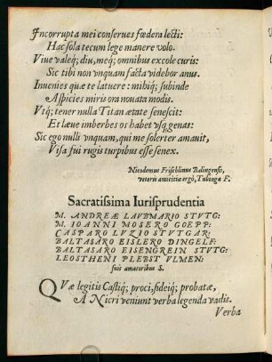
B2v-C3r, Sacratissima Iurisprudentia

Terra promissionis topographice descripta
![[Vorrede zu Formula Promissionis]](https://iiif.deutsche-digitale-bibliothek.de/image/2/bf3ad201-3339-4030-be86-6283e82f8093/full/!306,450/0/default.jpg)
[Vorrede zu Formula Promissionis]
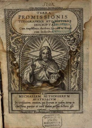
Terra promissionis topographice descripta
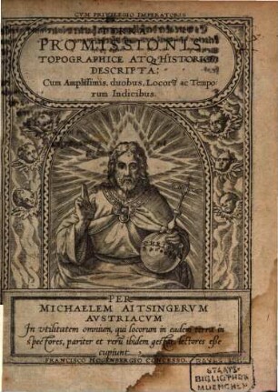
Terra promissionis topographice descripta

Caput VII. De anno Vocationis, traditae promissionis & coeptae peregrinationis Abrahami in terra Canaan, & principio annorum 430. Exod. 12. Gal. 3.
Diss. acad. sistens iter Israelitarum ex Aegypto ad terram Canaan
Diss. acad. sistens iter Israelitarum ex Aegypto ad terram Canaan
In sacratissima nocte
Canaán
Canaan.
Canaan
B2v-C3r, Sacratissima Iurisprudentia
Terra promissionis topographice descripta
[Vorrede zu Formula Promissionis]
Terra promissionis topographice descripta
Terra promissionis topographice descripta