- Alternative title
-
Mapp. IV,131 gpy
- Location
-
München, Bayerische Staatsbibliothek -- Cod.icon. 180 ubm
- Dimensions
-
34 x 37 cm, Blattgröße 51 x 37 cm
- Extent
-
1 Karte - Papier
- Language
-
Französisch
- Notes
-
Region: Brest
Maßstab in graphischer Form (200 Toises)
Mit ausführlichen Erläuterungen links und rechts neben der Karte
Ausstattung: Tusche und Aquarell auf Papier
BSB-Provenienz: Mit Stempel: K:B: Kriegs Ministerium, Signaturschildchen I.No. 3271
Altsignatur: Mapp. IV,131 gpy
Kurzaufnahme einer Handschrift
- Keyword
-
Brest
- URN
-
urn:nbn:de:bvb:12-bsb00111767-4
- Last update
-
27.11.2025, 8:47 AM CET
Data provider
This object is provided by:
Bayerische Staatsbibliothek. If you have any questions about the object, please contact the data provider.
Bayerische Staatsbibliothek. If you have any questions about the object, please contact the data provider.
Object type
- kartografisches Bild
Associated
Time of origin
- 1812
Other Objects (12)
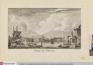
Port de Brest

Histoire de la ville et du port de Brest, 4

Histoire de la ville et du port de Brest, 2

Histoire de la ville et du port de Brest, 3

Histoire de la ville et du port de Brest, 1

Plan de la Ville de Brest. Mit einer Nebenkarte: Carte de la Rade et du Port de Brest
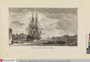
Vüe de l'Entrée du Port de Brest

Plan de la ville, du port et Arcenal de marine de Brest avec la Riviere de Penfeld

Les Ports militaires de la France, 1. Brest
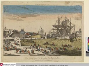
Vue perspective des Bassins du Port de Brest

PLAN// DE LA VILLE// DE// BREDA - BSB Cod.icon. 180 ufb

Plan de la ville, château et port de Siracuse
Port de Brest
Histoire de la ville et du port de Brest, 4
Histoire de la ville et du port de Brest, 2
Histoire de la ville et du port de Brest, 3
Histoire de la ville et du port de Brest, 1
Plan de la Ville de Brest. Mit einer Nebenkarte: Carte de la Rade et du Port de Brest
Vüe de l'Entrée du Port de Brest
Plan de la ville, du port et Arcenal de marine de Brest avec la Riviere de Penfeld
Les Ports militaires de la France, 1. Brest
Vue perspective des Bassins du Port de Brest
PLAN// DE LA VILLE// DE// BREDA - BSB Cod.icon. 180 ufb