Karte
Carta Geo-Hydrographica da Ilha De Porto Santo e dos Ilhéos E Baixos Adjacentes
- Location
-
Leibniz-Institut für Länderkunde e.V., Leipzig
- Collection
-
Collection Alphons Stübel
- Other number(s)
-
HK 1569 (Signatur)
- Material/Technique
-
unkolor.
- Inscription/Labeling
-
Maßstab in graph. Form (Mil. Geo, Kil.). - Titel unten Mitte. - Erkl. der Zeichen unten rechts. - Mit Reiseroute. - Mit Tiefenangaben. - Mit 5 Profilen: Vista de Porto Santo tirada do ancoradouro. Vista de Porto Santo demorando o Ilheo de Fora ao S. 40°E. Vista de Porto Santo demorando o Ilhéo de Ferro ao S. 30°O. Vista de Porto Santo demorando o Ilhéo de Fora ao S. 13°O. Vista de Porto Santo tirada da baixa do Falcão na sonda de 28 br. demorando o Ilhéo de Fóra ao S. 40°E. - Mit 1 Plan: Planta do Forte de S. José e do quartel do governador militar da Ilha de Porto Santo. - Relief: Schraffen
- Subject (what)
-
Altkarte
Insel
Afrikanische Inseln im Atlantischen Ozean
Porto Santo
- Event
-
Veröffentlichung
- (who)
-
Imprensa Nacional (Verlag)
- (where)
-
[S.l.]
- (when)
-
1877
- Rights
-
Leibniz-Institut für Länderkunde e.V.
- Last update
-
15.05.2025, 12:43 PM CEST
Data provider
This object is provided by:
Leibniz-Institut für Länderkunde e. V.. If you have any questions about the object, please contact the data provider.
Leibniz-Institut für Länderkunde e. V.. If you have any questions about the object, please contact the data provider.
Object type
- Karte
Associated
- Imprensa Nacional (Verlag)
Time of origin
- 1877
Other Objects (12)
[Fotografia do Santos, Ilha Porchat)
![Carta Geo-Hydrographica da Ilha da Madeira e dos Ilheus Baixos Adjacentes : [mittlerer Teil]](https://iiif.deutsche-digitale-bibliothek.de/image/2/20c220c3-462d-44d9-9be6-f480a03d0dae/full/!306,450/0/default.jpg)
Carta Geo-Hydrographica da Ilha da Madeira e dos Ilheus Baixos Adjacentes : [mittlerer Teil]
![[Carta Geo-Hydrographica da Ilha da Madeira e dos Ilheus Baixos Adjacentes] : [linker Teil]](https://iiif.deutsche-digitale-bibliothek.de/image/2/61ba233e-03bd-495f-8358-b3919302c1b0/full/!306,450/0/default.jpg)
[Carta Geo-Hydrographica da Ilha da Madeira e dos Ilheus Baixos Adjacentes] : [linker Teil]
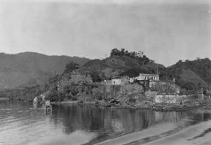
Ilha de Santo Amaro, Festung von Santo Amaro da Barra Grand

Madeira, Porto Santo
Madeira, Porto Santo
Madeira, Porto Santo
Madeira - Porto Santo
Madeira, Porto Santo
Madeira, Porto Santo
Madeira, Porto Santo
Madeira : Porto Santo
[Fotografia do Santos, Ilha Porchat)
Carta Geo-Hydrographica da Ilha da Madeira e dos Ilheus Baixos Adjacentes : [mittlerer Teil]
[Carta Geo-Hydrographica da Ilha da Madeira e dos Ilheus Baixos Adjacentes] : [linker Teil]
Ilha de Santo Amaro, Festung von Santo Amaro da Barra Grand
Madeira, Porto Santo
Madeira, Porto Santo
Madeira, Porto Santo
Madeira - Porto Santo
Madeira, Porto Santo
Madeira, Porto Santo
Madeira, Porto Santo