Karten und Pläne
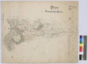
[Vermessung von Hofplatz und Baumgarten des Bronnbacher Hofs zu Allersheim] (Inselkarte)
Enthält: Hof im Grundriss, Baumgarten bildhaft
- Reference number
-
Landesarchiv Baden-Württemberg, Abt. Staatsarchiv Wertheim, R-K Nr. 351
- Dimensions
-
31 x 45 (Höhe x Breite)
- Notes
-
Makrofiche vorhanden
- Further information
-
Ausführung: Federzeichnung; handkoloriert
Maßstab: [1:250]
- Context
-
Karten und Pläne >> C. Bayern >> C.9. Giebelstadt >> C.9.1. Allersheim
- Holding
-
Landesarchiv Baden-Württemberg, Abt. Staatsarchiv Wertheim, R-K Karten und Pläne
- Indexentry place
-
Allersheim : Giebelstadt WÜ
- Creator
-
Autor/Fotograf: Jakob Lohr
- Date of creation
-
1798
- Other object pages
- View digital item at providers-website
- Rights
-
Es gelten die Nutzungsbedingungen des Landesarchivs Baden-Württemberg.
- Last update
-
26.03.2024, 9:04 AM CET
Data provider
This object is provided by:
Landesarchiv Baden-Württemberg. If you have any questions about the object, please contact the data provider.
Landesarchiv Baden-Württemberg. If you have any questions about the object, please contact the data provider.
Object type
- Karten und Pläne
Associated
- Autor/Fotograf: Jakob Lohr
Time of origin
- 1798
Other Objects (12)
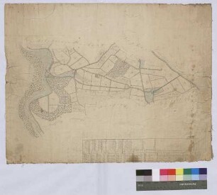
Bronnbacher Höfe (Inselkarte)
Felderanblümung der Höfe auf Bronnbacher Gemarkung (Inselkarte)
![[Neuabsteinung der Bronnbacher Gemarkung gegen Höhefeld] (Inselkarte)](https://iiif.deutsche-digitale-bibliothek.de/image/2/50ef1175-b4d2-412d-a523-05ed432f4235/full/!306,450/0/default.jpg)
[Neuabsteinung der Bronnbacher Gemarkung gegen Höhefeld] (Inselkarte)
![[Neueinteilung der Höfe auf Bronnbacher Gemarkung] (Inselkarte)](https://iiif.deutsche-digitale-bibliothek.de/image/2/944ac05d-6c03-4fc9-91a3-dbbb23eef5b9/full/!306,450/0/default.jpg)
[Neueinteilung der Höfe auf Bronnbacher Gemarkung] (Inselkarte)
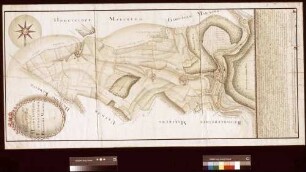
Geometrischer Hauptplan von der Bronnbacher Markung (Inselkarte)
Felderanblümung der Höfe auf Bronnbacher Gemarkung (Inselkarte)

(Hofplatz)
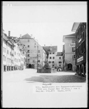
Hofplatz
Manual über Gült und Zehnt des Bronnbacher Hofs in Würzburg zu Allersheim
![[Vermessung der Bronnbacher Gemarkung östlich der Tauber] (Inselkarte)](https://iiif.deutsche-digitale-bibliothek.de/image/2/7e0290fe-dbac-438f-9244-c71d4cccb019/full/!306,450/0/default.jpg)
[Vermessung der Bronnbacher Gemarkung östlich der Tauber] (Inselkarte)

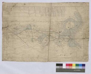
Verjüngte Hauptkarte über die Bronnbacher Markung 1806 (Inselkarte)
Ärmelabzeichen der Freiwilligen Feuerwehr Allersheim mit dem Wappen des Bronnbacher Abtes Engelbert Schäffner
Bronnbacher Höfe (Inselkarte)
Felderanblümung der Höfe auf Bronnbacher Gemarkung (Inselkarte)
[Neuabsteinung der Bronnbacher Gemarkung gegen Höhefeld] (Inselkarte)
[Neueinteilung der Höfe auf Bronnbacher Gemarkung] (Inselkarte)
Geometrischer Hauptplan von der Bronnbacher Markung (Inselkarte)
Felderanblümung der Höfe auf Bronnbacher Gemarkung (Inselkarte)
(Hofplatz)
Hofplatz
Manual über Gült und Zehnt des Bronnbacher Hofs in Würzburg zu Allersheim
[Vermessung der Bronnbacher Gemarkung östlich der Tauber] (Inselkarte)
Verjüngte Hauptkarte über die Bronnbacher Markung 1806 (Inselkarte)