Regionalkarte
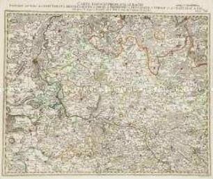
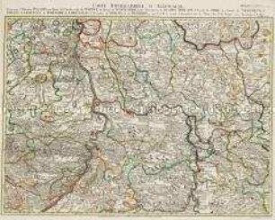
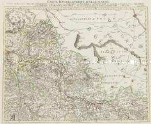
Grand Atlas . Bl. 34 (Sachsen, Oberlausitz, Böhmen): Contenant une Partie de l'Electorat de Saxe la Lusace Superieure, les Extrêmités du Rauyome de Boheme
- Alternative title
-
CARTE TOPOGRAPHIQUE D'ALLEMAGNE / Contenant une Partie de l'ELECTORAT de SAXE la Lusace Superieure, les Extrêmités du Rauyome de BOHEME
- Location
-
Deutsches Historisches Museum, Berlin
- Inventory number
-
Do 2006/1059.34
- Measurements
-
Höhe x Breite: 56,5 x 78 cm, Höhe: 56,5 cm, Breite: 78 cm, Tiefe: 3 cm (Atlas)
Höhe x Breite: 56,5 x 78 cm (Blatt)
Höhe x Breite: 52 x 68 cm (Platte)
Höhe x Breite: 46 x 59 cm (Karte)
- Material/Technique
-
Papier, Kupferstich, koloriert, gebunden |Fadenheftung
- Classification
-
Kartografie (Gattung)
- Subject (what)
-
Deutschland
- Event
-
Herstellung
- (who)
-
Verleger, Militärkartograph: Johann Wilhelm Abraham Jaeger
Stecher: Heinrich Hugo Cöntgen
- (where)
-
Frankfurt (Main) [historisch: Frankfurt, Reichsstadt], Deutschland
- (when)
-
um 1785
- Rights
-
Deutsches Historisches Museum
- Last update
-
24.03.2023, 9:28 AM CET
Data provider
This object is provided by:
Stiftung Deutsches Historisches Museum. If you have any questions about the object, please contact the data provider.
Stiftung Deutsches Historisches Museum. If you have any questions about the object, please contact the data provider.
Object type
- Regionalkarte
Associated
- Verleger, Militärkartograph: Johann Wilhelm Abraham Jaeger
- Stecher: Heinrich Hugo Cöntgen
Time of origin
- um 1785
Other Objects (12)
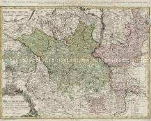
Carte de l'Electorat de Brandebourg
Grand Atlas . Bl. 24 (Brandenburg, Magdeburg, Anhalt, Sachsen): Contenant une Partie de l'Electorat de Brandenbourg le Duche de Magdebourg le Principaute d'Anhalt et de l'Electorat de Sax et et.

Grand Atlas . Bl. 60 (Bayern, Freising, Salzburg): Contenant une grande Partie de l'Electorat de Baviere, de l'Eveché de Freisingengen, une Partie de l'Archeveché de Saltzbourg et
Grand Atlas . Bl. 48 (Frankreich, Pfalz, Falkenstein, Leiningen, Bitsch): Contenant le Duché de Deux Ponts, une Partie du Duché de Lorraine, de l'Electorat de Palatinat, les Comtés de Falckenstein, Leiningen, Bitsche et et (Verbessertes Blatt)
Duchés de Bergue et Juliers Electorat de Cologne Gueldre et Comté de Meurs
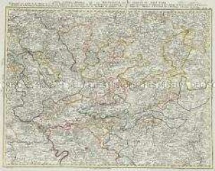
Grand Atlas . Bl. 49 (Pfalz, Mainz, Württemberg, Baden...): Contenant l'Electorat Palatin, une Partie de l'Archeveché de Mayence, du Duché de Würtemberg, et du Marcgraviat de Baaden=Durlach, l'Eveché de Spire les Comtés de Wertheim, d'Erpach, de Leiningen, de Hohenlohe, de Lowenstein, le Territoire de Worms, et de Heilbron et et (neu verbessertes Blatt)
Grand Atlas . Bl. 78 (Tirol, Kärnten, Brixen): Contenant une Partie du Comte de Tirol et du Duche de Carinthie Superieure et l'Eveche de Brixen
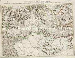
Grand Atlas . Bl. 40 (Wetterau, Oberrhein...): Contenante une partie de la Hesse et de Hesse Darmstadt, les Principautés de Nassau, de Hanau, une partie de l'Archêveché Electorale de Mayence et de l'Abbaye de Fuld, les Comtés et Principautés de Solms, de Stollberg, d'Ysemborg, de Goertz, de Runckel, et de plusieures Seigneuries et Territoires de quelques Villes de l'Empire etc.
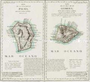
Mapa de la Isla de la Palma / Mapa de la Isla de la Gomera
Grand Atlas . Bl. 26 (Niederschlesien): Contenant une Partie de la Silesie Inferieure, savoir les Cercles de Schwibus de Grunberg de Freystadt de Sagan de Glogau de Sternberg et de Guhrau le Baronie de Beuthen et et
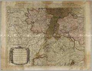
Table Geographique dans la quelle fort distinctement est montre la Partie Meridionale ou Superieure du Rhein, Meuse Moselle et les moindres rivieres qui se decharchent dans elles
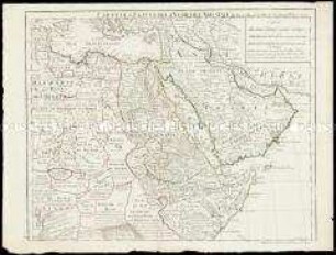
Carte de l'Egypte de la Nubie de l'Abissinie
Carte de l'Electorat de Brandebourg
Grand Atlas . Bl. 24 (Brandenburg, Magdeburg, Anhalt, Sachsen): Contenant une Partie de l'Electorat de Brandenbourg le Duche de Magdebourg le Principaute d'Anhalt et de l'Electorat de Sax et et.
Grand Atlas . Bl. 60 (Bayern, Freising, Salzburg): Contenant une grande Partie de l'Electorat de Baviere, de l'Eveché de Freisingengen, une Partie de l'Archeveché de Saltzbourg et
Grand Atlas . Bl. 48 (Frankreich, Pfalz, Falkenstein, Leiningen, Bitsch): Contenant le Duché de Deux Ponts, une Partie du Duché de Lorraine, de l'Electorat de Palatinat, les Comtés de Falckenstein, Leiningen, Bitsche et et (Verbessertes Blatt)
Duchés de Bergue et Juliers Electorat de Cologne Gueldre et Comté de Meurs
Grand Atlas . Bl. 49 (Pfalz, Mainz, Württemberg, Baden...): Contenant l'Electorat Palatin, une Partie de l'Archeveché de Mayence, du Duché de Würtemberg, et du Marcgraviat de Baaden=Durlach, l'Eveché de Spire les Comtés de Wertheim, d'Erpach, de Leiningen, de Hohenlohe, de Lowenstein, le Territoire de Worms, et de Heilbron et et (neu verbessertes Blatt)
Grand Atlas . Bl. 78 (Tirol, Kärnten, Brixen): Contenant une Partie du Comte de Tirol et du Duche de Carinthie Superieure et l'Eveche de Brixen
Grand Atlas . Bl. 40 (Wetterau, Oberrhein...): Contenante une partie de la Hesse et de Hesse Darmstadt, les Principautés de Nassau, de Hanau, une partie de l'Archêveché Electorale de Mayence et de l'Abbaye de Fuld, les Comtés et Principautés de Solms, de Stollberg, d'Ysemborg, de Goertz, de Runckel, et de plusieures Seigneuries et Territoires de quelques Villes de l'Empire etc.
Mapa de la Isla de la Palma / Mapa de la Isla de la Gomera
Grand Atlas . Bl. 26 (Niederschlesien): Contenant une Partie de la Silesie Inferieure, savoir les Cercles de Schwibus de Grunberg de Freystadt de Sagan de Glogau de Sternberg et de Guhrau le Baronie de Beuthen et et
Table Geographique dans la quelle fort distinctement est montre la Partie Meridionale ou Superieure du Rhein, Meuse Moselle et les moindres rivieres qui se decharchent dans elles