Regionalkarte
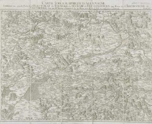
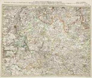
Grand Atlas . Bl. 60 (Bayern, Freising, Salzburg): Contenant une grande Partie de l'Electorat de Baviere, de l'Eveché de Freisingengen, une Partie de l'Archeveché de Saltzbourg et
- Alternative title
-
CARTE TOPOGRAPHIQUE D'ALLEMAGNE / Contenant une grande Partie de l'ELECTORAT de BAVIERE, de l'EVECHÉ de FREISINGENGEN, une Partie de l'ARCHEVECHÉ de / SALTZBOURG et
- Location
-
Deutsches Historisches Museum, Berlin
- Inventory number
-
Do 2006/1059.60
- Measurements
-
Höhe x Breite: 56,5 x 78 cm, Höhe: 56,5 cm, Breite: 78 cm, Tiefe: 3 cm (Atlas)
Höhe x Breite: 56,5 x 78 cm (Blatt)
Höhe x Breite: 52 x 68 cm (Platte)
Höhe x Breite: 46 x 59 cm (Karte)
- Material/Technique
-
Papier, Kupferstich, koloriert, gebunden |Fadenheftung
- Classification
-
Kartografie (Gattung)
- Subject (what)
-
Deutschland
- Event
-
Herstellung
- (who)
-
Verleger, Militärkartograph: Johann Wilhelm Abraham Jaeger
- (where)
-
Frankfurt (Main) [historisch: Frankfurt, Reichsstadt], Deutschland
- (when)
-
um 1787
- Rights
-
Deutsches Historisches Museum
- Last update
-
24.03.2023, 9:27 AM CET
Data provider
This object is provided by:
Stiftung Deutsches Historisches Museum. If you have any questions about the object, please contact the data provider.
Stiftung Deutsches Historisches Museum. If you have any questions about the object, please contact the data provider.
Object type
- Regionalkarte
Associated
- Verleger, Militärkartograph: Johann Wilhelm Abraham Jaeger
Time of origin
- um 1787
Other Objects (12)
60: Carte Topographique D'Allemagne Contenant une grande Partie de l'Electorat de Baviere, de l'Eveché de Freisingengen, une Partie de l'Archeveché de Saltzbourg

BASSE PARTIE DE L'EVECHÉ DE MÜNSTER

Une Partie de l'Enge

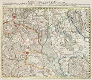
Carte Topographique Du Cours Du Rhin De Philisbourg à Mayence : Contenant Partie de l'Eveché de Spir et de Worms, Partie de L'Electorat De Mayence et du Landgraviat De Darmstat
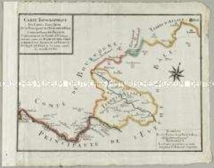
Carte Topographique des Limites d'une Partie de la Principauté de l'Evêche de Bâle contre les Terres de France
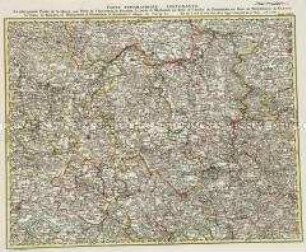
Grand Atlas . Bl. 31 (Hessen, Hannover, Westfalen...): Contenante La plus grande Partie de la Hesse, une Partie de l'Electorale de Hanovre, la Duché de Wesphalie, une Partie de l'Evêché de Paderborn, une Partie du Principeaute de Nassau, les Comtes de Waldeck, de Berlebourg, de Witgenstein, de Hatzfeld, l'abbaye de Corvey et c

Carte Topographique Contenante La plus grande Partie de la Hesse, une Partie de l'Electorale de Hanovre, la Duché de Wesphalie, une Partie de l'Evêché de Paderborn, une Partie du Principeaute de Nassau, les Comtes de Waldeck, de Berlebourg, de Witgenstein, de Hatzfeld, l'abbaye de Corvey etc ; a. P. d. S. M. I.
Grand Atlas . Bl. 12 (Münster, Oldenburg, Osnabrück, Ostfriesland): Contenant une Partie inferieure de l'Evêché de Munster, une Partie du Duche D'Oldenbourg, de l'Evêché d'Osnabruck, de Friesland Orientale de Gröningen et d'Over-Yssel, les Comtés de Benthem de Lingen et et

Plan d'une partie de Magdebourg ...
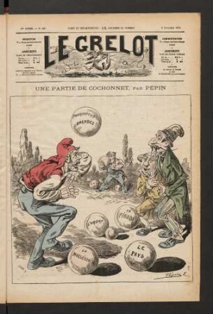
Une partie de cochonnet, par Pépin
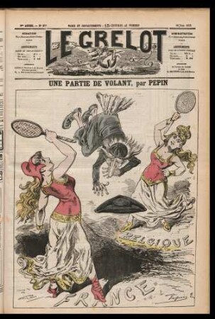
Une partie de volant, par Pépin
Grand Atlas . Bl. 24 (Brandenburg, Magdeburg, Anhalt, Sachsen): Contenant une Partie de l'Electorat de Brandenbourg le Duche de Magdebourg le Principaute d'Anhalt et de l'Electorat de Sax et et.
60: Carte Topographique D'Allemagne Contenant une grande Partie de l'Electorat de Baviere, de l'Eveché de Freisingengen, une Partie de l'Archeveché de Saltzbourg
BASSE PARTIE DE L'EVECHÉ DE MÜNSTER
Une Partie de l'Enge
Carte Topographique Du Cours Du Rhin De Philisbourg à Mayence : Contenant Partie de l'Eveché de Spir et de Worms, Partie de L'Electorat De Mayence et du Landgraviat De Darmstat
Carte Topographique des Limites d'une Partie de la Principauté de l'Evêche de Bâle contre les Terres de France
Grand Atlas . Bl. 31 (Hessen, Hannover, Westfalen...): Contenante La plus grande Partie de la Hesse, une Partie de l'Electorale de Hanovre, la Duché de Wesphalie, une Partie de l'Evêché de Paderborn, une Partie du Principeaute de Nassau, les Comtes de Waldeck, de Berlebourg, de Witgenstein, de Hatzfeld, l'abbaye de Corvey et c
Carte Topographique Contenante La plus grande Partie de la Hesse, une Partie de l'Electorale de Hanovre, la Duché de Wesphalie, une Partie de l'Evêché de Paderborn, une Partie du Principeaute de Nassau, les Comtes de Waldeck, de Berlebourg, de Witgenstein, de Hatzfeld, l'abbaye de Corvey etc ; a. P. d. S. M. I.
Grand Atlas . Bl. 12 (Münster, Oldenburg, Osnabrück, Ostfriesland): Contenant une Partie inferieure de l'Evêché de Munster, une Partie du Duche D'Oldenbourg, de l'Evêché d'Osnabruck, de Friesland Orientale de Gröningen et d'Over-Yssel, les Comtés de Benthem de Lingen et et
Plan d'une partie de Magdebourg ...
Une partie de cochonnet, par Pépin
Une partie de volant, par Pépin