Ämterkarte
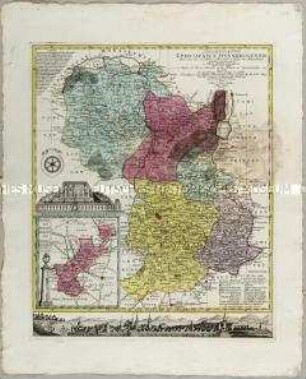
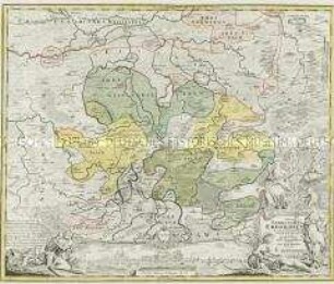
Territorii Episcopatus Osnabrugensis Tabula geographica. Mit einer Nebenkarte: Ditio Reckenbergensis
- Alternative title
-
Territorii EPISCOPATVS OSNABRVGENSIS Tabula geographica, olim à Joh. Gigante Ludensi, D. Med. & Math. 1631 delineata, nunc vero revisa et / fere ubique emendata et in omnes suos districtus vel satrapias (Ambter) accurato divisa à Johanne Henrico Meuschen. Osnagrugensi, Mad. Pract. et rerum Naturalium / Collectore. Reducente ad leges nostrae delineationis D. Tob. Mayero. M. P. Cura et impensis Homannianorum Heredum 1753
- Location
-
Deutsches Historisches Museum, Berlin
- Inventory number
-
Do 2006/1203
- Measurements
-
Höhe x Breite: 57 x 47 cm (Blatt)
Höhe x Breite: 46 x 40,5 cm (Karte)
Höhe x Breite: 50,5 x 45,3 cm (Platte)
- Material/Technique
-
Papier, Kupferstich, koloriert
- Classification
-
Kartografie (Gattung)
- Subject (what)
-
Osnabrück
- Event
-
Herstellung
- (who)
-
Geograph, Kartograf: Johann Michael Gigas
Kartograf ?: Johannes Heinrich Meuschen
Geograph, Kartograf, Astronom: Johann Tobias Mayer
Verlag: Homannsche Erben
- (where)
-
Nürnberg, Deutschland
- (when)
-
1753
- Rights
-
Deutsches Historisches Museum
- Last update
-
24.03.2023, 9:28 AM CET
Data provider
This object is provided by:
Stiftung Deutsches Historisches Museum. If you have any questions about the object, please contact the data provider.
Stiftung Deutsches Historisches Museum. If you have any questions about the object, please contact the data provider.
Object type
- Ämterkarte
Associated
- Geograph, Kartograf: Johann Michael Gigas
- Kartograf ?: Johannes Heinrich Meuschen
- Geograph, Kartograf, Astronom: Johann Tobias Mayer
- Verlag: Homannsche Erben
Time of origin
- 1753
Other Objects (12)
Delineatio Episcopatus Osnabrugensis. Mit einer Nebenkarte: Districtus Reckenbergensis und zwei Ansichten: Prospetus Palatii Osnabrug; Prospect der Stadt Osnabruck
Nova et accurata Territorii Ulmensis. Mit einer Nebenkarte: Grund und Abriß der Ulmischen Herrschaft zu Wain

Nova Territorii Erfordiensis
Episcopatum Monasteriensis et Osnabrugensis
Chorographia Territorii Naumburgo-Citiensis
Chorographia Territorii Naumburgo-Citiensis
Mappa Geographica Territorii Sacri Romani Imperii liberae Civitatis Norimbergensis. Mit einer Nebenkarte: Districtus Criminalis Praefecturae Norimbergensis Lichtenau, sub eadem Scala Milliarium
Nova Territorii Erfordien. Mit einer Ansicht: Die Stadt Erfurt
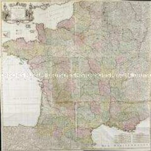
Carte de France. Mit einer Nebenkarte: Isles d'Ouessant
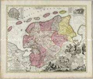
Tabula Frisiae Orientalis. Mit einer Nebenkarte: Facies Dollarti; und zwei Stadtplänen: Emden; Aurich
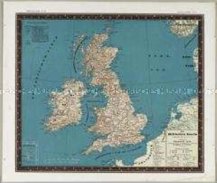
Bauerkeller's Handatlas der allgemeinen Erdkunde, der Länder- und Staatenkunde: Die Britischen Inseln. Mit einer Nebenkarte: Shetlands-Inseln
![Karte des Amtes Leipzig, ca. 1:240 000, Kupferstich, um 1720 : Leipziger Amts-Bezirk. - [Ca. 1:240 000]. - Leipzig : J. George Schreiber , [um 1720]. - 1 Kt. : Kupferst. ; 15 x 16 cm, Bildgr. 25 x 17 cm](https://iiif.deutsche-digitale-bibliothek.de/image/2/51509436-b020-4089-a653-94747d567606/full/!306,450/0/default.jpg)
Karte des Amtes Leipzig, ca. 1:240 000, Kupferstich, um 1720 : Leipziger Amts-Bezirk. - [Ca. 1:240 000]. - Leipzig : J. George Schreiber , [um 1720]. - 1 Kt. : Kupferst. ; 15 x 16 cm, Bildgr. 25 x 17 cm
Delineatio Episcopatus Osnabrugensis. Mit einer Nebenkarte: Districtus Reckenbergensis und zwei Ansichten: Prospetus Palatii Osnabrug; Prospect der Stadt Osnabruck
Nova et accurata Territorii Ulmensis. Mit einer Nebenkarte: Grund und Abriß der Ulmischen Herrschaft zu Wain
Nova Territorii Erfordiensis
Episcopatum Monasteriensis et Osnabrugensis
Chorographia Territorii Naumburgo-Citiensis
Chorographia Territorii Naumburgo-Citiensis
Mappa Geographica Territorii Sacri Romani Imperii liberae Civitatis Norimbergensis. Mit einer Nebenkarte: Districtus Criminalis Praefecturae Norimbergensis Lichtenau, sub eadem Scala Milliarium
Nova Territorii Erfordien. Mit einer Ansicht: Die Stadt Erfurt
Carte de France. Mit einer Nebenkarte: Isles d'Ouessant
Tabula Frisiae Orientalis. Mit einer Nebenkarte: Facies Dollarti; und zwei Stadtplänen: Emden; Aurich
Bauerkeller's Handatlas der allgemeinen Erdkunde, der Länder- und Staatenkunde: Die Britischen Inseln. Mit einer Nebenkarte: Shetlands-Inseln