- Alternative title
-
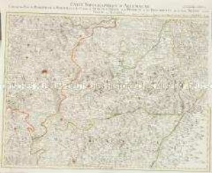
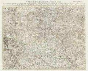
LES PROVINCES / DE BERRY BOURBONNOIS / ET NIVERNOIS / Divisée
- Location
-
Deutsches Historisches Museum, Berlin
- Inventory number
-
Do 2006/136
- Measurements
-
Höhe x Breite: 57,7 x 79,4 cm (Blatt)
Höhe x Breite: 50,1 x 68,4 cm (Platte)
Höhe x Breite: 50 x 68 cm (Karte)
- Material/Technique
-
Druckfarbe, Papier, Kupferstich, grenzkoloriert
- Classification
-
Kartografie (Gattung)
- Subject (what)
-
Frankreich
Bourbonnais
Berry
Nivernais
- Event
-
Herstellung
- (who)
-
Geograph, Kupferstecher, Verleger: Jean Baptiste Crépy
- (where)
-
Paris, Frankreich
- (when)
-
1780
- Rights
-
Deutsches Historisches Museum
- Last update
-
24.03.2023, 9:26 AM CET
Data provider
This object is provided by:
Stiftung Deutsches Historisches Museum. If you have any questions about the object, please contact the data provider.
Stiftung Deutsches Historisches Museum. If you have any questions about the object, please contact the data provider.
Object type
- Regionalkarte
Associated
- Geograph, Kupferstecher, Verleger: Jean Baptiste Crépy
Time of origin
- 1780
Other Objects (12)
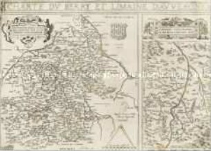
Charte du Berry et Limaine d'Auvergne
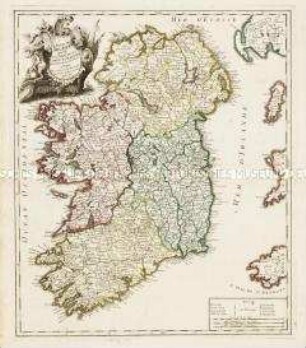
Le Royaume d'Irlande divisé en Provinces, Comtés et Baronies
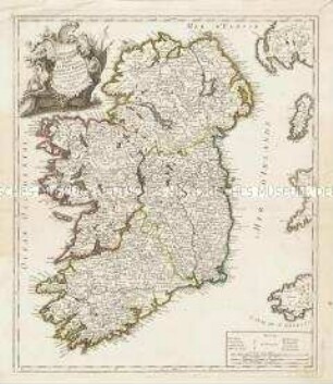
Le Royaume d'Irlande divisé en Provinces, Comtés et Baronies
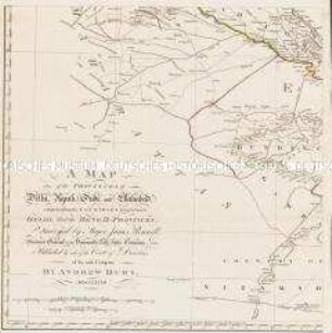
A Map of the Provinces of Delhi, Agrah, Oude, and Ellahabad, comprehending the Countries lying between Delhi, and the Bengal-Provinces

An actual Survey, of the Provinces of Bengal, Bahar &c.
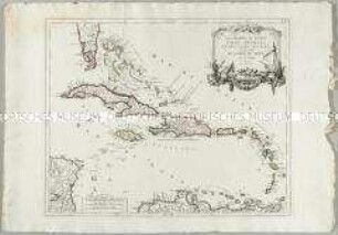
Les Grandes et Petites Isles Antilles et les Isles Lucayes
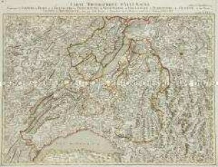
Les Suisses Leurs Sujets et Leurs Alliez
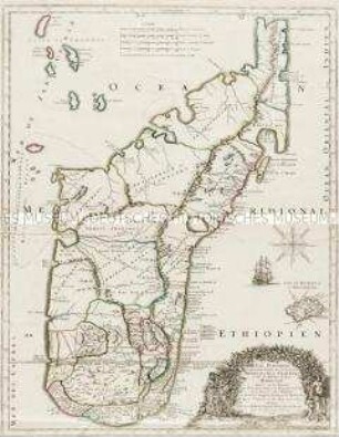
Isle Dauphine, communement nommée par les Europeens Madagascar, et St. Laurens et par les habitans du Pays Madecase
Grand Atlas . Bl. 75 (Bern, Freiburg, Neuenburg...) : Contenant les Cantons de Bern, et de Freybourg, les Principautés de Neufchatel, et Vallangin, le Territoire de Geneve, et une Partie Comté de Bourgogne. et et
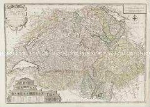
Grand Atlas . Bl. 54 (Mähren, Niederschlesien : Contenant une Partie du Margraviat de Moravie, savoir les Cercles d'Olmutz de Prerau et de Hradisch et les Principautés de la haute Silesie savoir Tropau et Teschen et et
Grand Atlas . Bl. 45 (Schlesien): Contenant la haute Silesie savoir les Principautés d'Oppeln, Ratibor, Troppau et Iaegerndorf, les Seigneuries de Plesen et de Beuten et une Partie du Margraviat de Moravie

L´Electorate De Hannover ou se Trouvent les Camps et les Plans des principales Villes de cette Province et de l´Eveché de Hildesheim qui y est enclavé
Charte du Berry et Limaine d'Auvergne
Le Royaume d'Irlande divisé en Provinces, Comtés et Baronies
Le Royaume d'Irlande divisé en Provinces, Comtés et Baronies
A Map of the Provinces of Delhi, Agrah, Oude, and Ellahabad, comprehending the Countries lying between Delhi, and the Bengal-Provinces
An actual Survey, of the Provinces of Bengal, Bahar &c.
Les Grandes et Petites Isles Antilles et les Isles Lucayes
Les Suisses Leurs Sujets et Leurs Alliez
Isle Dauphine, communement nommée par les Europeens Madagascar, et St. Laurens et par les habitans du Pays Madecase
Grand Atlas . Bl. 75 (Bern, Freiburg, Neuenburg...) : Contenant les Cantons de Bern, et de Freybourg, les Principautés de Neufchatel, et Vallangin, le Territoire de Geneve, et une Partie Comté de Bourgogne. et et
Grand Atlas . Bl. 54 (Mähren, Niederschlesien : Contenant une Partie du Margraviat de Moravie, savoir les Cercles d'Olmutz de Prerau et de Hradisch et les Principautés de la haute Silesie savoir Tropau et Teschen et et
Grand Atlas . Bl. 45 (Schlesien): Contenant la haute Silesie savoir les Principautés d'Oppeln, Ratibor, Troppau et Iaegerndorf, les Seigneuries de Plesen et de Beuten et une Partie du Margraviat de Moravie