- Alternative title
-
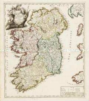
LE ROYAUME / D'IRLANDE / Divisé / EN PROVINCES,
- Location
-
Deutsches Historisches Museum, Berlin
- Inventory number
-
Do 2006/239
- Measurements
-
Höhe x Breite: 70,7 x 56 cm (Blatt)
Höhe x Breite: 55,1 x 46,5 cm (Karte)
Höhe x Breite: 58,5 x 49,8 cm (Platte)
- Material/Technique
-
Druckfarbe, Papier, Kupferstich, grenzkoloriert
- Classification
-
Kartografie (Gattung)
- Subject (what)
-
Irland
- Event
-
Herstellung
- (who)
-
Geograph: Georges-Louis Le Rouge
Verleger: ? Basset
- (where)
-
Paris, Frankreich
- (when)
-
1785
- Rights
-
Deutsches Historisches Museum
- Last update
- 24.03.2023, 9:30 AM CET
Data provider
This object is provided by:
Stiftung Deutsches Historisches Museum. If you have any questions about the object, please contact the data provider.
Stiftung Deutsches Historisches Museum. If you have any questions about the object, please contact the data provider.
Object type
- Regionalkarte
Associated
- Geograph: Georges-Louis Le Rouge
- Verleger: ? Basset
Time of origin
- 1785
Other Objects (12)
Le Royaume d'Irlande divisé en Provinces, Comtés et Baronies
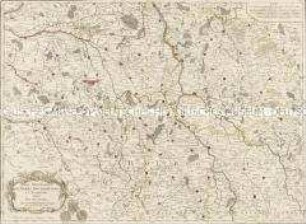
Les Provinces de Berry Bourbonnois et Nivernois
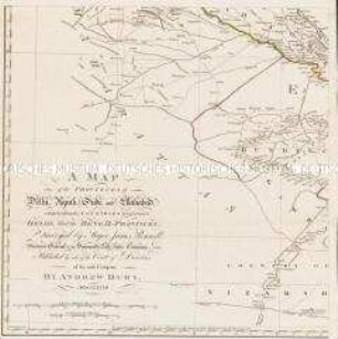
A Map of the Provinces of Delhi, Agrah, Oude, and Ellahabad, comprehending the Countries lying between Delhi, and the Bengal-Provinces

An actual Survey, of the Provinces of Bengal, Bahar &c.
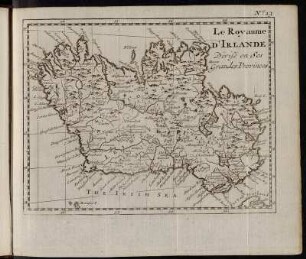
No. 13. Le Royaume d´Irlande Divisé en Ses Grandes Provinces.
Grand Atlas . Bl. 38 (Namur, Liége, Limburg, Bouillon, Luxemburg...): Contenante le Comté de Namur, une Partie de l'Eveché De Liege et des Duchés De Limbourg, De Bouillon et De Luxembourg, ce dernier divisé en Quartiers Wallon et Allemand, etc.

Bl. X: Le Royaume d'Irlande Divisé en Provinces, Comtés et Baronies.
Grand Atlas . Bl. 11 (Holland, Westfriesland): Contenant une Partie des Provinces Unies, savoir la Province de Friesland Occidentale, une Partie d'Over Yssel, de Gueldre, d'Hollande Septentrionale, de differentes Isles de la Meer d'Allemagne, et du Zuider See.

Le Royaume d'Irlande : Divisé En Provinces, Comtés Et Baroneries; Suivant les Nouvelles Observ.ts

Tabula Geographica Totam Borussiam ut et Districtum Notecensem. Mit einer Nebenkarte: Charte welche den Netz District vorstellet
Charte von Schwaben No. 60

Holstein, Lauenburg, Hamburg u. Lübeck
Le Royaume d'Irlande divisé en Provinces, Comtés et Baronies
Les Provinces de Berry Bourbonnois et Nivernois
A Map of the Provinces of Delhi, Agrah, Oude, and Ellahabad, comprehending the Countries lying between Delhi, and the Bengal-Provinces
An actual Survey, of the Provinces of Bengal, Bahar &c.
No. 13. Le Royaume d´Irlande Divisé en Ses Grandes Provinces.
Grand Atlas . Bl. 38 (Namur, Liége, Limburg, Bouillon, Luxemburg...): Contenante le Comté de Namur, une Partie de l'Eveché De Liege et des Duchés De Limbourg, De Bouillon et De Luxembourg, ce dernier divisé en Quartiers Wallon et Allemand, etc.
Bl. X: Le Royaume d'Irlande Divisé en Provinces, Comtés et Baronies.
Grand Atlas . Bl. 11 (Holland, Westfriesland): Contenant une Partie des Provinces Unies, savoir la Province de Friesland Occidentale, une Partie d'Over Yssel, de Gueldre, d'Hollande Septentrionale, de differentes Isles de la Meer d'Allemagne, et du Zuider See.
Le Royaume d'Irlande : Divisé En Provinces, Comtés Et Baroneries; Suivant les Nouvelles Observ.ts
Tabula Geographica Totam Borussiam ut et Districtum Notecensem. Mit einer Nebenkarte: Charte welche den Netz District vorstellet
Charte von Schwaben No. 60