Altkarte
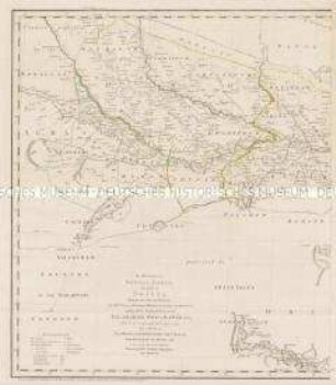
Map of the Indus River and the Neighbouring Countries : Comprising Sind, parts of Beloochistan and Afghanistan; Cashmeer, Punjab, Bhawulpoor, the Protected Sikh States, Bickaneer and Jaysulmeer; & the Western Parts of Rajpootana
- Location
-
Bayerische Staatsbibliothek
- Dimensions
-
Gesamtgr. 103 x 144 cm
- Extent
-
1 Kt. auf 2 Bl.
- Language
-
Englisch
- Notes
-
Lithographie
Maßstab in graph. Form (British Miles). - Mit Bergstrichen
- Keyword
-
Kaschmir
Khyber Pakhtunkhwa
Provinz Sind
Provinz Belutschistan
Pandschab
Industiefland
- Event
-
Veröffentlichung
- (where)
-
Calcutta//Kalkutta//
- (who)
-
J. B. Tassin
- (when)
-
1835
- Contributor
- URN
-
urn:nbn:de:bvb:12-bsb00018931-3
- Last update
-
16.04.2025, 8:45 AM CEST
Data provider
This object is provided by:
Bayerische Staatsbibliothek. If you have any questions about the object, please contact the data provider.
Bayerische Staatsbibliothek. If you have any questions about the object, please contact the data provider.
Object type
- Altkarte
Associated
- Graham, J.
- Tassin, Jean-Baptiste
- Winston, Ed.
- Chill, D. H.
- Everest, George
- J. B. Tassin
Time of origin
- 1835
Other Objects (12)

The aggregate and the representation of its parts
Parts of the body
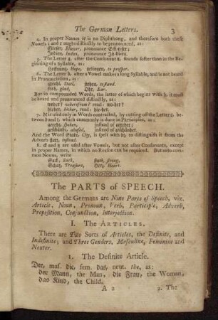
The Parts of Speech.
![[The German Letters.] - The Parts of Speech.](https://iiif.deutsche-digitale-bibliothek.de/image/2/84b8b562-5c73-4a5a-b98d-2015f4182f81/full/!306,450/0/default.jpg)
[The German Letters.] - The Parts of Speech.
The natural history of Aleppo and parts adjacent
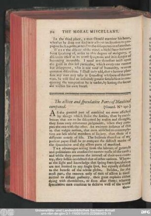
The active and speculative Parts of Mankind compared.
The Kingdoms of Bengal, Bahár, and parts of Orissa

ii. The parts of speech

Detached parts of the Bible

The Invariable Parts of Speech.
Contents of the three parts
The nature of parts of speech
The aggregate and the representation of its parts
Parts of the body
The Parts of Speech.
[The German Letters.] - The Parts of Speech.
The natural history of Aleppo and parts adjacent
The active and speculative Parts of Mankind compared.
The Kingdoms of Bengal, Bahár, and parts of Orissa
ii. The parts of speech
Detached parts of the Bible
The Invariable Parts of Speech.
Contents of the three parts