Fortifikationsplan
A Plan Of The Town And Fortifications Of Gibraltar. Mit zwei Nebenkarten: A Chart of the Straits of Gibraltar; The Bay of Gibraltar
- Alternative title
-
A PLAN OF THE TOWN AND FORTIFICATIONS / OF GIBRALTAR / with the SPANISH LINES &c.
- Location
-
Deutsches Historisches Museum, Berlin
- Inventory number
-
Do 2006/295
- Measurements
-
Höhe x Breite: 47 x 61 cm (Blatt)
Höhe x Breite: 34,5 x 51,2 cm (Karte)
Höhe x Breite: 37,7 x 54,5 cm (Platte)
- Material/Technique
-
Druckfarbe, Papier, Kupferstich, koloriert
- Classification
-
Kartografie (Gattung)
- Subject (what)
-
Gibraltar
- Event
-
Herstellung
- (who)
-
Kartograf: ? van Keulen
Verlag: Sayer and Bennett
- (where)
-
London, Großbritannien und Nordirland
- (when)
-
27.11.1779
- Rights
-
Deutsches Historisches Museum
- Last update
-
24.03.2023, 9:29 AM CET
Data provider
This object is provided by:
Stiftung Deutsches Historisches Museum. If you have any questions about the object, please contact the data provider.
Stiftung Deutsches Historisches Museum. If you have any questions about the object, please contact the data provider.
Object type
- Fortifikationsplan
Associated
- Kartograf: ? van Keulen
- Verlag: Sayer and Bennett
Time of origin
- 27.11.1779
Other Objects (12)
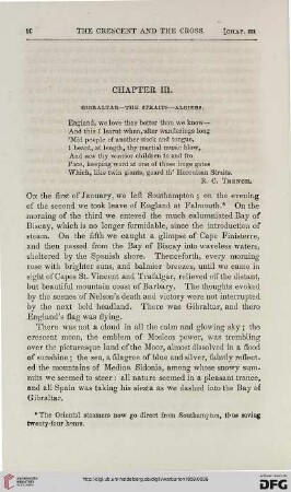
Chapter III: Gibraltar – the straits – Algiers

Overland and oversea migration of white storks through the water barriers of the straits of Gibraltar
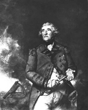
Lord Heathfield of Gibraltar
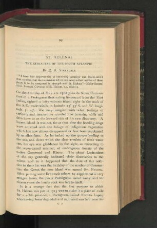
St. Helena. The Gibraltar of the South Atlantic.
Arab Natural Gas : Colonial challenges and risks from the Strait of Gibraltar to the Strait of Bab al-Mandab
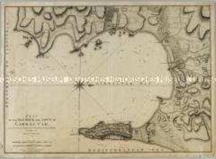
Plan of the Bay, Rock and Town of Gibraltar

Gibraltar Business Directory, ?. Aufl., Gibraltar 1966: Gibraltar Chronicle
Gibraltar
Gibraltar
Gibraltar
Gibraltar
Gibraltar
Chapter III: Gibraltar – the straits – Algiers
Overland and oversea migration of white storks through the water barriers of the straits of Gibraltar
Lord Heathfield of Gibraltar
St. Helena. The Gibraltar of the South Atlantic.
Arab Natural Gas : Colonial challenges and risks from the Strait of Gibraltar to the Strait of Bab al-Mandab
Plan of the Bay, Rock and Town of Gibraltar
Gibraltar Business Directory, ?. Aufl., Gibraltar 1966: Gibraltar Chronicle
Gibraltar
Gibraltar
Gibraltar
Gibraltar