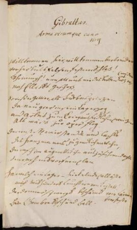
Fortifikationsplan
A Plan Of The Town And Fortifications Of Gibraltar. Mit zwei Nebenkarten: A Chart of the Straits of Gibraltar; The Bay of Gibraltar
- Alternativer Titel
-
A PLAN OF THE TOWN AND FORTIFICATIONS / OF GIBRALTAR / with the SPANISH LINES &c.
- Standort
-
Deutsches Historisches Museum, Berlin
- Inventarnummer
-
Do 2006/295
- Maße
-
Höhe x Breite: 47 x 61 cm (Blatt)
Höhe x Breite: 34,5 x 51,2 cm (Karte)
Höhe x Breite: 37,7 x 54,5 cm (Platte)
- Material/Technik
-
Druckfarbe, Papier, Kupferstich, koloriert
- Klassifikation
-
Kartografie (Gattung)
- Bezug (was)
-
Gibraltar
- Ereignis
-
Herstellung
- (wer)
-
Kartograf: ? van Keulen
Verlag: Sayer and Bennett
- (wo)
-
London, Großbritannien und Nordirland
- (wann)
-
27.11.1779
- Rechteinformation
-
Deutsches Historisches Museum
- Letzte Aktualisierung
-
24.03.2023, 09:29 MEZ
Datenpartner
Dieses Objekt wird bereitgestellt von:
Stiftung Deutsches Historisches Museum. Bei Fragen zum Objekt wenden Sie sich bitte an den Datenpartner.
Stiftung Deutsches Historisches Museum. Bei Fragen zum Objekt wenden Sie sich bitte an den Datenpartner.
Objekttyp
- Fortifikationsplan
Beteiligte
- Kartograf: ? van Keulen
- Verlag: Sayer and Bennett
Entstanden
- 27.11.1779
Ähnliche Objekte (12)
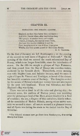
Chapter III: Gibraltar – the straits – Algiers

Overland and oversea migration of white storks through the water barriers of the straits of Gibraltar
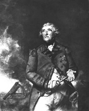
Lord Heathfield of Gibraltar
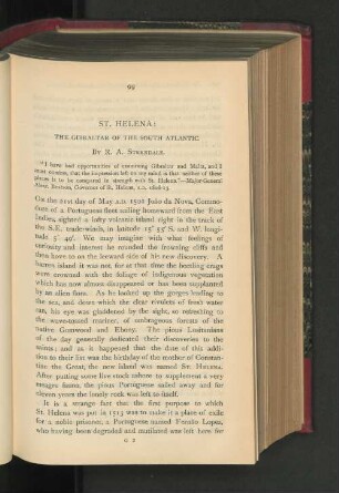
St. Helena. The Gibraltar of the South Atlantic.
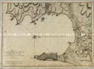
Plan of the Bay, Rock and Town of Gibraltar
Arab Natural Gas : Colonial challenges and risks from the Strait of Gibraltar to the Strait of Bab al-Mandab

Gibraltar Business Directory, ?. Aufl., Gibraltar 1966: Gibraltar Chronicle
Gibraltar
Gibraltar
Gibraltar
Gibraltar
Gibraltar
Chapter III: Gibraltar – the straits – Algiers
Overland and oversea migration of white storks through the water barriers of the straits of Gibraltar
Lord Heathfield of Gibraltar
St. Helena. The Gibraltar of the South Atlantic.
Plan of the Bay, Rock and Town of Gibraltar
Arab Natural Gas : Colonial challenges and risks from the Strait of Gibraltar to the Strait of Bab al-Mandab
Gibraltar Business Directory, ?. Aufl., Gibraltar 1966: Gibraltar Chronicle
Gibraltar
Gibraltar
Gibraltar
Gibraltar