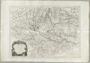
Grenzkarte
Karte vom preußischen Staate. Mit einer Nebenkarte Fürstenthum Neufchatel
- Alternative title
-
KARTE / vom / Preussischen Staate / mit
- Location
-
Deutsches Historisches Museum, Berlin
- Inventory number
-
Do 87/413
- Measurements
-
Höhe x Breite: 111 x 165 cm (Blatt)
Höhe x Breite: 109,8 x 163,8 cm (Karte)
- Material/Technique
-
Papier : Leinwand, Lithographie, grenzkoloriert
- Classification
-
Kartografie (Gattung)
- Subject (what)
-
Preußen
Deutschland
Polen
- Event
-
Herstellung
- (who)
-
Kartograf: ? Kurts
Verleger: Georg Ernst Reimer
- (where)
-
Berlin, Deutschland [historisch: Preußen, Königreich]
- (when)
-
1831
- Rights
-
Deutsches Historisches Museum
- Last update
-
24.03.2023, 9:31 AM CET
Data provider
This object is provided by:
Stiftung Deutsches Historisches Museum. If you have any questions about the object, please contact the data provider.
Stiftung Deutsches Historisches Museum. If you have any questions about the object, please contact the data provider.
Object type
- Grenzkarte
Associated
- Kartograf: ? Kurts
- Verleger: Georg Ernst Reimer
Time of origin
- 1831
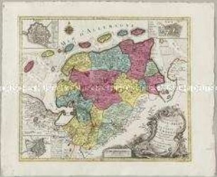
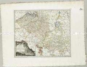
Other Objects (12)
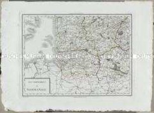
Atlas Nouveau: Gouvernement de Normandie. Mit einer Nebenkarte: Kanalinseln
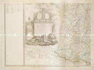
Carte de la France. Mit einer Nebenkarte: Departement de Corse
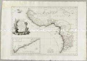
Carte de la Guinée. Mit einer Nebenkarte: Côte d'Or
Nova et accuratißima Ducatus Wurtenbergici. Mit einer Nebenkarte: Landgrafschaft Nellenburg
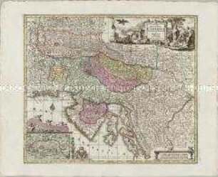
Diplomatischer Atlas: Karte von der Cisalpinischen Republik. Mit einer Nebenkarte: Breisgau
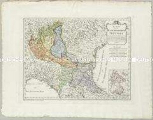
Exactissima Ducatus Carniolae Vinidorum Marchia et Histriae. Mit einer Nebenkarte: Der Czirknizer See
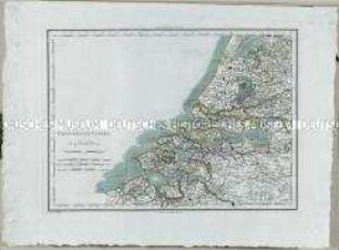
Atlas Nouveau: Provinces-Unies. Mit einer Nebenkarte: Détails Particuliers des Embouchures de l'Escaut
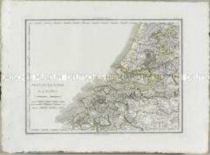
Atlas Nouveau: Provinces-Unies. Mit einer Nebenkarte: Détails Particuliers des Embouchures de l'Escaut
Nouvelle Carte de l'Etat de Milan. Mit einer Nebenkarte: Nouvelle Carte du Duché de Mantoue
La Principauté d'Ost-Frise ou Le Comté d'Embden. Mit einer Nebenkarte: Dollart und zwei Stadtplänen: Embden und Aurich

Carte Géographi-Diplomatique Suivant les Derniers Traités De Paix. Dédiée Au Général Beurnonville Ambassadeur De La République Francaise. Nebenkarte: Carte De La République Ionienne
Diplomatischer Atlas: Karte von den Niederlanden welche die Französische Republik von dem Erzhause durch den Frieden zu Campo formido den 17 Oct. 1797, und von den vereinigten Niederlanden durch den Frieden zu Haag den 17 May 1795 erhielt. Mit einer Nebenkarte: Inseln welche Frankreich durch den erstgenannten Frieden von Venedig an sich brachte
Atlas Nouveau: Gouvernement de Normandie. Mit einer Nebenkarte: Kanalinseln
Carte de la France. Mit einer Nebenkarte: Departement de Corse
Carte de la Guinée. Mit einer Nebenkarte: Côte d'Or
Nova et accuratißima Ducatus Wurtenbergici. Mit einer Nebenkarte: Landgrafschaft Nellenburg
Diplomatischer Atlas: Karte von der Cisalpinischen Republik. Mit einer Nebenkarte: Breisgau
Exactissima Ducatus Carniolae Vinidorum Marchia et Histriae. Mit einer Nebenkarte: Der Czirknizer See
Atlas Nouveau: Provinces-Unies. Mit einer Nebenkarte: Détails Particuliers des Embouchures de l'Escaut
Atlas Nouveau: Provinces-Unies. Mit einer Nebenkarte: Détails Particuliers des Embouchures de l'Escaut
Nouvelle Carte de l'Etat de Milan. Mit einer Nebenkarte: Nouvelle Carte du Duché de Mantoue
La Principauté d'Ost-Frise ou Le Comté d'Embden. Mit einer Nebenkarte: Dollart und zwei Stadtplänen: Embden und Aurich
Carte Géographi-Diplomatique Suivant les Derniers Traités De Paix. Dédiée Au Général Beurnonville Ambassadeur De La République Francaise. Nebenkarte: Carte De La République Ionienne