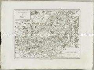
Grenzkarte
Atlas Nouveau: Gouvernement de Normandie. Mit einer Nebenkarte: Kanalinseln
- Alternative title
-
GOUVERNEMENT / de / NORMANDIE.
- Location
-
Deutsches Historisches Museum, Berlin
- Inventory number
-
Do 2006/578.27.1-4
- Measurements
-
Höhe x Breite: 43,5 x 60 cm (Blatt 1)
Höhe x Breite: 30,2 x 41 cm (Karte 1)
Höhe x Breite: 34 x 45 cm (Platte 1)
- Material/Technique
-
Papier, Kupferstich, grenzkoloriert
- Classification
-
Kartografie (Gattung)
- Subject (what)
-
Frankreich
Normandie
- Event
-
Herstellung
- (who)
-
Historiker, Geograph: Edme Mentelle
Stecher: Pierre Francois Tardieu
Stecher: ? Dubuisson
Stecher: Ph. Macquet
- (where)
-
Paris, Frankreich
- (when)
-
um 1782
- Rights
-
Deutsches Historisches Museum
- Last update
- 24.03.2023, 8:29 AM UTC
Data provider
This object is provided by:
Stiftung Deutsches Historisches Museum. If you have any questions about the object, please contact the data provider.
Stiftung Deutsches Historisches Museum. If you have any questions about the object, please contact the data provider.
Object type
- Grenzkarte
Associated
- Historiker, Geograph: Edme Mentelle
- Stecher: Pierre Francois Tardieu
- Stecher: ? Dubuisson
- Stecher: Ph. Macquet
Time of origin
- um 1782
Other Objects (12)
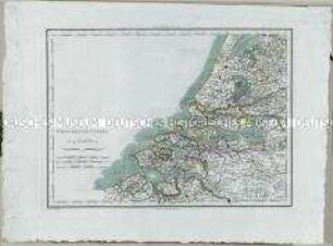
Atlas Nouveau: Provinces-Unies. Mit einer Nebenkarte: Détails Particuliers des Embouchures de l'Escaut
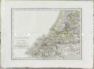
Atlas Nouveau: Provinces-Unies. Mit einer Nebenkarte: Détails Particuliers des Embouchures de l'Escaut
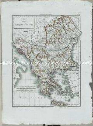
Atlas Nouveau: Carte de la Turquie d'Europe
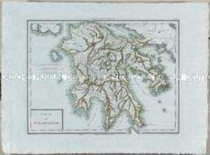
Atlas Nouveau: Carte du Péloponèse
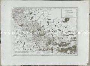
Atlas Nouveau: Gouvernement de Flandre
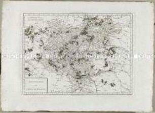
Atlas Nouveau: Gouvernement de l'Isle de France
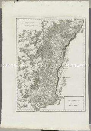
Atlas Nouveau: Gouvernement d'Alsace
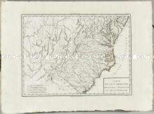
Atlas Nouveau: Carte de la Caroline Méridionale et Septentrionale et de la Virginie
Atlas Nouveau: Gouvernement de Berry
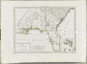
Atlas Nouveau: Carte de la Floride et de la Georgie
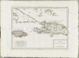
Atlas Nouveau: Carte des Isles de la Jamaique et de St. Domingue
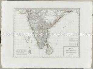
Atlas Nouveau: Inde Partie Méridionale de la Presqu'isle en deca du Gange
Atlas Nouveau: Provinces-Unies. Mit einer Nebenkarte: Détails Particuliers des Embouchures de l'Escaut
Atlas Nouveau: Provinces-Unies. Mit einer Nebenkarte: Détails Particuliers des Embouchures de l'Escaut
Atlas Nouveau: Carte de la Turquie d'Europe
Atlas Nouveau: Carte du Péloponèse
Atlas Nouveau: Gouvernement de Flandre
Atlas Nouveau: Gouvernement de l'Isle de France
Atlas Nouveau: Gouvernement d'Alsace
Atlas Nouveau: Carte de la Caroline Méridionale et Septentrionale et de la Virginie
Atlas Nouveau: Gouvernement de Berry
Atlas Nouveau: Carte de la Floride et de la Georgie
Atlas Nouveau: Carte des Isles de la Jamaique et de St. Domingue