Altkarte
Europae tabula nova multis locis tam ex terrestri peregrinatione, quam recentiori navigatione a probatissimis naucleris
- Location
-
München, Bayerische Staatsbibliothek -- Mapp. II,1 t
- Dimensions
-
79 x 135 cm, Gesamtgröße Blätter 118 x 160 cm
- Extent
-
1 Karte auf 8 Blättern
- Language
-
Latein
- Notes
-
Kupferstich
Maßstab in graphischer Form (Russica milliaria. Italica milliaria und 7 weitere). - Bildleiste mit 18 Ansichten und Illustrationen. - Literatur in: Schilder, Günter: Monumenta Cartographica Neerlandica, Alphen aan den Rijn, 2003, Band VII, Nr. 14.2.1
- Keyword
-
Europa
- Event
-
Veröffentlichung
- (where)
-
Antwerpen
- (who)
-
Cornelis Claeszoon
- (when)
-
1604
- URN
-
urn:nbn:de:bvb:12-bsb00130421-1
- Last update
-
16.04.2025, 8:32 AM CEST
Data provider
This object is provided by:
Bayerische Staatsbibliothek. If you have any questions about the object, please contact the data provider.
Bayerische Staatsbibliothek. If you have any questions about the object, please contact the data provider.
Object type
- Altkarte
Associated
- Claesz, Cornelis
- Vrients, Jan Baptista
- Keere, Pieter van der
- Ende, Josua van den
- Cornelis Claeszoon
Time of origin
- 1604
Other Objects (12)
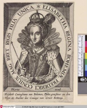
Elisabetha Regina Bohemiae
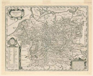
Germaniae veteris typus

Grundriß von Köln-Mülheim
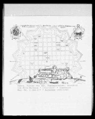
Plan von Köln-Mülheim
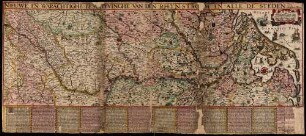
Nieuwe, En warachtighe Beschryvinghe van Den Rhynstrohm En Alle D Steden
![Westphaliae Tabula II [secunda]](https://iiif.deutsche-digitale-bibliothek.de/image/2/7af93770-4f4f-4d5b-877d-471d10bfdb61/full/!306,450/0/default.jpg)
Westphaliae Tabula II [secunda]
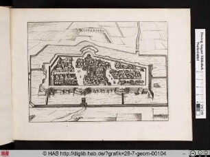
WITTENBERG.
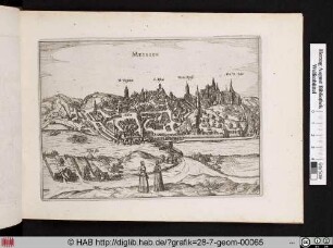
MEISSEN.
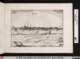
BONN.
STETTIN.
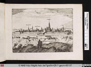
WIEN.
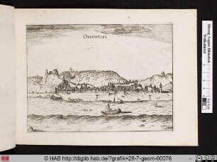
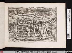
OBERWESEL.
Elisabetha Regina Bohemiae
Germaniae veteris typus
Grundriß von Köln-Mülheim
Plan von Köln-Mülheim
Nieuwe, En warachtighe Beschryvinghe van Den Rhynstrohm En Alle D Steden
Westphaliae Tabula II [secunda]
WITTENBERG.
MEISSEN.
BONN.
STETTIN.
WIEN.
OBERWESEL.
Elisabetha Regina Bohemiae
Germaniae veteris typus
Grundriß von Köln-Mülheim
Plan von Köln-Mülheim
Nieuwe, En warachtighe Beschryvinghe van Den Rhynstrohm En Alle D Steden
Westphaliae Tabula II [secunda]
WITTENBERG.
MEISSEN.
BONN.
STETTIN.
WIEN.