Regionalkarte
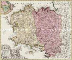
Gouvernement généraux de Languedoc. Mit einer Nebenkarte: Supplément pour les Cévennes
- Alternative title
-
GOUVERNEMENS GÉNÉRAUX / DE LANGUEDOC, / DE FOIX, ET DE ROUSSILLON. / PAR LE Sr. ROBERT DE VAUGONDY
- Location
-
Deutsches Historisches Museum, Berlin
- Inventory number
-
Do 2006/150
- Measurements
-
Höhe x Breite: 58 x 81 cm (Blatt)
Höhe x Breite: 51,1 x 65,3 cm (Karte)
Höhe x Breite: 53 x 75,5 cm (Platte)
- Material/Technique
-
Druckfarbe, Papier, Kupferstich, grenzkoloriert
- Classification
-
Kartografie (Gattung)
- Subject (what)
-
Frankreich
Languedoc
Foix
Roussillon
- Event
-
Herstellung
- (who)
-
Geograph, Kartograf: Didier Robert de Vaugondy
Verleger: Jean Baptiste Fortin
- (where)
-
Paris, Frankreich
- (when)
-
1778
- Rights
-
Deutsches Historisches Museum
- Last update
-
24.03.2023, 9:29 AM CET
Data provider
This object is provided by:
Stiftung Deutsches Historisches Museum. If you have any questions about the object, please contact the data provider.
Stiftung Deutsches Historisches Museum. If you have any questions about the object, please contact the data provider.
Object type
- Regionalkarte
Associated
- Geograph, Kartograf: Didier Robert de Vaugondy
- Verleger: Jean Baptiste Fortin
Time of origin
- 1778
Other Objects (12)
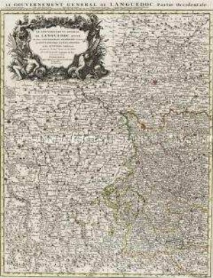
Le Gouvernement General de Languedoc
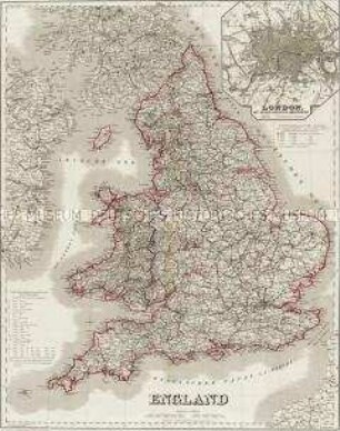
England. Mit einer Nebenkarte: London
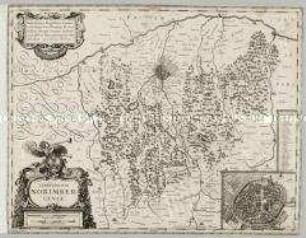
Territorium Norimbergense. Mit einer Nebenkarte: Nurnberg
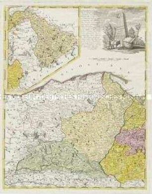
Borussiae Occidentalis Tabula. Mit einer Nebenkarte: Ermland
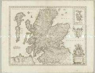
Scotia Regnum. Mit einer Nebenkarte: Orcades Insulae.
Tabula Ducatus Britanniae. Mit einer Nebenkarte: BREST
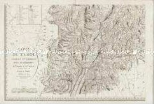
Carte du Tyrol. Mit einer Nebenkarte: Carte Générale
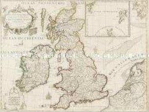
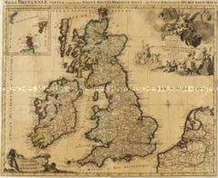
Les Isles Britanniques. Mit einer Nebenkarte: Orkney- und Shetlandinseln
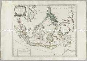
Archipel des Indes Orientales. Mit einer Nebenkarte: Isles Marianes
Les Isles Britanniques. Mit einer Nebenkarte: Orkney- und Shetlandinseln
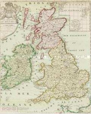
Les Isles Britanniques. Mit einer Nebenkarte: Orkney und Shetland Inseln
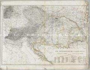
Der Österreichische Kaiser-Staat. Mit einer Nebenkarte: Umgegend von Wien
Le Gouvernement General de Languedoc
England. Mit einer Nebenkarte: London
Territorium Norimbergense. Mit einer Nebenkarte: Nurnberg
Borussiae Occidentalis Tabula. Mit einer Nebenkarte: Ermland
Scotia Regnum. Mit einer Nebenkarte: Orcades Insulae.
Tabula Ducatus Britanniae. Mit einer Nebenkarte: BREST
Carte du Tyrol. Mit einer Nebenkarte: Carte Générale
Les Isles Britanniques. Mit einer Nebenkarte: Orkney- und Shetlandinseln
Archipel des Indes Orientales. Mit einer Nebenkarte: Isles Marianes
Les Isles Britanniques. Mit einer Nebenkarte: Orkney- und Shetlandinseln
Les Isles Britanniques. Mit einer Nebenkarte: Orkney und Shetland Inseln