- Alternative title
-
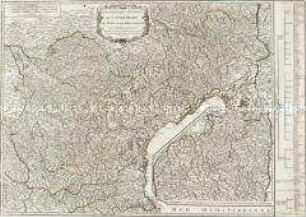
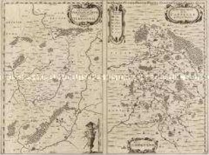
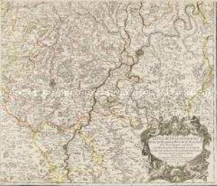
LE GOUVERNEMENT GENERAL / DE LANGUEDOC DIVISÉ / En trois LIEUTENANCES GENERALES Scavoir / LA HAUT LANGUEDOC, LA BAS LANGUEDOC
- Location
-
Deutsches Historisches Museum, Berlin
- Inventory number
-
Do 2006/149.1-2
- Measurements
-
Höhe x Breite: 67 x 57 cm (Blatt 1)
Höhe x Breite: 56,2 x 44 cm (Karte 1)
Höhe x Breite: 60 x 46 cm (Platte 1)
Höhe x Breite: 67 x 56 cm (Blatt 2)
Höhe x Breite: 56,2 x 44,4 cm (Karte 2)
Höhe x Breite: 60,2 x 46,2 cm (Platte 2)
- Material/Technique
-
Druckfarbe, Papier, Kupferstich, grenzkoloriert
- Classification
-
Kartografie (Gattung)
- Subject (what)
-
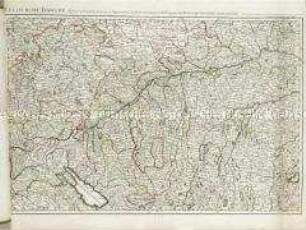
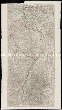
Frankreich
Languedoc
- Event
-
Herstellung
- (who)
-
Geograph, Kartograf: Guillaume Sanson?
Verlag: Covens et Mortier
- (where)
-
Amsterdam, Niederlande
- (when)
-
um 1750
- Rights
-
Deutsches Historisches Museum
- Last update
- 24.03.2023, 9:28 AM CET
Data provider
This object is provided by:
Stiftung Deutsches Historisches Museum. If you have any questions about the object, please contact the data provider.
Stiftung Deutsches Historisches Museum. If you have any questions about the object, please contact the data provider.
Object type
- Regionalkarte
Associated
- Geograph, Kartograf: Guillaume Sanson?
- Verlag: Covens et Mortier
Time of origin
- um 1750
Other Objects (12)
Gouvernement généraux de Languedoc. Mit einer Nebenkarte: Supplément pour les Cévennes
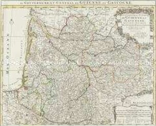
Le Gouvernement General de Guienne et Gascogne
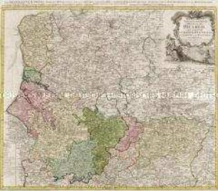
Carte du Gouvernement General De Picardie
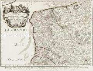
Gouvernement General de Picardie (Titel nicht erhalten!)
Descriptio Veromanduorum / Gouvernement de la Cappelle
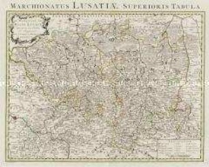
Le Marquisat De Haute-Lusace / Le Marquisat De Basse-Lusace
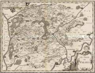
Le Pais de Valois

Le Royaume de Boheme
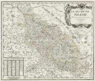
Le Duché De Silesie
Le Duché de Luxembourg
Le cours du Danube
Le cours du Rhin
Gouvernement généraux de Languedoc. Mit einer Nebenkarte: Supplément pour les Cévennes
Le Gouvernement General de Guienne et Gascogne
Carte du Gouvernement General De Picardie
Gouvernement General de Picardie (Titel nicht erhalten!)
Descriptio Veromanduorum / Gouvernement de la Cappelle
Le Marquisat De Haute-Lusace / Le Marquisat De Basse-Lusace
Le Pais de Valois
Le Royaume de Boheme
Le Duché De Silesie
Le Duché de Luxembourg
Le cours du Danube