- Alternativer Titel
-
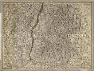
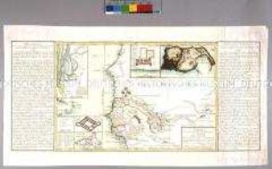
LE COURS DU RHIN depuis Worms jusqua Bonne ET LES PAYS ADJACES / Par Guillaume Del'Isle Geograph de l'Academie Royale des Sciences / avec Privilege du Roy
- Standort
-
Deutsches Historisches Museum, Berlin
- Inventarnummer
-
Do 2006/982
- Maße
-
Höhe x Breite: 147,7 x 82 cm (Blatt)
Höhe x Breite: 137 x 61,6 cm (Karte)
Höhe x Breite: 141 x 64,3 cm (Platte)
- Material/Technik
-
Papier, Kupferstich, grenzkoloriert
- Klassifikation
-
Kartografie (Gattung)
- Bezug (was)
-
Rhein
- Ereignis
-
Herstellung
- (wer)
-
Kartograf, Verleger: Guillaume Delisle
Geograph, Verleger, Kupferstecher: Philippe Buache
- (wo)
-
Paris, Frankreich
- (wann)
-
30.04.1745
- Rechteinformation
-
Deutsches Historisches Museum
- Letzte Aktualisierung
- 24.03.2023, 09:29 MEZ
Datenpartner
Dieses Objekt wird bereitgestellt von:
Stiftung Deutsches Historisches Museum. Bei Fragen zum Objekt wenden Sie sich bitte an den Datenpartner.
Stiftung Deutsches Historisches Museum. Bei Fragen zum Objekt wenden Sie sich bitte an den Datenpartner.
Objekttyp
- Regionalkarte
Beteiligte
- Kartograf, Verleger: Guillaume Delisle
- Geograph, Verleger, Kupferstecher: Philippe Buache
Entstanden
- 30.04.1745
Ähnliche Objekte (12)
Le cours du Rhin
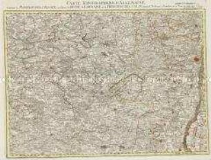
Carte Topographique du Cours du Rhin
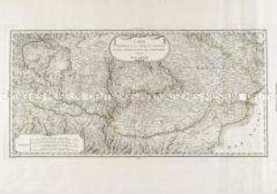
Le cours du Danube
Cours du Rhin, depuis sa source jusqu'à son embouchure
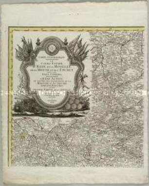
Carte Geographique representant le cours entier du Rhin, de la Moselle, de la Meuse et de l'Escaut
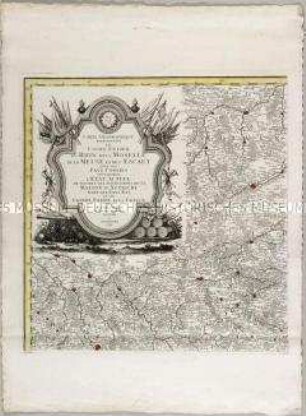
Carte Geographique representant le cours entier du Rhin, de la Moselle, de la Meuse et de l'Escaut
Le cours de la riviere du Rhein
Carte comprenant le cours du Danube depuis Vienne jusqu'à son embouchure dans la Mer Noire
Carte du cours des fleuves du Sénégal. Mit zwei Nebenkarten: Carte de l'entrée de la riviere du Sénégal; Vue de l'isle de Gorée; und drei Plänen: Plan du Fort Saint Joseph; Plan de James-Fort; Plan du Fort St. Louis
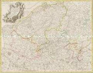
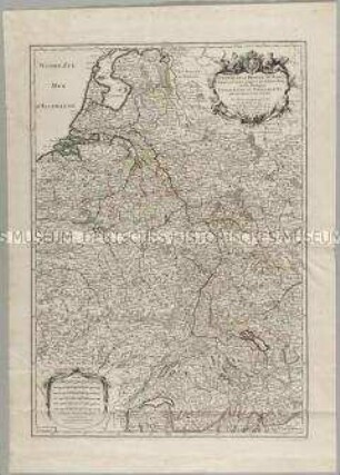
La Flandre, le Hainaut, le Brabant, l'Artois une partie de la Picardie, et du Luxembourg
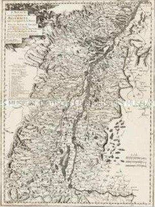
L'Alsace, ou Conquestes du Roy, en Allemagne, tant decà que delà le Rhein
Grand Atlas . Bl. 57 (Elsass, Lothringen, Salm): Contenant le Margraviat de l'Alsace, une Partie du Duché de Lorraine, et le Principauté de Salm.
Le cours du Rhin
Carte Topographique du Cours du Rhin
Le cours du Danube
Cours du Rhin, depuis sa source jusqu'à son embouchure
Carte Geographique representant le cours entier du Rhin, de la Moselle, de la Meuse et de l'Escaut
Carte Geographique representant le cours entier du Rhin, de la Moselle, de la Meuse et de l'Escaut
Le cours de la riviere du Rhein
Carte comprenant le cours du Danube depuis Vienne jusqu'à son embouchure dans la Mer Noire
Carte du cours des fleuves du Sénégal. Mit zwei Nebenkarten: Carte de l'entrée de la riviere du Sénégal; Vue de l'isle de Gorée; und drei Plänen: Plan du Fort Saint Joseph; Plan de James-Fort; Plan du Fort St. Louis
La Flandre, le Hainaut, le Brabant, l'Artois une partie de la Picardie, et du Luxembourg
L'Alsace, ou Conquestes du Roy, en Allemagne, tant decà que delà le Rhein