Altkarte
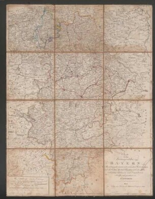
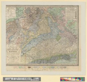
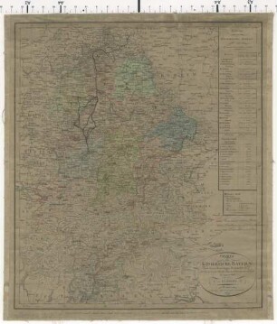
Topographisch-militairische Special-Charte von dem Koenigreiche Bayern und dem Fürstenthume Lichtenstein
- Alternative title
-
Topographisch-militärische Spezial-Karte von dem Königreiche Bayern
- Location
-
München, Bayerische Staatsbibliothek -- Mapp. XI,55 l
- Dimensions
-
je Bl. 39 x 29 cm
- Extent
-
Kt. auf 41 Bl.
- Notes
-
Kupferstich
Maßstab in graph. Form (3 Meilen). - Mit Übersichtsnetz
- Keyword
-
Geschichte 1813
Bayern
- Event
-
Veröffentlichung
- (where)
-
Weimar
- (when)
-
1813
- URN
-
urn:nbn:de:bvb:12-bsb00012765-4
- Last update
-
16.04.2025, 8:34 AM CEST
Data provider
This object is provided by:
Bayerische Staatsbibliothek. If you have any questions about the object, please contact the data provider.
Bayerische Staatsbibliothek. If you have any questions about the object, please contact the data provider.
Object type
- Altkarte
Time of origin
- 1813
Other Objects (12)

Charte vom Königreiche Bayern
Charte von dem Königreiche Bayern
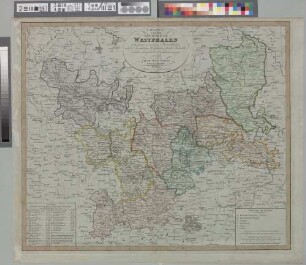
Charte von dem Königreiche Westphalen
Charte von dem Nordwestlichen Theile des Königreichs Bayern, dem Grossherzogthume Würzburg, dem Fürstenthume Aschaffenburg &c.c. oder Der Maÿn
Charte vom Königreiche Bayern : nach seiner neuesten Eintheilung vom Jahre 1810
Charte vom Königreiche Bayern : nach den vorzüglichen Hülfsmitteln und der neuesten Kreis-Eintheilung
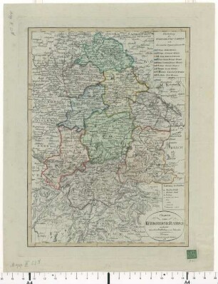
Neueste Charte der Koenigreiche Baiern und Würtemberg, des Grossherzogthums Baden nebst dem Fürstenthum Hohenzollern

Topographisch-militairische Special-Charte von dem Koenigreiche Bayern und dem Fürstenthume Lichtenstein
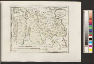
Das Herzogthum Geldern Kurbrandenburgischen Antheils mit dem Fürstenthume Mörs
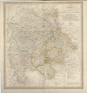
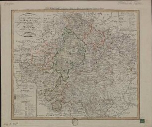
Charte von den Königlich Preussischen Provinzen Westphalen, Cleve-Berg und Niederrhein, dem Kurfürstenthume Hessen, Grossherzogthume Hessen, dem Herzogthume Nassau, Fürstenthume Waldeck und dem Gebiete der freien Stadt Frankfurt
Charte vom Königreiche Bayern : nach seinen dermaligen Bestandtheilen, und der neuesten Eintheilung in XV Kreise berichtigt im August 1808
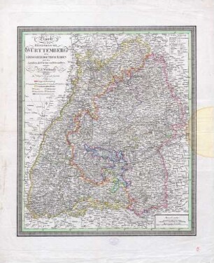
Charte von dem Königreiche Württemberg, dem Grossherzogthum Baden und den Laendern der Fürsten von Hohenzollern ; entworfen von C.F. Weiland
Charte vom Königreiche Bayern
Charte von dem Königreiche Bayern
Charte von dem Königreiche Westphalen
Charte von dem Nordwestlichen Theile des Königreichs Bayern, dem Grossherzogthume Würzburg, dem Fürstenthume Aschaffenburg &c.c. oder Der Maÿn
Charte vom Königreiche Bayern : nach seiner neuesten Eintheilung vom Jahre 1810
Charte vom Königreiche Bayern : nach den vorzüglichen Hülfsmitteln und der neuesten Kreis-Eintheilung
Neueste Charte der Koenigreiche Baiern und Würtemberg, des Grossherzogthums Baden nebst dem Fürstenthum Hohenzollern
Topographisch-militairische Special-Charte von dem Koenigreiche Bayern und dem Fürstenthume Lichtenstein
Das Herzogthum Geldern Kurbrandenburgischen Antheils mit dem Fürstenthume Mörs
Charte von den Königlich Preussischen Provinzen Westphalen, Cleve-Berg und Niederrhein, dem Kurfürstenthume Hessen, Grossherzogthume Hessen, dem Herzogthume Nassau, Fürstenthume Waldeck und dem Gebiete der freien Stadt Frankfurt
Charte vom Königreiche Bayern : nach seinen dermaligen Bestandtheilen, und der neuesten Eintheilung in XV Kreise berichtigt im August 1808