- Alternative title
-
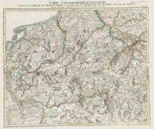
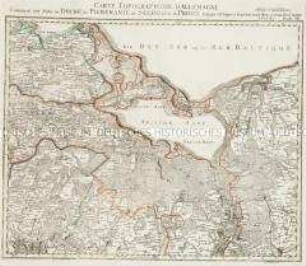
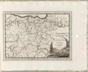
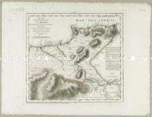
LA PRUSSE/ divisée en/ PRUSSE ROYALE, et/ PRUSSE DUCALE laquelle a eté/ erigée en Royaume par l'Empereur/ Leopold en faveur de Frédéric I. Elect./ de Brandebourg couronné en Janvier 1701./ Par le S.r Robert Géog./ À VENISE/ Par P. Santini 1778./ Chez M.r Remondini.
- Location
-
Deutsches Historisches Museum, Berlin
- Inventory number
-
Do 2002/140
- Measurements
-
Höhe x Breite: 51,1 x 74 cm (Blatt), Höhe x Breite: 49,3 x 61,2 cm (Platte)
- Material/Technique
-
Papier, Kupferstich
- Classification
-
Kartografie (Gattung)
- Subject (what)
-
Preußen
- Event
-
Herstellung
- (who)
-
Geograph: Gilles Robert de Vaugondy?
Kartograf: P. Santini
Kartograph, Verleger: Giuseppe Remondini (?)
- (where)
-
Venedig, Italien [historisch: Republik Venedig]
- (when)
-
1778
- Rights
-
Deutsches Historisches Museum
- Last update
-
24.03.2023, 9:29 AM CET
Data provider
This object is provided by:
Stiftung Deutsches Historisches Museum. If you have any questions about the object, please contact the data provider.
Stiftung Deutsches Historisches Museum. If you have any questions about the object, please contact the data provider.
Object type
- Regionalkarte
Associated
- Geograph: Gilles Robert de Vaugondy?
- Kartograf: P. Santini
- Kartograph, Verleger: Giuseppe Remondini (?)
Time of origin
- 1778
Other Objects (12)

La Prusse
Carte de la Prusse Occidentale
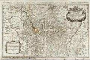
Grand Atlas, Bl. 6 (Mecklenburg, Pommern): Contenant Le Duche De Mecklenburg et une Partie De La Pomeranie De Suedois aussy bien De Prusse.
Grand Atlas, Bl. 7 (Pommern, Preussen) : Contenant une Partie du Duché de Pomeranie de Suedois et de Prusse.
Mapa de la Isla de la Palma / Mapa de la Isla de la Gomera
Partie Méridionale de la Louisiane, avec de la Floride, la Caroline et la Virginie
Nuovo Atlante Geografico Universale: La Biscaglia La Castilia Vecchia e La Navarra
La Lorraine
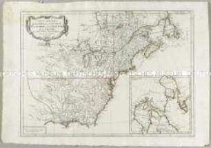
Carte Générale du Canada, de la Louisiane, de la Floride, de la Caroline, de la Virginie, de la Nouvelle Angleterre etc. Mit einer Anschlusskarte
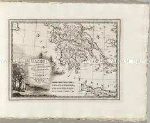
Nuovo Atlante Geografico Universale: La Morea La Livadia
Carta Plana de la Provincia de La Hacha
La Haute Et La Basse Silesie. Mit einem Stadtplan: La Ville Capitale de Breslau
La Prusse
Carte de la Prusse Occidentale
Grand Atlas, Bl. 6 (Mecklenburg, Pommern): Contenant Le Duche De Mecklenburg et une Partie De La Pomeranie De Suedois aussy bien De Prusse.
Grand Atlas, Bl. 7 (Pommern, Preussen) : Contenant une Partie du Duché de Pomeranie de Suedois et de Prusse.
Mapa de la Isla de la Palma / Mapa de la Isla de la Gomera
Partie Méridionale de la Louisiane, avec de la Floride, la Caroline et la Virginie
Nuovo Atlante Geografico Universale: La Biscaglia La Castilia Vecchia e La Navarra
La Lorraine
Carte Générale du Canada, de la Louisiane, de la Floride, de la Caroline, de la Virginie, de la Nouvelle Angleterre etc. Mit einer Anschlusskarte
Nuovo Atlante Geografico Universale: La Morea La Livadia
Carta Plana de la Provincia de La Hacha