- Standort
-
München, Bayerische Staatsbibliothek -- 2 Mapp. 462 m
- Maße
-
31 x 34 cm
- Umfang
-
1 Karte
- Sprache
-
Latein
- Anmerkungen
-
Kupferstich
Maßstab in graph. Form (Milliaria Germanica com[m]., Milliaria Hollandica et Brab.). - Nullmeridian: Ferro. - Titelkartusche oben links, Maßstabskartusche unten links
Nebent. unten rechts: 18. Niederlande
- Erschienen in
-
Tabula Geogr. Belgii Universi XVII Provinc. ; pages:18
Atlas Geographicus / Iussu Academiae Regiae Scient. Et Eleg. Litt. Boruss. Ad Emendatiora, Quae Adhuc Prodiere Exempla Descriptus Atque Ad Usum Potissimum Scholarum Et Institutionem Iuventutis Editus. [Einl. von:] L. Euler ; 18
- Schlagwort
-
Niederlande
- Ereignis
-
Veröffentlichung
- (wo)
-
[Berlin]
- (wer)
-
[Ex Officina Michaelis]
- (wann)
-
1753?
- Beteiligte Personen und Organisationen
- URN
-
urn:nbn:de:bvb:12-bsb00139559-2
- Letzte Aktualisierung
-
16.04.2025, 08:42 MESZ
Datenpartner
Dieses Objekt wird bereitgestellt von:
Bayerische Staatsbibliothek. Bei Fragen zum Objekt wenden Sie sich bitte an den Datenpartner.
Bayerische Staatsbibliothek. Bei Fragen zum Objekt wenden Sie sich bitte an den Datenpartner.
Objekttyp
- Altkarte
Beteiligte
- Euler, Leonhard
- [Ex Officina Michaelis]
Entstanden
- 1753?
Ähnliche Objekte (12)

Bildnis des Leonhard Euler

Nur Personenkarteikarte vorhanden
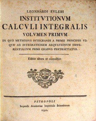
Institutiones calculi integralis, 1. In quo methodus integrandi a primis principiis usque ad integrationem aeqationum differentialium primi gradus pertractatur. - Ed. 2. - 1792. - 466 S.

Abramson, Abraham: Leonhard Euler

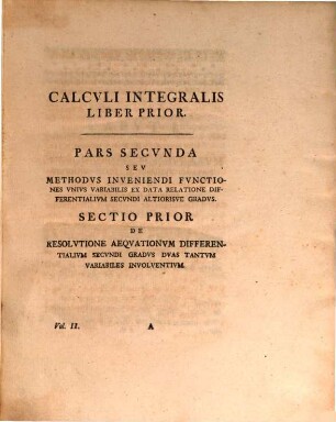
Institutio calculi integralis, 3
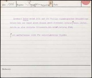
Leonhard Euler weist 1756 auf die Vorzüge megaskopischer Projektionsbilder hin und lässt einen diesem Zweck dienenden Apparat mit auffallendem Licht für undurchsichtige Objekte bauen
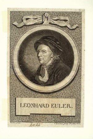
Leonhard Euler
Institutio calculi integralis, 2
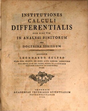
Institutiones Calculi differentialis
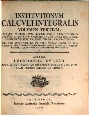
Institutiones calculi integralis, 3. In quo methodus inveniendi functiones duarum et plurium variabilium, ex data relatione differentialium cuiusvis gradus per tractatur. - 1770. - 639 S.
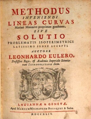
Methodus inveniendi lineas curvas maximi minimive proprietate gaudentes, sive Solutio problematis isoperimetrici latissimo sensu accepti
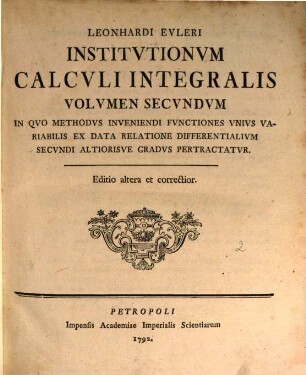
Institutiones calculi integralis, 2. In quo methodus inveniendi functiones unius variabilis ex data relatione differentialium secundi altiorisve gradus pertractatur. - Ed. 2. - 1792. - 434 S.
Bildnis des Leonhard Euler
Nur Personenkarteikarte vorhanden
Institutiones calculi integralis, 1. In quo methodus integrandi a primis principiis usque ad integrationem aeqationum differentialium primi gradus pertractatur. - Ed. 2. - 1792. - 466 S.
Abramson, Abraham: Leonhard Euler
Institutio calculi integralis, 3
Leonhard Euler weist 1756 auf die Vorzüge megaskopischer Projektionsbilder hin und lässt einen diesem Zweck dienenden Apparat mit auffallendem Licht für undurchsichtige Objekte bauen
Leonhard Euler
Institutio calculi integralis, 2
Institutiones Calculi differentialis
Institutiones calculi integralis, 3. In quo methodus inveniendi functiones duarum et plurium variabilium, ex data relatione differentialium cuiusvis gradus per tractatur. - 1770. - 639 S.
Methodus inveniendi lineas curvas maximi minimive proprietate gaudentes, sive Solutio problematis isoperimetrici latissimo sensu accepti