Regionalkarte
Ortsnamen- und Regionalkarte der Burgundischen Niederlande bzw. der Siebzehn Provinzen (in lateinischer, niederländischer und französischer Sprache)
- Alternativer Titel
-
Novus XVII / Inferioris Germaniae / Provinciarum Typus / de integro multis in locis emendatus à / Guliel. Blaeu.
- Standort
-
Deutsches Historisches Museum, Berlin
- Inventarnummer
-
Do 90/9602
- Maße
-
Höhe x Breite: 42,2 x 52,3 cm (Blatt)
- Material/Technik
-
Druckfarbe (schwarz), Papier, gedruckt
- Klassifikation
-
Landkarten (Gattung)
- Bezug (was)
-
Stadt
Landschaft
Territorium
Nordsee
Atlantikküste
Schifffahrt (Motiv)
Habsburger
Burgund
- Ereignis
-
Herstellung
- (wer)
-
Stecher: Willem Janszoon Blaeu
- (wo)
-
Niederlande
- (wann)
-
1634
- Rechteinformation
-
Deutsches Historisches Museum
- Letzte Aktualisierung
-
24.03.2023, 09:27 MEZ
Datenpartner
Dieses Objekt wird bereitgestellt von:
Stiftung Deutsches Historisches Museum. Bei Fragen zum Objekt wenden Sie sich bitte an den Datenpartner.
Stiftung Deutsches Historisches Museum. Bei Fragen zum Objekt wenden Sie sich bitte an den Datenpartner.
Objekttyp
- Regionalkarte
Beteiligte
- Stecher: Willem Janszoon Blaeu
Entstanden
- 1634
Ähnliche Objekte (12)
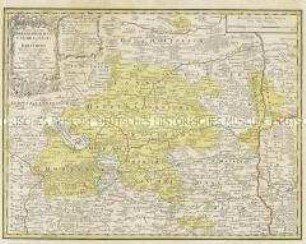
Brandenburger Regionalkarte

Regionalkarte der Elbe
La Province d'Alsace

Carte Générale de l'Empire d'Allemagne. Mit einer Übersichtskarte
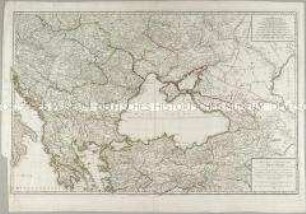
Carte des environs de la Mer-Noire
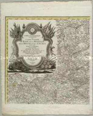
Carte Geographique representant le cours entier du Rhin, de la Moselle, de la Meuse et de l'Escaut

Kolorierte Tuschfederzeichnung der Grafschaft Eger
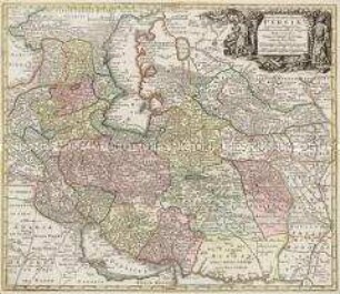
Opulentissimi Regni Persiae iuxta suas Provincias
La Principauté d'Orange et Comtat de Venaissin

Icon Sinus Baiarum
Karte: Beschreibung der Schweiz

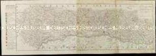
Charte von Schwaben No. 49
Brandenburger Regionalkarte
Regionalkarte der Elbe
La Province d'Alsace
Carte Générale de l'Empire d'Allemagne. Mit einer Übersichtskarte
Carte des environs de la Mer-Noire
Carte Geographique representant le cours entier du Rhin, de la Moselle, de la Meuse et de l'Escaut
Kolorierte Tuschfederzeichnung der Grafschaft Eger
Opulentissimi Regni Persiae iuxta suas Provincias
La Principauté d'Orange et Comtat de Venaissin
Icon Sinus Baiarum
Karte: Beschreibung der Schweiz