Altkarte
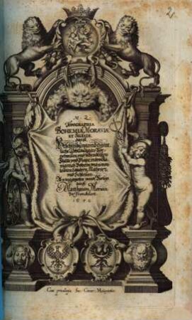
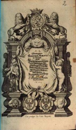
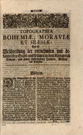
M. Z. Topographia Bohemiae, Moraviae Et Silesiae : das ist, Beschreibung vnd eigentliche Abbildung der Vornehmsten, vnd bekandtisten Stätte, vnd Plätze, in dem Königreich Boheim vnd einverleibten Landern, Mähren, vnd Schlesien
- Alternative title
-
Topographia Bohemiae, Moraviae Et Silesiae
- Location
-
Regensburg, Staatliche Bibliothek -- 999/2Hist.pol.619(23/25
- Dimensions
-
33 cm
- Extent
-
192 S., [8] Bl., [25] doppels. Taf.
- Language
-
Deutsch
- Notes
-
Kupfert., Ill., Kt., Pläne (Kupferst.)
Bibliogr. Nachweis: Wüthrich IV, Nr. 51
- Keyword
-
Topografie
Stadtbeschreibung
Stadt
Ostmitteleuropa
Schlesien
Böhmen
Mähren
- Event
-
Veröffentlichung
- (where)
-
Franckfurt//Frankfurt am Main//
- (who)
-
An tag gegeben vnndt Verlegt durch Matthaeum Merian//Merian//
- (when)
-
1650
- Contributor
- URN
-
urn:nbn:de:bvb:12-bsb11055568-3
- Last update
-
16.04.2025, 8:44 AM CEST
Data provider
This object is provided by:
Bayerische Staatsbibliothek. If you have any questions about the object, please contact the data provider.
Bayerische Staatsbibliothek. If you have any questions about the object, please contact the data provider.
Object type
- Altkarte
Associated
- Merian, Matthaeus (der Ältere)
- Zeiller, Martin
- An tag gegeben vnndt Verlegt durch Matthaeum Merian//Merian//
Time of origin
- 1650
Other Objects (12)
M.Z. Topographia Bohemiae, Moraviae Et Silesiae das ist, Beschreibung vnd eigentliche Abbildung der Vornehmsten, vnd bekandtisten Stätte, vnd Plätze, in dem Königreich Boheim vnd einverleibten Landern, Mähren, vnd Schlesien
M. Z. Topographia Bohemiae, Moraviae Et Silesiae : das ist Beschreibung vnd eigentliche Abbildung der Vornehmsten vnd bekandtisten Stätte vnd Plätze in dem Königreich Boheim vnd einverleibten Landern Mähren vnd Schlesien
M. Z. Topographia Bohemiae, Moraviae Et Silesiae : das ist, Beschreibung vnd eigentliche Abbildung der Vornehmsten, vnd bekandtisten Stätte, vnd Plätze, in dem Königreich Boheim vnd einverleibten Landern, Mähren, vnd Schlesien
M. Z. Topographia Bohemiae, Moraviae Et Silesiae : das ist, Beschreibung vnd eigentliche Abbildung der Vornehmsten, vnd bekandtisten Stätte, vnd Plätze, in dem Königreich Boheim vnd einverleibten Landern, Mähren, vnd Schlesien
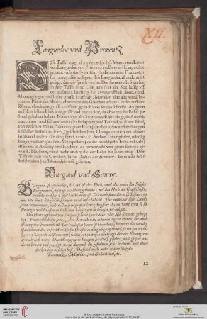
Languedoc vnd Prouentz / Burgund vnd Sauoy

Kurtzer vnd nützlicher Bericht vnd anleitung
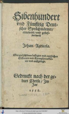
Sibenhundert vnd Fuenfftzig Deutscher Spruechwoertter : Mit viel schoenen lustigen vnd nutzlichen Historien vnd Exemplen erklaeret vnd außgelegt.
Vnd letztlich von der Dapfferkeit, strengigkeit vnd vleiß frembde Nationen zubekriegen vnd Newe Colonos vnd Völcker anzurichten.
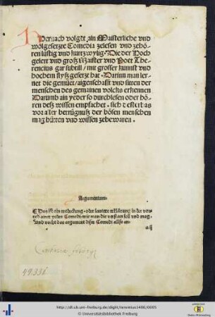
Hernach volget Maisterliche vnd wolgesetzte Comedia zelesen vnd zehören lustig vnd kurtzwylig …
Hernach volget Maisterliche vnd wolgesetzte Comedia zelesen vnd zehören lustig vnd kurtzwylig
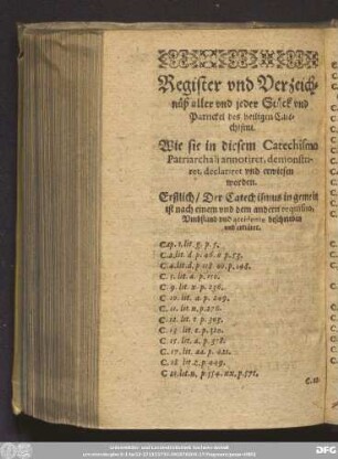
Register vnd Verzeichnüß aller vnd jeder Stück vnd Partickel des heiligen Catechismi.

Vnterschied / vnd enickeit / des gesetz vnd Euangelij
M.Z. Topographia Bohemiae, Moraviae Et Silesiae das ist, Beschreibung vnd eigentliche Abbildung der Vornehmsten, vnd bekandtisten Stätte, vnd Plätze, in dem Königreich Boheim vnd einverleibten Landern, Mähren, vnd Schlesien
M. Z. Topographia Bohemiae, Moraviae Et Silesiae : das ist Beschreibung vnd eigentliche Abbildung der Vornehmsten vnd bekandtisten Stätte vnd Plätze in dem Königreich Boheim vnd einverleibten Landern Mähren vnd Schlesien
M. Z. Topographia Bohemiae, Moraviae Et Silesiae : das ist, Beschreibung vnd eigentliche Abbildung der Vornehmsten, vnd bekandtisten Stätte, vnd Plätze, in dem Königreich Boheim vnd einverleibten Landern, Mähren, vnd Schlesien
M. Z. Topographia Bohemiae, Moraviae Et Silesiae : das ist, Beschreibung vnd eigentliche Abbildung der Vornehmsten, vnd bekandtisten Stätte, vnd Plätze, in dem Königreich Boheim vnd einverleibten Landern, Mähren, vnd Schlesien
Languedoc vnd Prouentz / Burgund vnd Sauoy
Kurtzer vnd nützlicher Bericht vnd anleitung
Sibenhundert vnd Fuenfftzig Deutscher Spruechwoertter : Mit viel schoenen lustigen vnd nutzlichen Historien vnd Exemplen erklaeret vnd außgelegt.
Vnd letztlich von der Dapfferkeit, strengigkeit vnd vleiß frembde Nationen zubekriegen vnd Newe Colonos vnd Völcker anzurichten.
Hernach volget Maisterliche vnd wolgesetzte Comedia zelesen vnd zehören lustig vnd kurtzwylig …
Hernach volget Maisterliche vnd wolgesetzte Comedia zelesen vnd zehören lustig vnd kurtzwylig
Register vnd Verzeichnüß aller vnd jeder Stück vnd Partickel des heiligen Catechismi.