Altkarte | Stadtplan
Carte hydrographique de l'Isar et de ses bras dans les environs de Munic
- Location
-
München, Bayerische Staatsbibliothek -- Hbks/E 35 z-5
- Dimensions
-
Blattgr. 66 x 39 cm, Kartengröße mit Anlagestreifen 239 x 39 cm, gefaltet
- Extent
-
1 Kt. aus 6 Teilen auf 1 Bl.
- Language
-
Französisch
- Notes
-
Lithographie
Maßstab in graph. Form (pieds). - Mit Anmerkung: Tab. C. ad p. 282. - Mit 1 angeklebten Kartenstreifen von 2 Druckplatten. - Mit 2 Profilen: Profil du développement de l'Isar à compter du prèmier déversoir jusqu'à la fin de la Correction de cette Rivière
- Bibliographic citation
-
Theoretisch-practische Wasserbaukunst / von Carl Friedrich Wiebeking, Kgl.-Baier. geheimen Rath, General-Direktor des Wasser-, Brücken- und Strassenbaues ; [5], [Tafeln], 1811-1817, Tab. 117
- Keyword
-
Hydrologie
Isar
München
München
- Event
-
Veröffentlichung
- (where)
-
[München]
- (when)
-
[1811-1817]
- Contributor
- URN
-
urn:nbn:de:bvb:12-bsb00090719-1
- Last update
-
27.11.2025, 8:40 AM CET
Data provider
This object is provided by:
Bayerische Staatsbibliothek. If you have any questions about the object, please contact the data provider.
Bayerische Staatsbibliothek. If you have any questions about the object, please contact the data provider.
Object type
- Altkarte
- Stadtplan
Associated
Time of origin
- [1811-1817]
Other Objects (12)

Plan De Philadelphie Et Environs

Plan of Calcutta : shewing the latest improvements as existing in 1854 ; with part of the environs

Plan von Haidhausen : Vorstadt der königlichen Haupt- und Residenz-Stadt München rechts der Isar
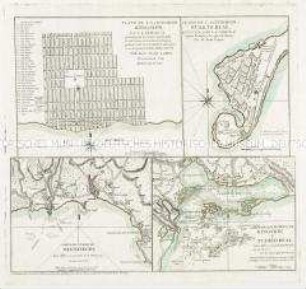
Plano de la Ciudad de Kingston / Plano de la Ciudad de Puerto Real / Carta del Puerto de Bluefields / Carta de los Puertos de Kingston, y Puerto Real
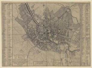
Plan de la Ville de BERLIN. Capitale de l`Electorat...

Plan de la Ville de Paris et de ses Faubourgs
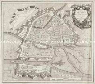
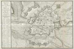
Plan de la Ville de Metz
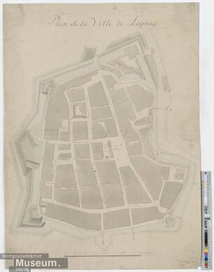
Plan de la Ville de Leipzig
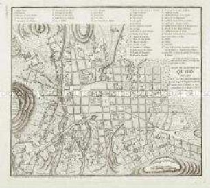
Plano De La Ciudad De Quito

Le Plan de Paris de Louis Bretez, dit Plan de Turgot
Nouveau Plan de la Ville de Metz
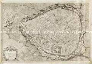
Plan routier de la Ville de Bruxelles
Plan De Philadelphie Et Environs
Plan of Calcutta : shewing the latest improvements as existing in 1854 ; with part of the environs
Plan von Haidhausen : Vorstadt der königlichen Haupt- und Residenz-Stadt München rechts der Isar
Plano de la Ciudad de Kingston / Plano de la Ciudad de Puerto Real / Carta del Puerto de Bluefields / Carta de los Puertos de Kingston, y Puerto Real
Plan de la Ville de BERLIN. Capitale de l`Electorat...
Plan de la Ville de Paris et de ses Faubourgs
Plan de la Ville de Metz
Plan de la Ville de Leipzig
Plano De La Ciudad De Quito
Le Plan de Paris de Louis Bretez, dit Plan de Turgot
Nouveau Plan de la Ville de Metz