Stadtplan
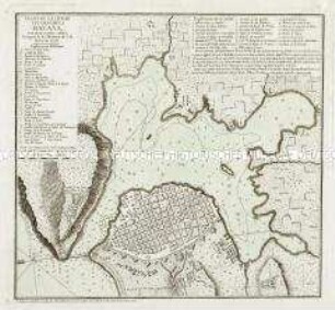
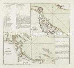
Plano de la Ciudad de Kingston / Plano de la Ciudad de Puerto Real / Carta del Puerto de Bluefields / Carta de los Puertos de Kingston, y Puerto Real
- Alternativer Titel
-
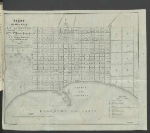
PLANO DE LA CIUDAD DE / KINGSTON, / EN LA JAMAICA. / Segun el proyecto del Coronel Christiano Lilly.
- Standort
-
Deutsches Historisches Museum, Berlin
- Inventarnummer
-
Do 2006/324
- Maße
-
Höhe x Breite: 48,2 x 60,3 cm (Blatt)
Höhe x Breite: 19,6 x 22,5 cm (Karte 1)
Höhe x Breite: 19,3 x 14,4 cm (Karte 2)
Höhe x Breite: 15,5 x 19,2 cm (Karte 3)
Höhe x Breite: 15,6 x 19,6 cm (Karte 4)
Höhe x Breite: 38,7 x 40,3 cm (Platte)
- Material/Technik
-
Druckfarbe, Papier, Kupferstich, koloriert
- Klassifikation
-
Kartografie (Gattung)
- Bezug (was)
-
Bluefields
Jamaika
- Ereignis
-
Herstellung
- (wer)
-
Geograph, Kartograf: Juan Lopez
- (wo)
-
Madrid, Spanien
- (wann)
-
1782
- Rechteinformation
-
Deutsches Historisches Museum
- Letzte Aktualisierung
-
24.03.2023, 09:30 MEZ
Datenpartner
Dieses Objekt wird bereitgestellt von:
Stiftung Deutsches Historisches Museum. Bei Fragen zum Objekt wenden Sie sich bitte an den Datenpartner.
Stiftung Deutsches Historisches Museum. Bei Fragen zum Objekt wenden Sie sich bitte an den Datenpartner.
Objekttyp
- Stadtplan
Beteiligte
- Geograph, Kartograf: Juan Lopez
Entstanden
- 1782
Ähnliche Objekte (12)

Plano De La Ciudad Y Puerto De La Havana
Plano de la Ciudad y Puerto de la Havana
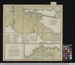
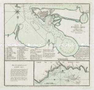
Plano de Puerto-Rico
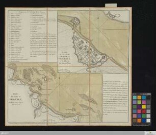
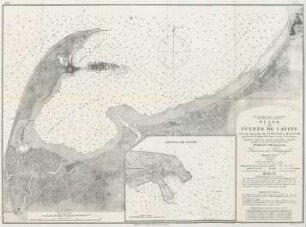
Plano Del Puerto De Veracruz
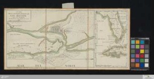
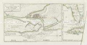
Plano De La Ciudad Y Puerto De San Agustin De La Florida

Plano del Puerto de San Blas
Plano del Puerto de Veracruz. Mit einer Nebenkarte: Plano de la Ciudad y Plaza de la Veracruz
Plano de Puerto-Rico. Mit einer Nebenkarte: Parte de la Isla de Puerto-Rico
No. 5. Plano del Puerto de Cavite
Plano de la Ciudad y Puerto de San Agustin. Mit einer Nebenkarte: (Florida, Kuba)
Plano del Puerto y Villa de la Libertad
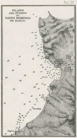
No. 31. Plano del Puerto de Santo Domingo de Basco
Plano De La Ciudad Y Puerto De La Havana
Plano de la Ciudad y Puerto de la Havana
Plano de Puerto-Rico
Plano Del Puerto De Veracruz
Plano De La Ciudad Y Puerto De San Agustin De La Florida
Plano del Puerto de San Blas
Plano del Puerto de Veracruz. Mit einer Nebenkarte: Plano de la Ciudad y Plaza de la Veracruz
Plano de Puerto-Rico. Mit einer Nebenkarte: Parte de la Isla de Puerto-Rico
No. 5. Plano del Puerto de Cavite
Plano de la Ciudad y Puerto de San Agustin. Mit einer Nebenkarte: (Florida, Kuba)
Plano del Puerto y Villa de la Libertad