- Location
-
Dillingen, Studienbibliothek -- X 122#Nr.1
- Dimensions
-
46 x 73 cm
- Extent
-
1 Karte auf 2 Blättern
- Language
-
Latein
- Notes
-
Kupferstich
Leere Titelkartusche obend und unten jeweils in der Mitte
Links beschnitten, unteres rechtes Eck fehlt
Geistiger Schöpfer ermittelt, aus Ruge, Walther: Älteres kartographisches Material in dt. Bibliotheken. 4. Bericht (1911) in: Nachrichten der Kgl. Ges. der Wiss. zu Göttingen, Phil.-Hist. Klasse 1911, S. 132-152 = Nr. 89. - Literatur in: Shirley, Rodney W.: The mapping of the world, 2001, Nr. 99 und Associazione "Roberto Almagià": Quando l'Italia disegnava il mondo, 2016, Tav. 02
Map includes medallion portraits of Ptolemy and Floriano. The map is based on Gerard Mercator's 1538 double-cordiform map. Depicts North America as separate from Asia
- Bibliographic citation
-
[Lafreri-Atlas der Studienbibliothek Dillingen X,122] ; [1]
- Keyword
-
Weltkarte
- URN
-
urn:nbn:de:bvb:12-bsb00107298-1
- Last update
-
16.04.2025, 8:47 AM CEST
Data provider
This object is provided by:
Bayerische Staatsbibliothek. If you have any questions about the object, please contact the data provider.
Bayerische Staatsbibliothek. If you have any questions about the object, please contact the data provider.
Object type
- Altkarte
Associated
Time of origin
- [1555?]
Other Objects (12)
![[Weltkarte]](https://iiif.deutsche-digitale-bibliothek.de/image/2/ba4753a7-74ce-4dab-9b3c-b4481576dead/full/!306,450/0/default.jpg)
[Weltkarte]
![[Weltkarte]](https://iiif.deutsche-digitale-bibliothek.de/image/2/fcd5b4d2-47f1-4499-9a83-16a889dffd43/full/!306,450/0/default.jpg)
[Weltkarte]
![[Weltkarte]](https://iiif.deutsche-digitale-bibliothek.de/image/2/1b3abf05-117b-4041-bd14-0408ca940636/full/!306,450/0/default.jpg)
[Weltkarte]
![[Ovale Weltkarte] : [Planiglob]](https://iiif.deutsche-digitale-bibliothek.de/image/2/2babd3e0-08db-45ba-94ff-b07c418a7b59/full/!306,450/0/default.jpg)
[Ovale Weltkarte] : [Planiglob]
![[Ovale Weltkarte] : [Planiglob]](https://iiif.deutsche-digitale-bibliothek.de/image/2/b32d908f-cae8-4fb3-988e-bb8021be5411/full/!306,450/0/default.jpg)
[Ovale Weltkarte] : [Planiglob]
![[Weltkarte in gnomonischer Projektion]](https://iiif.deutsche-digitale-bibliothek.de/image/2/b04c3d76-1d20-4e12-ad7d-a18922dbd470/full/!306,450/0/default.jpg)
[Weltkarte in gnomonischer Projektion]
![[Weltkarte]](https://iiif.deutsche-digitale-bibliothek.de/image/2/d150ce36-30a6-4e0c-905a-56c16c011e26/full/!306,450/0/default.jpg)
[Weltkarte]
![[Weltkarte]](https://iiif.deutsche-digitale-bibliothek.de/image/2/1c72ae05-a90f-4c0c-8b25-864203809a3c/full/!306,450/0/default.jpg)
[Weltkarte]
![[Weltkarte]](https://iiif.deutsche-digitale-bibliothek.de/image/2/c4105bd9-5162-4c61-9afe-4fe069173951/full/!306,450/0/default.jpg)
[Weltkarte]
![[Weltkarte in zwei herzförmigen Teilen] : Quam hic vides orbis imaginē lector cādide...](https://iiif.deutsche-digitale-bibliothek.de/image/2/31c938a5-9e05-43cc-843b-045ce320e7f6/full/!306,450/0/default.jpg)
[Weltkarte in zwei herzförmigen Teilen] : Quam hic vides orbis imaginē lector cādide...
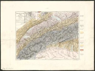
Geognostische Karte Der Alpen In Savoyen Und Der Schweiz : in einem Theile von Deutschland, Frankreich, Piemont und der Lombardei
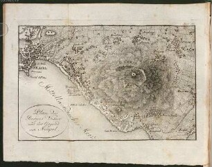
Plan des Berges Vesuv und der Gegend von Neapel
[Weltkarte]
[Weltkarte]
[Weltkarte]
[Ovale Weltkarte] : [Planiglob]
[Ovale Weltkarte] : [Planiglob]
[Weltkarte in gnomonischer Projektion]
[Weltkarte]
[Weltkarte]
[Weltkarte]
[Weltkarte in zwei herzförmigen Teilen] : Quam hic vides orbis imaginē lector cādide...
Geognostische Karte Der Alpen In Savoyen Und Der Schweiz : in einem Theile von Deutschland, Frankreich, Piemont und der Lombardei