- Alternative title
-
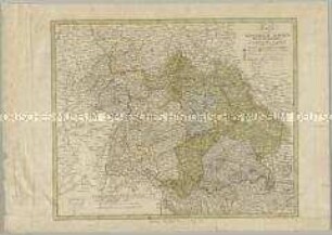
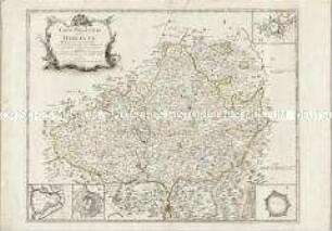
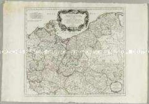
KÖNIGREICH BAIERN / 1806.
- Location
-
Deutsches Historisches Museum, Berlin
- Inventory number
-
Do 2006/1237
- Measurements
-
Höhe x Breite: 60 x 71 cm (Blatt)
Höhe x Breite: 51,3 x 61,3 cm (Karte)
- Material/Technique
-
Tinte (rot), Tinte (blau), Papier, Kupferstich, grenzkoloriert, handgeschrieben
- Classification
-
Kartografie (Gattung)
- Subject (what)
-
Bayern
- Event
-
Herstellung
- (who)
-
Verleger: Johann L. C. Rheinwald
Kartograf: J. G. Friedrich Herdegen
- (where)
-
München ?, Deutschland; Landschaft: Süddeutschland
- (when)
-
zwischen 1806 und 1810
- Rights
-
Deutsches Historisches Museum
- Last update
-
24.03.2023, 9:28 AM CET
Data provider
This object is provided by:
Stiftung Deutsches Historisches Museum. If you have any questions about the object, please contact the data provider.
Stiftung Deutsches Historisches Museum. If you have any questions about the object, please contact the data provider.
Object type
- Kreiskarte
Associated
- Verleger: Johann L. C. Rheinwald
- Kartograf: J. G. Friedrich Herdegen
Time of origin
- zwischen 1806 und 1810
Other Objects (12)
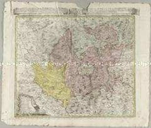
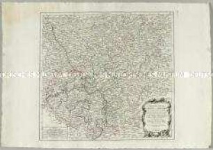
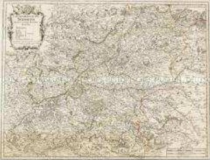
Karte vom Königreich Baiern Würtemberg und Grossht Baden

Charte von dem Königreich Preussen
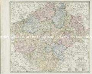
Karte von dem Koenigreich Boeheim

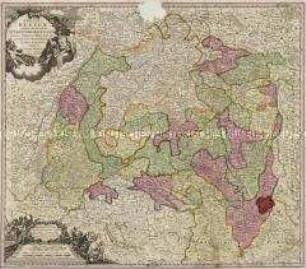
Le Cercle de Baviere
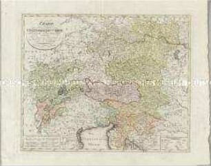
Charte den Oesterreichischen Kreis nach seinen Haupt- und Unter-Abtheilungen vorstellend
Atlas Regni Bohemiae: Repraesentatio Geographica Circuli Egerani, nec non Elnbogensis / Carte du Territoire d'Egra, & du Cercle d'Elnbogue
Carte particuliere de la Moravie. Mit vier Stadtplänen: Brunn; Olmutz; Iglaw; Neustatt
Carte des Cercles du Haut et du Bas Rhin
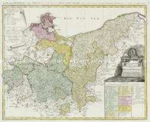
Der nördliche Theil des Obersächsischen Kreises oder die Mark Brandenburg und das Herzogthum Pommern
S. R. I. Circulus Sueviae Continens Ducatum Wirtenbergensem
Partie Septentrionale du Cercle de Haute Saxe. Mit einer Nebenkarte: Supplément pour le Marquisat de Brandebourg
La Generalité de Soissons
Karte vom Königreich Baiern Würtemberg und Grossht Baden
Charte von dem Königreich Preussen
Karte von dem Koenigreich Boeheim
Le Cercle de Baviere
Charte den Oesterreichischen Kreis nach seinen Haupt- und Unter-Abtheilungen vorstellend
Atlas Regni Bohemiae: Repraesentatio Geographica Circuli Egerani, nec non Elnbogensis / Carte du Territoire d'Egra, & du Cercle d'Elnbogue
Carte particuliere de la Moravie. Mit vier Stadtplänen: Brunn; Olmutz; Iglaw; Neustatt
Carte des Cercles du Haut et du Bas Rhin
Der nördliche Theil des Obersächsischen Kreises oder die Mark Brandenburg und das Herzogthum Pommern
S. R. I. Circulus Sueviae Continens Ducatum Wirtenbergensem
Partie Septentrionale du Cercle de Haute Saxe. Mit einer Nebenkarte: Supplément pour le Marquisat de Brandebourg