- Location
-
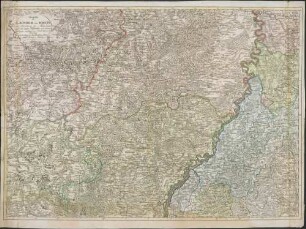
München, Bayerische Staatsbibliothek -- Mapp. XIV,10 u
- Dimensions
-
51 x 57 cm
- Extent
-
1 Kt.
- Notes
-
Kupferstich
Maßstab in graph. Form (Geographische Meilen, Italienische Meilen). - Mit 1 Nebenkt.: Malta. - Mit Bergstrichen
- Keyword
-
Verwaltungsgrenze
Illyrien
Sardinien
Korsika
Italien
- Event
-
Veröffentlichung
- (where)
-
Nürnberg
- (who)
-
Christoph Fembo
- (when)
-
1816
- Contributor
- URN
-
urn:nbn:de:bvb:12-bsb00125206-7
- Last update
-
27.11.2025, 8:27 AM CET
Data provider
This object is provided by:
Bayerische Staatsbibliothek. If you have any questions about the object, please contact the data provider.
Bayerische Staatsbibliothek. If you have any questions about the object, please contact the data provider.
Object type
- Altkarte
Associated
Time of origin
- 1816
Other Objects (12)
![Die Baierische Monarchie : [Gewidmet] Seiner Königlichen Maiestät Von Baiern Maximilian Ioseph](https://iiif.deutsche-digitale-bibliothek.de/image/2/74a16793-42f4-4967-8551-892fe65ee68d/full/!306,450/0/default.jpg)
Die Baierische Monarchie : [Gewidmet] Seiner Königlichen Maiestät Von Baiern Maximilian Ioseph
![Die Baierische Monarchie : [gewidmet] Maximilian Ioseph](https://iiif.deutsche-digitale-bibliothek.de/image/2/b04459b2-ac28-4b5c-9938-7ed1130515a1/full/!306,450/0/default.jpg)
Die Baierische Monarchie : [gewidmet] Maximilian Ioseph
![Die Baierische Monarchie In Bistümer eingetheilt : [Gewidmet] Maximilian Ioseph ; mit königl. bayer. allergn. Privilegio](https://iiif.deutsche-digitale-bibliothek.de/image/2/db20fde3-e338-4c43-a15a-b18a75b11651/full/!306,450/0/default.jpg)
Die Baierische Monarchie In Bistümer eingetheilt : [Gewidmet] Maximilian Ioseph ; mit königl. bayer. allergn. Privilegio
![Die Baierische Monarchie : [Gewidmet] Maximilian Ioseph](https://iiif.deutsche-digitale-bibliothek.de/image/2/791dfb0f-140e-4bd7-a5bc-0c741b0fbb44/full/!306,450/0/default.jpg)
Die Baierische Monarchie : [Gewidmet] Maximilian Ioseph

Die Baierische Monarchie

Geschichte der Vandalen

Ueberblick von Nürnbergs Aufkeimen, Blüthe und Sinken

Miscellanea meist diplomatischen Inhalts
![Die Baierische Monarchie : [Gewidmet] seiner Königlichen Maiestät von Baiern Maximilian Ioseph](https://iiif.deutsche-digitale-bibliothek.de/image/2/239624d0-48d5-4784-b237-70795406a55d/full/!306,450/0/default.jpg)
Die Baierische Monarchie : [Gewidmet] seiner Königlichen Maiestät von Baiern Maximilian Ioseph

Freyheit der Franken. Adel. Sklaverey : Untersuchungen über einen Theil der altdeutschen Verfassung

Freyheit der Franken : Adel. Sklaverei. Unters. über e. Theil d. altdt. Verfassung
Charte der Laender am Rhein : von Strasburg bis Mannheim ; nach den besten Hilfsmitteln und astronom. Bestimmungen
Die Baierische Monarchie : [Gewidmet] Seiner Königlichen Maiestät Von Baiern Maximilian Ioseph
Die Baierische Monarchie : [gewidmet] Maximilian Ioseph
Die Baierische Monarchie In Bistümer eingetheilt : [Gewidmet] Maximilian Ioseph ; mit königl. bayer. allergn. Privilegio
Die Baierische Monarchie : [Gewidmet] Maximilian Ioseph
Die Baierische Monarchie
Geschichte der Vandalen
Ueberblick von Nürnbergs Aufkeimen, Blüthe und Sinken
Miscellanea meist diplomatischen Inhalts
Die Baierische Monarchie : [Gewidmet] seiner Königlichen Maiestät von Baiern Maximilian Ioseph
Freyheit der Franken. Adel. Sklaverey : Untersuchungen über einen Theil der altdeutschen Verfassung
Freyheit der Franken : Adel. Sklaverei. Unters. über e. Theil d. altdt. Verfassung