Geowissenschaftliche Landesaufnahme in der Planungsregion 12 Donau-Wald : Hydrogeologische Karte, 1. Klassifikation der hydrogeologischen Einheiten
- Location
-
Bayerische Staatsbibliothek
- Dimensions
-
129 x 100 cm, gefaltet
- Extent
-
1 Kt.
- Edition
-
1:100 000
- Language
-
Deutsch
- Notes
-
mehrfarb.
- Bibliographic citation
-
Geowissenschaftliche Landesaufnahme in der Planungsregion 12 Donau-Wald ; 1
- Event
-
Veröffentlichung
- (where)
-
Augsburg
- (who)
-
Bayerisches Landesamt für Umwelt
- (when)
-
2011
- Contributor
- URN
-
urn:nbn:de:bvb:12-babs-0000017735
- Last update
-
16.04.2025, 8:45 AM CEST
Data provider
This object is provided by:
Bayerische Staatsbibliothek. If you have any questions about the object, please contact the data provider.
Bayerische Staatsbibliothek. If you have any questions about the object, please contact the data provider.
Associated
- Diepolder, Gerold W.
- Bayerisches Landesamt für Umwelt
- Bayerisches Landesamt für Umwelt
Time of origin
- 2011
Other Objects (12)
![Geowissenschaftliche Landesaufnahme in der Planungsregion 12 Donau-Wald : Hydrogeologische Karte, [0]. Erläuterungen zur hydrogeologischen Karte 1:100 000](https://iiif.deutsche-digitale-bibliothek.de/image/2/338b6c54-b856-4045-977d-9daccb3ce2c6/full/!306,450/0/default.jpg)
Geowissenschaftliche Landesaufnahme in der Planungsregion 12 Donau-Wald : Hydrogeologische Karte, [0]. Erläuterungen zur hydrogeologischen Karte 1:100 000
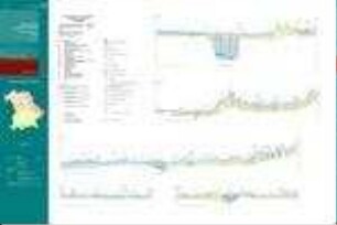
Geowissenschaftliche Landesaufnahme in der Planungsregion 12 Donau-Wald : Hydrogeologische Karte, 5. Hydrogeologische Profilschnitte
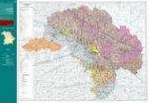
Geowissenschaftliche Landesaufnahme in der Planungsregion 12 Donau-Wald : Hydrogeologische Karte, 3. Hydrogeologische Grunddaten
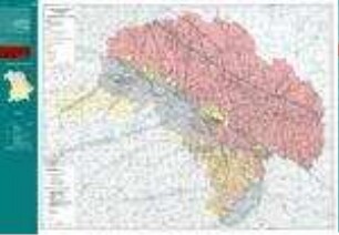
Geowissenschaftliche Landesaufnahme in der Planungsregion 12 Donau-Wald : Hydrogeologische Karte, 2. Grundwasserhöhengleichen

Hydrogeologische Modelle : Bedeutung des hydrogeologischen a-priori-Wissens
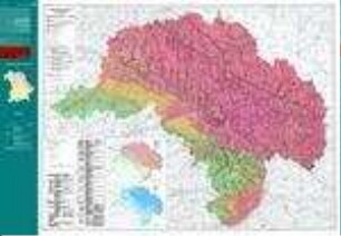
Geowissenschaftliche Landesaufnahme in der Planungsregion 12 Donau-Wald : Hydrogeologische Karte, 4. Schutzfunktion der Grundwasserüberdeckung
Landesamt für Umwelt (Hrsg.), Geowissenschaftliche Landesaufnahme in der Planungsregion 13 Landshut. Erläuterungen zur Hydrogeologischen Karte, München 2007
Hydrogeologische Landesaufnahme Bayerns
Hydrogeologische Kartenwer der Deutschen Demokratischen Republik 1 : 50.000. Nutzerrichtlinie - Hydrogeologische Grundkarte und Karte der hydrogeologischen Kennwerte
Hydrogeologische Karte der Deutschen Demokratischen Republik. Karte der Hydrogeologischen Kennwerte - Grundwasserleiter
Nutzerrichtlinie für die Hydrogeologische Grundkarte, Karte der hydrogeologischen Kennwerte und Karte der Hydroisohypsen
Hydrogeologische Karte von Sachsen-Anhalt. Karte der hydrogeologischen Standortbeschreibung für die oberflächennahe Erdwärmenutzung
Geowissenschaftliche Landesaufnahme in der Planungsregion 12 Donau-Wald : Hydrogeologische Karte, [0]. Erläuterungen zur hydrogeologischen Karte 1:100 000
Geowissenschaftliche Landesaufnahme in der Planungsregion 12 Donau-Wald : Hydrogeologische Karte, 5. Hydrogeologische Profilschnitte
Geowissenschaftliche Landesaufnahme in der Planungsregion 12 Donau-Wald : Hydrogeologische Karte, 3. Hydrogeologische Grunddaten
Geowissenschaftliche Landesaufnahme in der Planungsregion 12 Donau-Wald : Hydrogeologische Karte, 2. Grundwasserhöhengleichen
Hydrogeologische Modelle : Bedeutung des hydrogeologischen a-priori-Wissens
Geowissenschaftliche Landesaufnahme in der Planungsregion 12 Donau-Wald : Hydrogeologische Karte, 4. Schutzfunktion der Grundwasserüberdeckung
Landesamt für Umwelt (Hrsg.), Geowissenschaftliche Landesaufnahme in der Planungsregion 13 Landshut. Erläuterungen zur Hydrogeologischen Karte, München 2007
Hydrogeologische Landesaufnahme Bayerns
Hydrogeologische Kartenwer der Deutschen Demokratischen Republik 1 : 50.000. Nutzerrichtlinie - Hydrogeologische Grundkarte und Karte der hydrogeologischen Kennwerte
Hydrogeologische Karte der Deutschen Demokratischen Republik. Karte der Hydrogeologischen Kennwerte - Grundwasserleiter
Nutzerrichtlinie für die Hydrogeologische Grundkarte, Karte der hydrogeologischen Kennwerte und Karte der Hydroisohypsen