- Former reference number
-
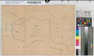
Regierung Düsseldorf Kataster Karten Nr. R 15
- Dimensions
-
Höhe: 65 cm, Breite: 102 cm, Maßstab: 1:2.500
- Notes
-
Diese Karte war vor der Neuverzeichnung Bestandteil eines Atlanten (Altsignatur: Regierung Düsseldorf Kat Karten R 15)
- Context
-
Kreis Kleve: Katasterkarten >> 74. Wankum (3184) >> 74.2. Urkarten
- Holding
-
BR 0146 Kreis Kleve: Katasterkarten
- Provenance
-
Regierung Düsseldorf
- Date of creation
-
ca. 1814-1815
- Other object pages
- Delivered via
- Last update
-
24.06.2025, 2:01 PM CEST
Data provider
This object is provided by:
Landesarchiv Nordrhein-Westfalen. Abteilung Rheinland. If you have any questions about the object, please contact the data provider.
Landesarchiv Nordrhein-Westfalen. Abteilung Rheinland. If you have any questions about the object, please contact the data provider.
Object type
- Karten / Pläne
Associated
- Regierung Düsseldorf
Time of origin
- ca. 1814-1815
Other Objects (12)

Section J - Vorst
Section C - Vorst, Blatt 1
Bürgermeisterei Vorst: Gemeinde Vorst
Vorst (Bürgermeisterei): Gemeinde Vorst
Bürgermeisterei Vorst: Gemeinde Vorst
Wankum (Kanton) I: - Gemeinde Grefrath 1: Übersichtskarte 2: Section A Vorst 3: Section B Langendonk 4: Section C Bruckhausen 5: Section D Grefrath 6: Section E Slibbeck 7: Section F Schaphausen 8: Section G Nette 9: Section H Vinckrath
Neersen (Kanton) I: - Gemeinde Gladbach 1: Section A Großeheide (Grosshaide) 2: Section A Großeheide (Grosshaide), Nr. 1 3: Section B Windberg und Großeheide (Grosshaide) 4: Section C Eicken 5: Section D Lurip 6: Section E Compesmühle 7: Section F Haterbroich 8: Section G Lupersende 9: Section H Thal 10: Section I Ohler und Holt 11: Section K Hehn-Holt 12: Section L Venn und Beltinghoven 13: Section M Runder und Waldhausen 14: Section M Runder und Waldhausen 15: Section N Kreuz 16: Section O Gladbach - Gemeinde Hardt (Haardt) 17: Section A Waye 18: Section B Rassel 19: Section C Vorst Hardt (Vorst Haardt) 20: Section D Pfarrhaus 21: Section E Hardterbusch (Haardterbusch), I. Blatt 22: Section E Hardterbusch (Haardterbusch), II. Blatt 23: Section F Landwehr, I. Blatt 24: Section F Landwehr, II. Blatt 25: Section G Hardt (Haardt) 26: Section H Hehn Hardt (Haardt) 27: Section I Vorst Gladbach 28: Section K Winkel - Gemeinde Neuwerk 29: Section A Clörather Bruch 30: Section D Abtshof 31: Section E Uedding, Nr. 1 32: Section E Uedding, Nr. 2 33: Section G Bethrath und Hoven
Neersen (Kanton) IV: - Gemeinde Süchteln 1: Übersichtskarte 2: Section N Süchteln 3: Section A Hagenbroicherbroich 4: Section B Treibgraben 5: Section C Postelsheide 6: Section D Vorst 7: Section E Sittard 8: Section F Rade 9: Section G Grand-Bois, I 10: Section G Grand-Bois, II 11: Section H Dornbusch 12: Section I Windberg 13: Section K Hagenbroicherhütte 14: Section L Hagenbroich 15: Section M Hagelkreutz
Beiblatt zur Übersichtskarte Blatt 2 (Vorst)
Gemarkungsgrenzen Vorst - Sankt Tönis - Benrad
Section A - Grotewinter; Section B - Husmanns, Blatt 1
Grenze zwischen der Bürgermeisterei Vorst und der Gemeinde Kleinkempen. Auszug aus dem Grenzhandriß von Vorst.
Section J - Vorst
Section C - Vorst, Blatt 1
Bürgermeisterei Vorst: Gemeinde Vorst
Vorst (Bürgermeisterei): Gemeinde Vorst
Bürgermeisterei Vorst: Gemeinde Vorst
Wankum (Kanton) I: - Gemeinde Grefrath 1: Übersichtskarte 2: Section A Vorst 3: Section B Langendonk 4: Section C Bruckhausen 5: Section D Grefrath 6: Section E Slibbeck 7: Section F Schaphausen 8: Section G Nette 9: Section H Vinckrath
Neersen (Kanton) I: - Gemeinde Gladbach 1: Section A Großeheide (Grosshaide) 2: Section A Großeheide (Grosshaide), Nr. 1 3: Section B Windberg und Großeheide (Grosshaide) 4: Section C Eicken 5: Section D Lurip 6: Section E Compesmühle 7: Section F Haterbroich 8: Section G Lupersende 9: Section H Thal 10: Section I Ohler und Holt 11: Section K Hehn-Holt 12: Section L Venn und Beltinghoven 13: Section M Runder und Waldhausen 14: Section M Runder und Waldhausen 15: Section N Kreuz 16: Section O Gladbach - Gemeinde Hardt (Haardt) 17: Section A Waye 18: Section B Rassel 19: Section C Vorst Hardt (Vorst Haardt) 20: Section D Pfarrhaus 21: Section E Hardterbusch (Haardterbusch), I. Blatt 22: Section E Hardterbusch (Haardterbusch), II. Blatt 23: Section F Landwehr, I. Blatt 24: Section F Landwehr, II. Blatt 25: Section G Hardt (Haardt) 26: Section H Hehn Hardt (Haardt) 27: Section I Vorst Gladbach 28: Section K Winkel - Gemeinde Neuwerk 29: Section A Clörather Bruch 30: Section D Abtshof 31: Section E Uedding, Nr. 1 32: Section E Uedding, Nr. 2 33: Section G Bethrath und Hoven
Neersen (Kanton) IV: - Gemeinde Süchteln 1: Übersichtskarte 2: Section N Süchteln 3: Section A Hagenbroicherbroich 4: Section B Treibgraben 5: Section C Postelsheide 6: Section D Vorst 7: Section E Sittard 8: Section F Rade 9: Section G Grand-Bois, I 10: Section G Grand-Bois, II 11: Section H Dornbusch 12: Section I Windberg 13: Section K Hagenbroicherhütte 14: Section L Hagenbroich 15: Section M Hagelkreutz
Beiblatt zur Übersichtskarte Blatt 2 (Vorst)
Gemarkungsgrenzen Vorst - Sankt Tönis - Benrad
Section A - Grotewinter; Section B - Husmanns, Blatt 1