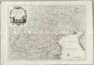
Verwaltungskarte
Partie Meridionale de l'Archevesché et Eslectorat de Cologne, des Duchés de Iuliers et de Berg, le Duché de Limbourg, &c.
- Alternative title
-
PARTIE MERIDIONALE DE L'ARCHEVESCHÉ ET ESLECTORAT DE COLOGNE, DES DUCHÉS DE IULIERS ET DE BERG, LE DUCHÉ DE LIMBOURG, &c. / Par le Sr. IALLOT, Geographe Ordinaire du Roy. A PARIS Chez Dezauche Géographe, Successeur des Srs. Delisle et Phil. Buache 1ers. Geog. du Roi, Rue des Noyers
- Location
-
Deutsches Historisches Museum, Berlin
- Inventory number
-
Do 2006/1199
- Measurements
-
Höhe x Breite: 56,7 x 79 cm (Blatt)
Höhe x Breite: 46,3 x 68,8 cm (Karte)
Höhe x Breite: 51,3 x 72 cm (Platte)
- Material/Technique
-
Papier, Kuperstich, grenzkoloriert
- Classification
-
Kartografie (Gattung)
- Subject (what)
-
Köln
Jülich
Berg
- Event
-
Herstellung
- (who)
-
Geograph, Kartograf, Verleger: Alexis-Hubert Jaillot
Verleger, Geograph, Stecher: Jean-Claude Dezauche
- (where)
-
Paris, Frankreich
- (when)
-
um 1707
- Rights
-
Deutsches Historisches Museum
- Last update
-
24.03.2023, 9:28 AM CET
Data provider
This object is provided by:
Stiftung Deutsches Historisches Museum. If you have any questions about the object, please contact the data provider.
Stiftung Deutsches Historisches Museum. If you have any questions about the object, please contact the data provider.
Object type
- Verwaltungskarte
Associated
- Geograph, Kartograf, Verleger: Alexis-Hubert Jaillot
- Verleger, Geograph, Stecher: Jean-Claude Dezauche
Time of origin
- um 1707
Other Objects (12)
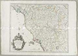
Carte du Grand-Duché de Toscane
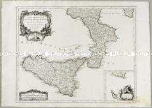
Partie Méridionale du Royaume de Naples. Mit einer Nebenkarte: Supplement pour l'Isle de Malte
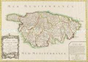
Nouvelle Carte de l'Isle de Corse
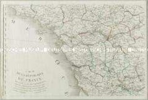
Carte de la République de France divisée en 87 Departements. Mit einer Nebenkarte: Département de l'Isle de Corse
Estat de la Seigneurie et République de Venise
Partie Occidentale de l'Empire de Russie en Asie
Atlas Nouveau: Gouvernements de Bourgogne et de Franche-Comté
Partie Orientale de l'Empire de Russie en Asie
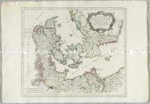
Royaume de Danemarck
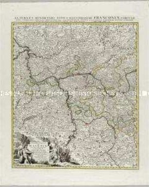
Grand Theatre de la Guerre: L'Electorat de Mayence, le Bas Palatinat et une partie du pays de Hesse et de la rivière du Mein
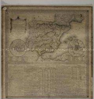
Carte Statistique Politique et Comparée de la Peninsule Hispanique. Mit zwei Stadtplänen: Plan de Lisbone; Plan de Madrid
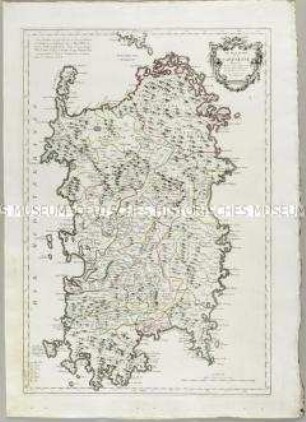
Le Royaume de Sardaigne
Carte du Grand-Duché de Toscane
Partie Méridionale du Royaume de Naples. Mit einer Nebenkarte: Supplement pour l'Isle de Malte
Nouvelle Carte de l'Isle de Corse
Carte de la République de France divisée en 87 Departements. Mit einer Nebenkarte: Département de l'Isle de Corse
Estat de la Seigneurie et République de Venise
Partie Occidentale de l'Empire de Russie en Asie
Atlas Nouveau: Gouvernements de Bourgogne et de Franche-Comté
Partie Orientale de l'Empire de Russie en Asie
Royaume de Danemarck
Grand Theatre de la Guerre: L'Electorat de Mayence, le Bas Palatinat et une partie du pays de Hesse et de la rivière du Mein
Carte Statistique Politique et Comparée de la Peninsule Hispanique. Mit zwei Stadtplänen: Plan de Lisbone; Plan de Madrid