- Alternative title
-
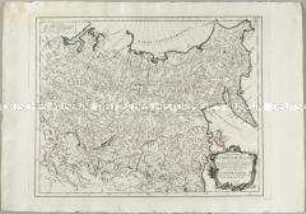
PARTIE OCCIDENTALE / DE L'EMPIRE DE RUSSIE / EN ASIE / Contenant les Provinces de
- Location
-
Deutsches Historisches Museum, Berlin
- Inventory number
-
Do 2006/892
- Measurements
-
Höhe x Breite: 55 x 79 cm (Blatt)
Höhe x Breite: 45,5 x 57 cm (Karte)
Höhe x Breite: 48 x 60 cm (Platte)
- Material/Technique
-
Papier, Kupferstich, grenzkoloriert
- Classification
-
Kartografie (Gattung)
- Subject (what)
-
Russland
- Event
-
Herstellung
- (who)
-
Kartograf, Geograph: Didier Robert de Vaugondy
Stecher, Kartograf: Paolo Santini
Kartograf, Verleger: Giuseppe Antonio Remondini
- (where)
-
Venedig, Italien
- (when)
-
um 1780
- Rights
-
Deutsches Historisches Museum
- Last update
- 24.03.2023, 9:29 AM CET
Data provider
This object is provided by:
Stiftung Deutsches Historisches Museum. If you have any questions about the object, please contact the data provider.
Stiftung Deutsches Historisches Museum. If you have any questions about the object, please contact the data provider.
Object type
- Verwaltungskarte
Associated
- Kartograf, Geograph: Didier Robert de Vaugondy
- Stecher, Kartograf: Paolo Santini
- Kartograf, Verleger: Giuseppe Antonio Remondini
Time of origin
- um 1780
Other Objects (12)
Partie Orientale de l'Empire de Russie en Asie
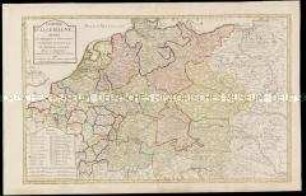
L'Empire d'Allemagne. Divisée en ses Principautés et Souverainetés

Carte Itinéraire de l'Empire Français donnant toutes les Nouvelles Routes 1807. Mit Schuber
Topographische Karte des Elbetals und Umgebung nordwestlich von Dresden in Sachsen
Administrative Karte von Norddeutschland mit den Postleitgebieten
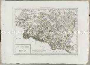
Atlas Nouveau: Gouvernement de Bearn
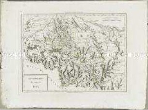
Atlas Nouveau: Gouvernement du Comté de Foix

Topographische Karte der Gegend östlich von Emmendingen zwischen Dörlinbach, Prechtal, Elzach, Triberg, Furtwangen, St. Peter und Freiburg im Breisgau, heute Südlicher Oberrhein und Regierungsbezirk Freiburg
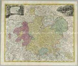
Landgraviatus Hassiae Inferioris nova Tabula
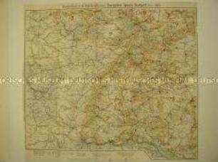
Verwaltungskarte mit den Postleitgebieten Karlsruhe, Saargebiet, Speyer, Stuttgart
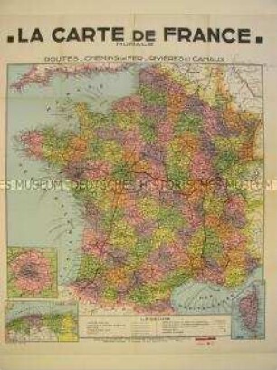
Verwaltungskarte von Frankreich
Topographische Karte der Gegend um Collmnitz zwischen Gohrisch, Frauenhain, Walda, Sageritz und Grödel in Sachsen
Partie Orientale de l'Empire de Russie en Asie
L'Empire d'Allemagne. Divisée en ses Principautés et Souverainetés
Carte Itinéraire de l'Empire Français donnant toutes les Nouvelles Routes 1807. Mit Schuber
Topographische Karte des Elbetals und Umgebung nordwestlich von Dresden in Sachsen
Administrative Karte von Norddeutschland mit den Postleitgebieten
Atlas Nouveau: Gouvernement de Bearn
Atlas Nouveau: Gouvernement du Comté de Foix
Topographische Karte der Gegend östlich von Emmendingen zwischen Dörlinbach, Prechtal, Elzach, Triberg, Furtwangen, St. Peter und Freiburg im Breisgau, heute Südlicher Oberrhein und Regierungsbezirk Freiburg
Landgraviatus Hassiae Inferioris nova Tabula
Verwaltungskarte mit den Postleitgebieten Karlsruhe, Saargebiet, Speyer, Stuttgart
Verwaltungskarte von Frankreich