Verwaltungskarte
L'Empire d'Allemagne. Divisée en ses Principautés et Souverainetés
- Alternativer Titel
-
L'EMPIRE / D'ALLEMAGNE. / DIVISÉE / en ses Principautés et Souverainetés
- Standort
-
Deutsches Historisches Museum, Berlin
- Inventarnummer
-
Do 2006/1080
- Maße
-
Höhe x Breite: 63,5 x 98,5 cm (Blatt)
Höhe x Breite: 53,3 x 86 cm (Karte)
Höhe x Breite: 59 x 89 cm (Platte)
- Material/Technik
-
Papier, Kupferstich, koloriert
- Klassifikation
-
Kartografie (Gattung)
- Bezug (was)
-
Heiliges Römisches Reich
Deutschland
Frankreich
Niederlande
- Ereignis
-
Herstellung
- (wer)
-
Geograph, Kartograf: Guillaume Sanson?
Verlag: Mondhare et Jean
- (wo)
-
Paris, Frankreich
- (wann)
-
1792
- Rechteinformation
-
Deutsches Historisches Museum
- Letzte Aktualisierung
- 24.03.2023, 09:28 MEZ
Datenpartner
Dieses Objekt wird bereitgestellt von:
Stiftung Deutsches Historisches Museum. Bei Fragen zum Objekt wenden Sie sich bitte an den Datenpartner.
Stiftung Deutsches Historisches Museum. Bei Fragen zum Objekt wenden Sie sich bitte an den Datenpartner.
Objekttyp
- Verwaltungskarte
Beteiligte
- Geograph, Kartograf: Guillaume Sanson?
- Verlag: Mondhare et Jean
Entstanden
- 1792
Ähnliche Objekte (12)
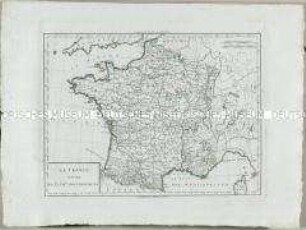
Atlas Nouveau: La France divisee en 32 gr.ds Gouvernemens

Robert (?Jean) Janvier: La France divisée par généralités. Paris 1769. Zweiteilige Karte. Teil 1.
Robert (?Jean) Janvier: La France divisée par généralités. Paris 1769. Zweiteilige Karte. Teil 2.
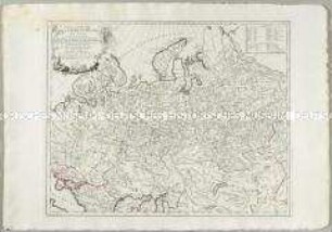
Partie Orientale de l'Empire de Russie en Asie
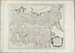
Partie Occidentale de l'Empire de Russie en Asie
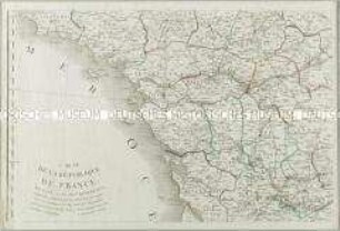
Carte de la République de France divisée en 87 Departements. Mit einer Nebenkarte: Département de l'Isle de Corse
Carte Itinéraire de l'Empire Français donnant toutes les Nouvelles Routes 1807. Mit Schuber
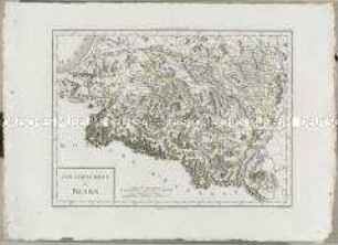
Atlas Nouveau: Gouvernement de Bearn
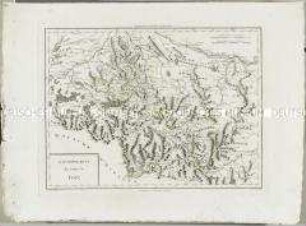
Atlas Nouveau: Gouvernement du Comté de Foix

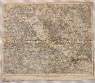
Topographische Karte der Gegend östlich von Emmendingen zwischen Dörlinbach, Prechtal, Elzach, Triberg, Furtwangen, St. Peter und Freiburg im Breisgau, heute Südlicher Oberrhein und Regierungsbezirk Freiburg
Topographische Karte des Elbetals und Umgebung nordwestlich von Dresden in Sachsen
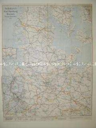
Administrative Karte von Norddeutschland mit den Postleitgebieten
Atlas Nouveau: La France divisee en 32 gr.ds Gouvernemens
Robert (?Jean) Janvier: La France divisée par généralités. Paris 1769. Zweiteilige Karte. Teil 1.
Robert (?Jean) Janvier: La France divisée par généralités. Paris 1769. Zweiteilige Karte. Teil 2.
Partie Orientale de l'Empire de Russie en Asie
Partie Occidentale de l'Empire de Russie en Asie
Carte de la République de France divisée en 87 Departements. Mit einer Nebenkarte: Département de l'Isle de Corse
Carte Itinéraire de l'Empire Français donnant toutes les Nouvelles Routes 1807. Mit Schuber
Atlas Nouveau: Gouvernement de Bearn
Atlas Nouveau: Gouvernement du Comté de Foix
Topographische Karte der Gegend östlich von Emmendingen zwischen Dörlinbach, Prechtal, Elzach, Triberg, Furtwangen, St. Peter und Freiburg im Breisgau, heute Südlicher Oberrhein und Regierungsbezirk Freiburg
Topographische Karte des Elbetals und Umgebung nordwestlich von Dresden in Sachsen