Archivale
Hoher-Heckenweg
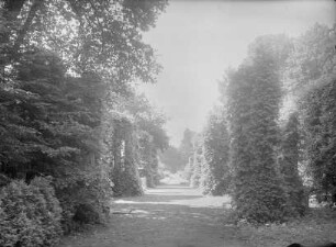
Längenprofil und Lageplan vom Niedersachsenring bis zum Coerder Leichenweg. Querschnitte.
- Reference number
-
Slg-KUP, A 134,19a,17
- Dimensions
-
Bl. 63,9 x 153,3
- Formal description
-
Papier geknickt und stark eingerissen; gefaltet. Mit Tesa geklebt.
- Further information
-
Ausführung: Pause, koloriert
Maßstab: 1:100, 1:2000
- Context
-
Karten und Pläne >> 01. Stadtdarstellungen >> 01.04. Straßen und Plätze
- Holding
-
Slg-KUP Karten und Pläne
- Indexentry person
-
Ho
Si
- Indexentry place
-
Hoher Heckenweg
- Date of creation
-
1939, 03. 07.
- Other object pages
- Provenance
-
. Städtisches Tiefbauamt
- Delivered via
- Last update
-
05.11.2025, 3:47 PM CET
Data provider
This object is provided by:
Stadtarchiv Münster. If you have any questions about the object, please contact the data provider.
Stadtarchiv Münster. If you have any questions about the object, please contact the data provider.
Object type
- Archivale
Time of origin
- 1939, 03. 07.
Other Objects (12)

Heckenweg
Heckenweg
Heckenweg
Besitzung Kajüter am Hohen Heckenweg
Britische Schule am Hohen Heckenweg
Heckenweg
Plan über die Kanalisation, Hoher Heckenweg
Umbau des Bauernhauses Hoher Heckenweg 175
Besitzung Hoher Heckenweg 56, Landwirt Riesenbeck
Errichtung einer Behelfsschule am Hohen Heckenweg
Diergardtstr. (Heckenweg)
Bebauungsplan Nr. 148 Hoher Heckenweg/Kösliner Straße
Heckenweg
Heckenweg
Heckenweg
Besitzung Kajüter am Hohen Heckenweg
Britische Schule am Hohen Heckenweg
Heckenweg
Plan über die Kanalisation, Hoher Heckenweg
Umbau des Bauernhauses Hoher Heckenweg 175
Besitzung Hoher Heckenweg 56, Landwirt Riesenbeck
Errichtung einer Behelfsschule am Hohen Heckenweg
Diergardtstr. (Heckenweg)