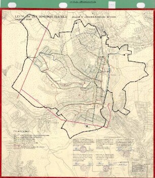
Karten und Pläne
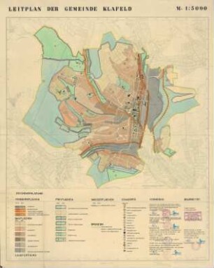
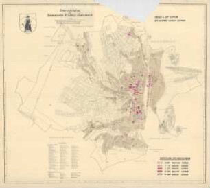
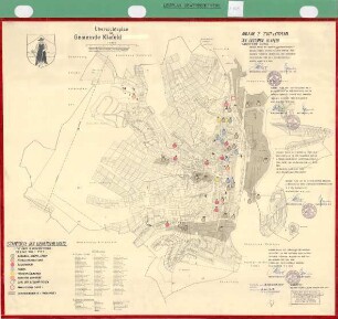
Leitplan der Gemeinde Klafeld, Anlage 11 Bevölkerungsdichte
- Archivaliensignatur
-
Best. 752 Karten und Pläne, P 1318
- Formalbeschreibung
-
Karte ist farbig.
- Bemerkungen
-
Inhalt: Geisweid, Klafeld, Dillnhütten, Birlenbach, Buschgotthardshütten, Hüttental usw.
- Sonstige Erschließungsangaben
-
Ort: Klafeld
Ort: Geisweid
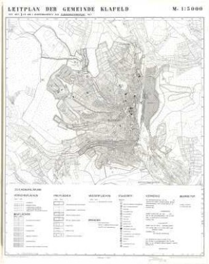
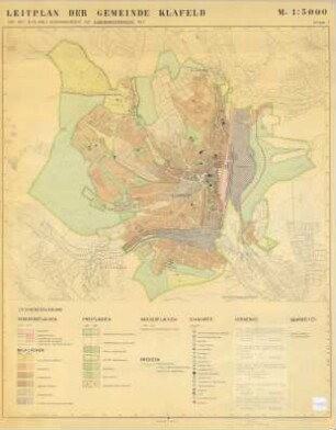
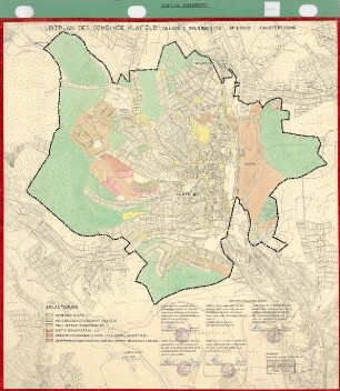
Maßstab: 1:5000
- Kontext
-
Karten und Pläne >> 4. Stadtteile der Großstadt Siegen >> Klafeld-Geisweid >> Leitplan Klafeld
- Bestand
-
Best. 752 Karten und Pläne
- Provenienz
-
FB 7/5 Stadtplanung
- Laufzeit
-
1956
- Weitere Objektseiten
- Letzte Aktualisierung
-
04.06.2025, 09:09 MESZ
Datenpartner
Dieses Objekt wird bereitgestellt von:
Stadtarchiv Siegen. Bei Fragen zum Objekt wenden Sie sich bitte an den Datenpartner.
Stadtarchiv Siegen. Bei Fragen zum Objekt wenden Sie sich bitte an den Datenpartner.
Objekttyp
- Karten / Pläne
Beteiligte
- FB 7/5 Stadtplanung
Entstanden
- 1956
Ähnliche Objekte (12)
Leitplan der Gemeinde Klafeld
Leitplan der Gemeinde Klafeld
Leitplan der Gemeinde Klafeld
Leitplan der Gemeinde Klafeld, Anlage 3 Grundbesitz
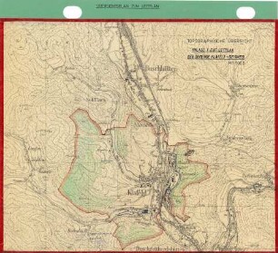
Leitplan der Gemeinde Klafeld, Anlage 1, topographische Ansicht
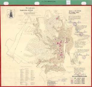
Übersichtsplan der Gemeinde Klafeld-Geisweid, Anlage 4 zum Leitplan der Gemeinde Klafeld-Geisweid
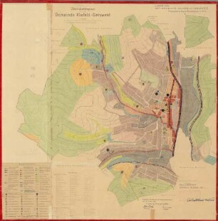
Übersichtsplan der Gemeinde Klafeld-Geisweid, Leitplan der Gemeinde Klafeld-Geisweid
Leitplan der Gemeinde Klafeld, Anlage 6 Versorgungsplan zum Übersichtsplan der Gemeinde
Leitplan der Gemeinde Klafeld, Anlage 7 Gewerbebetriebe zum Übersichtsplan der Gemeinde
Leitplan der Gemeinde Klafeld, Anlage 4 Kriegsschäden zum Übersichtsplan der Gemeinde
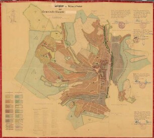
Leitplan und Wirtschaftsplan der Gemeinde Klafeld, 1. Ausfertigung

Bevölkerungsdichte
Leitplan der Gemeinde Klafeld
Leitplan der Gemeinde Klafeld
Leitplan der Gemeinde Klafeld
Leitplan der Gemeinde Klafeld, Anlage 3 Grundbesitz
Leitplan der Gemeinde Klafeld, Anlage 1, topographische Ansicht
Übersichtsplan der Gemeinde Klafeld-Geisweid, Anlage 4 zum Leitplan der Gemeinde Klafeld-Geisweid
Übersichtsplan der Gemeinde Klafeld-Geisweid, Leitplan der Gemeinde Klafeld-Geisweid
Leitplan der Gemeinde Klafeld, Anlage 6 Versorgungsplan zum Übersichtsplan der Gemeinde
Leitplan der Gemeinde Klafeld, Anlage 7 Gewerbebetriebe zum Übersichtsplan der Gemeinde
Leitplan der Gemeinde Klafeld, Anlage 4 Kriegsschäden zum Übersichtsplan der Gemeinde
Leitplan und Wirtschaftsplan der Gemeinde Klafeld, 1. Ausfertigung