- Archivaliensignatur
-
Best. 752 Karten und Pläne, P 1324
- Formalbeschreibung
-
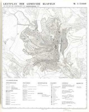
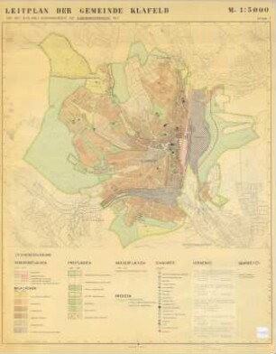
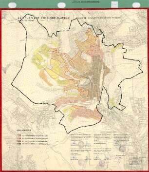
Karte ist farbig und hat leichte Beschädigungen.
- Bemerkungen
-
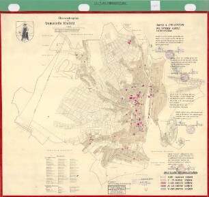
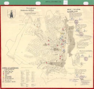
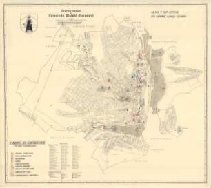
Inhalt: Zeichenerklärung für Verkehrsflächen, Bauflächen, Freifläche, Wasserfläche, Grenzen, Standorte von div. Gebäude, Plätze usw., Buschgotthardshütten, Birlenbach, Dillnhütten usw.
- Sonstige Erschließungsangaben
-
Ort: Klafeld
Ort: Geisweid
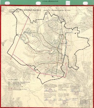
Maßstab: 1:5000
- Kontext
-
Karten und Pläne >> 4. Stadtteile der Großstadt Siegen >> Klafeld-Geisweid >> Leitplan Klafeld
- Bestand
-
Best. 752 Karten und Pläne
- Laufzeit
-
1958
- Weitere Objektseiten
- Provenienz
-
FB 7/5 Stadtplanung
- Letzte Aktualisierung
-
04.06.2025, 09:09 MESZ
Datenpartner
Dieses Objekt wird bereitgestellt von:
Stadtarchiv Siegen. Bei Fragen zum Objekt wenden Sie sich bitte an den Datenpartner.
Stadtarchiv Siegen. Bei Fragen zum Objekt wenden Sie sich bitte an den Datenpartner.
Objekttyp
- Karten / Pläne
Entstanden
- 1958
Ähnliche Objekte (12)
Leitplan der Gemeinde Klafeld
Leitplan der Gemeinde Klafeld
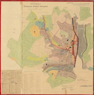
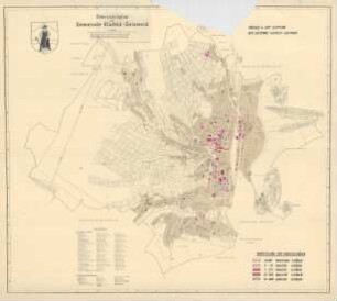
Übersichtsplan der Gemeinde Klafeld-Geisweid, Leitplan der Gemeinde Klafeld-Geisweid
Leitplan der Gemeinde Klafeld, Anlage 3 Grundbesitz
Leitplan der Gemeinde Klafeld, Anlage 11 Bevölkerungsdichte
Übersichtsplan der Gemeinde Klafeld-Geisweid, Anlage 4 zum Leitplan der Gemeinde Klafeld-Geisweid
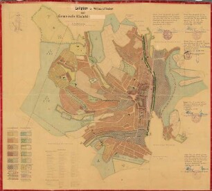
Leitplan und Wirtschaftsplan der Gemeinde Klafeld, 1. Ausfertigung
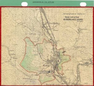
Leitplan der Gemeinde Klafeld, Anlage 1, topographische Ansicht
Leitplan der Gemeinde Klafeld, Anlage 4 Kriegsschäden zum Übersichtsplan der Gemeinde
Leitplan der Gemeinde Klafeld, Anlage 6 Versorgungsplan zum Übersichtsplan der Gemeinde
Leitplan der Gemeinde Klafeld, Anlage 7 Gewerbebetriebe zum Übersichtsplan der Gemeinde
Leitplan der Gemeinde Klafeld, Anlage 7 Gewerbebetriebe mit über 10 Beschäftigte zum Übersichtsplan der Gemeinde
Leitplan der Gemeinde Klafeld
Leitplan der Gemeinde Klafeld
Übersichtsplan der Gemeinde Klafeld-Geisweid, Leitplan der Gemeinde Klafeld-Geisweid
Leitplan der Gemeinde Klafeld, Anlage 3 Grundbesitz
Leitplan der Gemeinde Klafeld, Anlage 11 Bevölkerungsdichte
Übersichtsplan der Gemeinde Klafeld-Geisweid, Anlage 4 zum Leitplan der Gemeinde Klafeld-Geisweid
Leitplan und Wirtschaftsplan der Gemeinde Klafeld, 1. Ausfertigung
Leitplan der Gemeinde Klafeld, Anlage 1, topographische Ansicht
Leitplan der Gemeinde Klafeld, Anlage 4 Kriegsschäden zum Übersichtsplan der Gemeinde
Leitplan der Gemeinde Klafeld, Anlage 6 Versorgungsplan zum Übersichtsplan der Gemeinde
Leitplan der Gemeinde Klafeld, Anlage 7 Gewerbebetriebe zum Übersichtsplan der Gemeinde