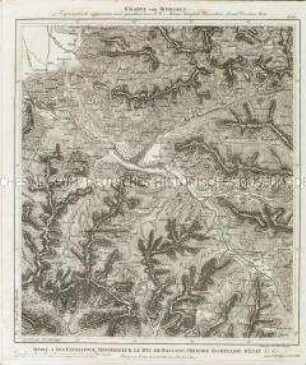
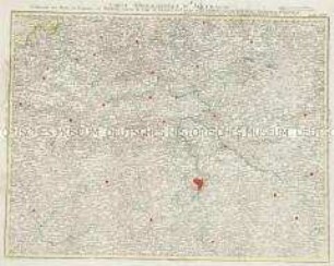
Regionalkarte
Karte der Bistümer Hildesheim, Halberstadt und Magdeburg sowie der Herzogtümer Braunschweig, Wolfenbüttel, Wernigerode (Grand Atlas, Bl. 23)
- Alternative title
-
CARTE TOPOGRAPHIQUE D'ALLEMAGNE / Contenant l'EVECHÉ de HILDESHEIM, le DUCHÉ de PRUNSWIG WOLFENBVTEL, le HARZ, la PRINCIPAUTE de HALBERSTAT / le COMTE de WERNIGERODE, l'ABBAYE de QUEDLENBOURG une partie du DUCHÉ de LUNEB: PRINCIPAUTE d'ANHALT et de le DUCHE de MAGDEBOURG.
- Location
-
Deutsches Historisches Museum, Berlin
- Inventory number
-
Do 2006/1059.23
- Measurements
-
Höhe x Breite: 56,5 x 78 cm, Höhe: 56,5 cm, Breite: 78 cm, Tiefe: 3 cm (Atlas)
Höhe x Breite: 56,5 x 78 cm (Blatt)
Höhe x Breite: 52 x 68 cm (Platte)
Höhe x Breite: 46 x 59 cm (Karte)
- Material/Technique
-
Papier, Kupferstich, koloriert, gebunden |Fadenheftung
- Classification
-
Kartografie (Gattung)
- Subject (what)
-
Deutschland
- Event
-
Herstellung
- (who)
-
Verleger, Militärkartograph: Johann Wilhelm Abraham Jaeger
- (where)
-
Frankfurt (Main) [historisch: Frankfurt, Reichsstadt], Deutschland
- (when)
-
um 1785
- Rights
-
Deutsches Historisches Museum
- Last update
-
24.03.2023, 9:27 AM CET
Data provider
This object is provided by:
Stiftung Deutsches Historisches Museum. If you have any questions about the object, please contact the data provider.
Stiftung Deutsches Historisches Museum. If you have any questions about the object, please contact the data provider.
Object type
- Regionalkarte
Associated
- Verleger, Militärkartograph: Johann Wilhelm Abraham Jaeger
Time of origin
- um 1785
Other Objects (12)

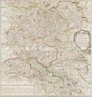
Grand Atlas . Bl. 22 (Westfalen, Braunschweig, Wolfenbüttel, Paderborn, Osnabrück, Hildesheim...): Contenant une Partie de Wesphalie, les Principautés de Braunschw. Wolffenbuttel, de Callnberg, et de Munden, l'Eveche de Paderborn, d'Osnabruck, et de Hildesheim, les Comtés de la Lippe, de Ravensberg, de Schaumburg, de Pyrmont et de Ritberg. l'Abbaye de Corvey et et

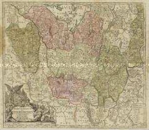
L´Electorate De Hannover ou se Trouvent les Camps et les Plans des principales Villes de cette Province et de l´Eveché de Hildesheim qui y est enclavé

Tabula Geographica Totam Borussiam ut et Districtum Notecensem. Mit einer Nebenkarte: Charte welche den Netz District vorstellet
Charte von Schwaben No. 60

Holstein, Lauenburg, Hamburg u. Lübeck
Charte von Schwaben (unvollständig; Titel nicht erhalten)
La Flandre, le Hainaut, le Brabant, l'Artois une partie de la Picardie, et du Luxembourg
Atlas Nouveau: Isles Britanniques Troisieme Carte
Grand Atlas . Bl. 43 (Böhmen...): Contenant une Partie du Royaume de Boheme, Scavoir la Ville de Prague, les Cercles de Ragonitz, Saatz, Leitmeriz, Kaurizim et de Buntzlau.
Gouvernemens généraux du Maine et Perche, de l'Anjou, de la Touraine et du Saumurois
Electoratus sive Marchia Brandenburgensis
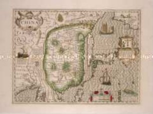
China
Grand Atlas . Bl. 22 (Westfalen, Braunschweig, Wolfenbüttel, Paderborn, Osnabrück, Hildesheim...): Contenant une Partie de Wesphalie, les Principautés de Braunschw. Wolffenbuttel, de Callnberg, et de Munden, l'Eveche de Paderborn, d'Osnabruck, et de Hildesheim, les Comtés de la Lippe, de Ravensberg, de Schaumburg, de Pyrmont et de Ritberg. l'Abbaye de Corvey et et
L´Electorate De Hannover ou se Trouvent les Camps et les Plans des principales Villes de cette Province et de l´Eveché de Hildesheim qui y est enclavé
Tabula Geographica Totam Borussiam ut et Districtum Notecensem. Mit einer Nebenkarte: Charte welche den Netz District vorstellet
Charte von Schwaben No. 60
Holstein, Lauenburg, Hamburg u. Lübeck
Charte von Schwaben (unvollständig; Titel nicht erhalten)
La Flandre, le Hainaut, le Brabant, l'Artois une partie de la Picardie, et du Luxembourg
Atlas Nouveau: Isles Britanniques Troisieme Carte
Grand Atlas . Bl. 43 (Böhmen...): Contenant une Partie du Royaume de Boheme, Scavoir la Ville de Prague, les Cercles de Ragonitz, Saatz, Leitmeriz, Kaurizim et de Buntzlau.
Gouvernemens généraux du Maine et Perche, de l'Anjou, de la Touraine et du Saumurois
Electoratus sive Marchia Brandenburgensis