Karten und Pläne
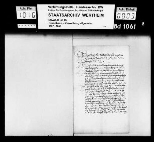
Delineation über die Grenzen der an Bronnbach im Jahr 1786 abgetretenen kurmainzischen Schönertsjagd (Inselkarte)
- Reference number
-
Landesarchiv Baden-Württemberg, Abt. Staatsarchiv Wertheim, R-K Nr. 338
- Dimensions
-
29 x 44 (Höhe x Breite)
- Notes
-
vgl. StAWt R-J 3 Nr. 434; Makrofiche vorhanden
- Further information
-
Ausführung: Federzeichnung; handkoloriert
Maßstab: [ca. 1:5000]
- Context
-
Karten und Pläne >> B. Baden >> B.22. Wertheim >> B.22.14. Reicholzheim >> B.22.14.1. Bronnbach >> B.22.14.1.14. Kloster (vor der Säkularisation) >> B.22.14.1.14.2. Gemarkung
- Holding
-
Landesarchiv Baden-Württemberg, Abt. Staatsarchiv Wertheim, R-K Karten und Pläne
- Indexentry place
-
Külsheim TBB; Gewann, Schönert; Jagd
- Creator
-
Autor/Fotograf: J. Lohr, G. Ehrmann
- Provenance
-
[Abtei Bronnbach]
- Date of creation
-
[um 1790]
- Other object pages
- View digital item at providers-website
- Rights
-
Es gelten die Nutzungsbedingungen des Landesarchivs Baden-Württemberg.
- Last update
-
26.03.2024, 9:04 AM CET
Data provider
This object is provided by:
Landesarchiv Baden-Württemberg. If you have any questions about the object, please contact the data provider.
Landesarchiv Baden-Württemberg. If you have any questions about the object, please contact the data provider.
Object type
- Karten und Pläne
Associated
- Autor/Fotograf: J. Lohr, G. Ehrmann
- [Abtei Bronnbach]
Time of origin
- [um 1790]
Other Objects (12)

Oberförsterei Bronnbach: Walddistrikte des Schutzbezirks Bronnbach (Inselkarte)
Übersichtskarte der Gemarkung Bronnbach (Inselkarte)
Mehrere auf der Gemarkung Bronnbach liegende Walddistrikte (Inselkarte)
Baum- und Rebschule auf dem Josefsberg bei Bronnbach (Inselkarte)
Auszug aus kurmainzischen Rechnungen über die vom Kloster Bronnbach erlegte Türkensteuer
Übergriffe des kurmainzischen Kellers zu Stadtprozelten gegen Gerechtesame des Klosters Bronnbach
![Dittmannslehen [des Klosters Bronnbach in Werbach], Ackerfeld im Kießel, Bischofsheimer Flur (Inselkarte)](https://iiif.deutsche-digitale-bibliothek.de/image/2/a09d7928-30c2-4834-a39e-a10ef52ca471/full/!306,450/0/default.jpg)
Dittmannslehen [des Klosters Bronnbach in Werbach], Ackerfeld im Kießel, Bischofsheimer Flur (Inselkarte)
Karte der vom von Donopschen Nessenberg der Dorfschaft Wöbbel abgetretenen 85 Scheffelsaat,. Inselkarte
Delineation der mit Bronnbach in Disput kommend welche ober Urphar, Dietenhan, Kembach, Höhefeld und Wagenbuch
Delineation der von den Hauptleuten zu Driefel abgetretenen Ländereien Vermesser/Zeichner: Johann Conrad Musculus (Laufzeit erschlossen)
Düsseldorfer Extension, Delineation
Irrungen zwischen Kloster Bronnbach und den kurmainzischen Dörfern Riedern und Guggenberg wegen dem Münchwald
Oberförsterei Bronnbach: Walddistrikte des Schutzbezirks Bronnbach (Inselkarte)
Übersichtskarte der Gemarkung Bronnbach (Inselkarte)
Mehrere auf der Gemarkung Bronnbach liegende Walddistrikte (Inselkarte)
Baum- und Rebschule auf dem Josefsberg bei Bronnbach (Inselkarte)
Auszug aus kurmainzischen Rechnungen über die vom Kloster Bronnbach erlegte Türkensteuer
Übergriffe des kurmainzischen Kellers zu Stadtprozelten gegen Gerechtesame des Klosters Bronnbach
Dittmannslehen [des Klosters Bronnbach in Werbach], Ackerfeld im Kießel, Bischofsheimer Flur (Inselkarte)
Karte der vom von Donopschen Nessenberg der Dorfschaft Wöbbel abgetretenen 85 Scheffelsaat,. Inselkarte
Delineation der mit Bronnbach in Disput kommend welche ober Urphar, Dietenhan, Kembach, Höhefeld und Wagenbuch
Delineation der von den Hauptleuten zu Driefel abgetretenen Ländereien Vermesser/Zeichner: Johann Conrad Musculus (Laufzeit erschlossen)
Düsseldorfer Extension, Delineation