Druckgraphik
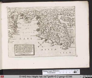
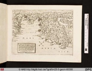
Landkarte mit Stadtansicht von Modon/Methoni unter osmanischen Beschuss.
- Location
-
Herzog August Bibliothek, Wolfenbüttel
- Inventory number
-
5.2 Geogr. (56)
- Measurements
-
Höhe: 169 mm (Platte)
Breite: 236 mm
Höhe: 204 mm (Blatt)
Breite: 266 mm
- Material/Technique
-
Kupferstich
- Inscription/Labeling
-
Inschrift: Il vero sitto overo conttado de Modon, doue si ritroua la armata del turcho assediata dalla potentisima armata della santtissima Lega / / Marthinus Rota sibinicensis faciebat
- Classification
-
Druckgraphik (Gattung)
- Subject (what)
-
Hafen
Krieg
Schiff
Stadt
Topographie
Seeschlacht
Insel
Landkarte
Befestigungsanlage (Militär)
Griechenland
Militär
Venedig
Stadtmauer
Kartusche
Mittelmeer
Stadtansicht
ICONCLASS: Segelschiff, Segelboot
ICONCLASS: Küste
ICONCLASS: befestigte Stadt
ICONCLASS: Namen von Städten und Dörfern (METHONI)
- Subject (where)
-
Modon/Methoni
- Delivered via
- Last update
-
13.06.2023, 2:16 PM CEST
Data provider
This object is provided by:
Herzog August Bibliothek Wolfenbüttel. If you have any questions about the object, please contact the data provider.
Herzog August Bibliothek Wolfenbüttel. If you have any questions about the object, please contact the data provider.
Object type
- Druckgraphik
Associated
- Rota, Martino (Verleger)
- Unbekannt (Stecher)
Time of origin
- 1571-1574
Other Objects (12)
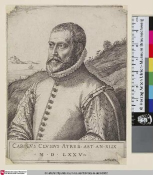
Charles L'Ecluse
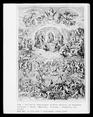
Jüngstes Gericht
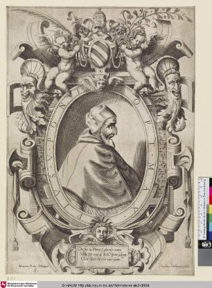
Papst Pius V.
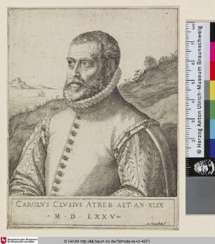
Charles L'Ecluse
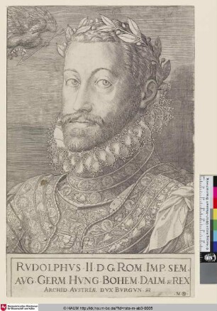
Kaiser Rudolph II.
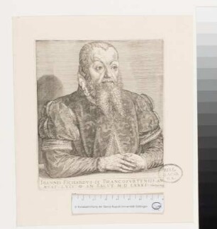
Portrait von Johann Fichard
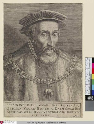
Kaiser Ferdinand I.
![[Küste um Split in Dalmatien]](https://iiif.deutsche-digitale-bibliothek.de/image/2/b11b441b-16ea-4cab-83ec-f15128934b8e/full/!306,450/0/default.jpg)
[Küste um Split in Dalmatien]
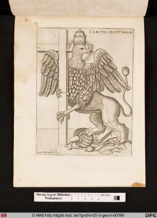
Abbildung eines Greifes der Papstmitra und die Schlüssel Petri als Ornament trägt. Der umarmt das Kreuz während er mohammedanischen/osmanischen Trophäen zertrampelt.
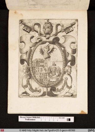
Symbolische Kombinationswappen zusammengesetzt von Vatikan, Doge von Venedig und spanischen Habsburg Wappen, mit geschlachteter Serpent als Symbol der besiegte osmanischen Armee in bezug auf der Seeschlacht von Lepanto.
Landkarte Istrien und der Golf von Trieste.
Landkarte Istrien und der Golf von Trieste.
Charles L'Ecluse
Jüngstes Gericht
Papst Pius V.
Charles L'Ecluse
Kaiser Rudolph II.
Portrait von Johann Fichard
Kaiser Ferdinand I.
[Küste um Split in Dalmatien]
Abbildung eines Greifes der Papstmitra und die Schlüssel Petri als Ornament trägt. Der umarmt das Kreuz während er mohammedanischen/osmanischen Trophäen zertrampelt.
Symbolische Kombinationswappen zusammengesetzt von Vatikan, Doge von Venedig und spanischen Habsburg Wappen, mit geschlachteter Serpent als Symbol der besiegte osmanischen Armee in bezug auf der Seeschlacht von Lepanto.
Landkarte Istrien und der Golf von Trieste.