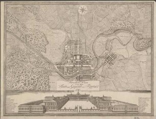
Karten und Pläne
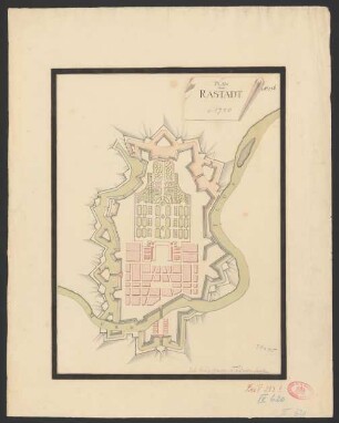
Situationsplan von der Stadt und Gegend von Rastadt 1798
Duplikat von Nr. 10 und 10 a.
- Reference number
-
Abt. Generallandesarchiv Karlsruhe, H Rastatt 10 b
- Dimensions
-
51 x 67,5 (Höhe x Breite)
- Further information
-
Ausführung: Stich
Orientierung: N
Originalmaßstab: 1 600 Wiener Schuh, 100 = 0,5 cm
- Context
-
Gemarkungspläne >> Badische Orte >> R >> Rastatt, Stadt, RA
- Holding
-
Landesarchiv Baden-Württemberg, Abt. Generallandesarchiv Karlsruhe, H Gemarkungspläne
- Date of creation
-
1798
- Other object pages
- View digital item at providers-website
- Rights
-
Es gelten die Nutzungsbedingungen des Landesarchivs Baden-Württemberg.
- Last update
-
04.04.2025, 8:04 AM CEST
Data provider
This object is provided by:
Landesarchiv Baden-Württemberg. If you have any questions about the object, please contact the data provider.
Landesarchiv Baden-Württemberg. If you have any questions about the object, please contact the data provider.
Object type
- Karten und Pläne
Time of origin
- 1798
Other Objects (12)

Situationsplan von der Stadt und Gegend von Rastadt 1798
Situationsplan von der Stadt und Gegend von Rastadt 1798

Situationsplan von der Stadt und Gegend von Rastadt 1798
Situationsplan von der Stadt und Gegend von Rastadt 1798
Précis des negociations du Congrès de Rastadt (1798)
Geologische Bemerkungen über die Gegend von Baden bei Rastadt

Rastadt
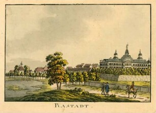
Rastadt.
Rastadt
Plan von Rastadt
Murgbrücke Rastadt
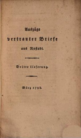
Auszüge vertrauter Briefe aus Rastadt, 3. Dritte Lieferung, März 1798
Situationsplan von der Stadt und Gegend von Rastadt 1798
Situationsplan von der Stadt und Gegend von Rastadt 1798
Situationsplan von der Stadt und Gegend von Rastadt 1798
Situationsplan von der Stadt und Gegend von Rastadt 1798
Précis des negociations du Congrès de Rastadt (1798)
Geologische Bemerkungen über die Gegend von Baden bei Rastadt
Rastadt
Rastadt.
Rastadt
Plan von Rastadt
Murgbrücke Rastadt