- Location
-
München, Bayerische Staatsbibliothek -- Bavar. 1241 x#Kartenbeilage
- Dimensions
-
15 x 22 cm, gefaltet
- Extent
-
1 Kt.
- Language
-
Deutsch
- Notes
-
Mit 4 Wappendarst. - Maßstab auch in graph. Form (Meter)
- Bibliographic citation
-
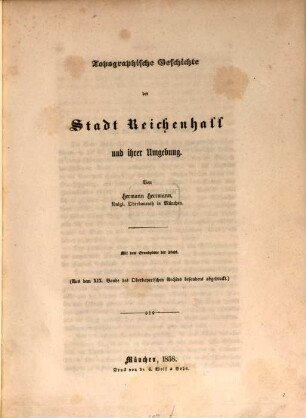
Topographische Geschichte der Stadt Reichenhall und ihrer Umgebung ; mit dem Grundplan der Stadt / von Hermann Herrmann ; [Kartenbeilage]
- Keyword
-
Bad Reichenhall
- Event
-
Veröffentlichung
- (where)
-
München
- (who)
-
Wolf
- (when)
-
1858
- Contributor
-
Bernhard, C.
- URN
-
urn:nbn:de:bvb:12-bsb00105703-6
- Last update
-
16.04.2025, 8:32 AM CEST
Data provider
This object is provided by:
Bayerische Staatsbibliothek. If you have any questions about the object, please contact the data provider.
Bayerische Staatsbibliothek. If you have any questions about the object, please contact the data provider.
Object type
- Stadtplan
Associated
- Bernhard, C.
- Wolf
Time of origin
- 1858
Other Objects (12)
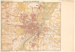
Neuester Plan von München
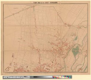
Plan der k. b. Stadt Schwabing

Grundplan der Stadt Rain 1858
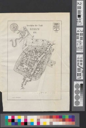
Grundplan der Stadt Aichach 1858
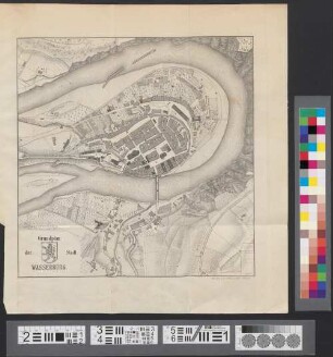
Grundplan der Stadt Wasserburg
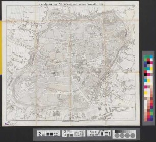
Grundplan von Nürnberg und seinen Vorstädten
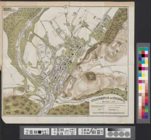
Situationsplan von Reichenhall
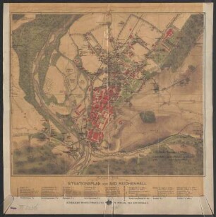
Situationsplan von Bad Reichenhall
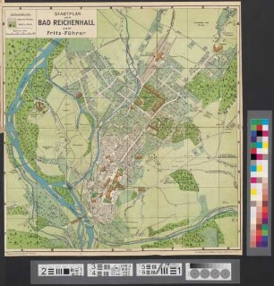
Stadtplan von Bad Reichenhall zum Fritz-Führer
Topographische Geschichte der Stadt Reichenhall und ihrer Umgebung : mit dem Grundplan der Stadt

Königliches Hof- und Nationaltheater. 1858
![Plan von Leipzig und den angrenzenden Ortschaften, mit Plan des Stadttheaters , ca. 1:6 700, 1858 : Werl's General-Situations-Plan von Leipzig und angrenzenden Ortschaften. - [Ca. 1:6 700]. - Leipzig : Werl , 1858. - 1 Kt. : zweifarb. ; 55 x 42 cm, gefaltet](https://iiif.deutsche-digitale-bibliothek.de/image/2/138a545a-9a7e-4289-b543-a59cf9d95213/full/!306,450/0/default.jpg)
Plan von Leipzig und den angrenzenden Ortschaften, mit Plan des Stadttheaters , ca. 1:6 700, 1858 : Werl's General-Situations-Plan von Leipzig und angrenzenden Ortschaften. - [Ca. 1:6 700]. - Leipzig : Werl , 1858. - 1 Kt. : zweifarb. ; 55 x 42 cm, gefaltet
Neuester Plan von München
Plan der k. b. Stadt Schwabing
Grundplan der Stadt Rain 1858
Grundplan der Stadt Aichach 1858
Grundplan der Stadt Wasserburg
Grundplan von Nürnberg und seinen Vorstädten
Situationsplan von Reichenhall
Situationsplan von Bad Reichenhall
Stadtplan von Bad Reichenhall zum Fritz-Führer
Topographische Geschichte der Stadt Reichenhall und ihrer Umgebung : mit dem Grundplan der Stadt
Königliches Hof- und Nationaltheater. 1858