zweidimensionales bewegtes Bild
Mapping floods in urban areas from space at local risk level
- Location
-
Hannover TIB
- Extent
-
103MB, 00:28:08:24 (unknown)
- Language
-
Englisch
- Notes
-
Audiovisuelles Material
- Bibliographic citation
-
FOSS4G 2021 Argentina ; (Jan. 2021)
- Event
-
Veröffentlichung
- (who)
-
FOSS4G, Open Source Geospatial Foundation (OSGeo)
- (when)
-
2021-01-01
- Contributor
-
Schumann, Guy
Borges, Dave (Moderation)
- DOI
-
10.5446/58615
- Last update
-
04.12.2024, 8:09 AM CET
Data provider
This object is provided by:
Technische Informationsbibliothek (TIB). If you have any questions about the object, please contact the data provider.
Technische Informationsbibliothek (TIB). If you have any questions about the object, please contact the data provider.
Object type
- zweidimensionales bewegtes Bild
Associated
- Schumann, Guy
- Borges, Dave (Moderation)
- FOSS4G, Open Source Geospatial Foundation (OSGeo)
Time of origin
- 2021-01-01
Other Objects (12)
Flood mapping and analysis platform based on open satellite data and free and open source geospatial
FloodWatch: Combining Wearable Tech + Disaster Alerts
Community Health Mapping
Mapping for Investigations

Adopting OGC Standards in a Flood Alert System
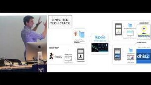
Tupaia - Health Resource Mapping
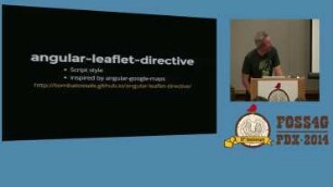
Mapping with AngularJS
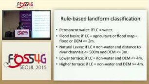
Evaluating Flood Hazard Potential in Danang City, Vietnam Using FOSS4G
Challenges of indoor mapping formats
Mapping the world beyond 3857
An Easy Web Mapping Framework
Bootleaf: an open-source web mapping framework
Flood mapping and analysis platform based on open satellite data and free and open source geospatial
FloodWatch: Combining Wearable Tech + Disaster Alerts
Community Health Mapping
Mapping for Investigations
Adopting OGC Standards in a Flood Alert System
Tupaia - Health Resource Mapping
Mapping with AngularJS
Evaluating Flood Hazard Potential in Danang City, Vietnam Using FOSS4G
Challenges of indoor mapping formats
Mapping the world beyond 3857
An Easy Web Mapping Framework