Karten / Pläne
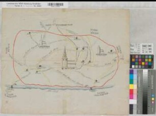
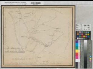
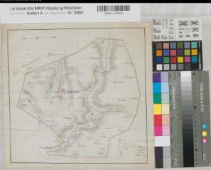
Aplerbeck (Dortmund) Ortsplan (Municipalität) 1810 2 Stunden = 26,5 cm 39 x 51 Zeichnung KSA Nr. 161
- Reference number
-
W 051, 5499
- Former reference number
-
Kartensammlung Arnsberg 161
- Further information
-
Ort: Aplerbeck, Dortmund
- Context
-
Karten A (Allgemein) >> 1. Topographische Karte, Übersichtskarten >> 1.5. Stadt-/ Ortspläne
- Holding
-
W 051 Karten A (Allgemein)
- Indexentry place
-
Aplerbeck, Dortmund
Aplerbeck, Ortsplan, 1810
- Provenance
-
Sammlungsregistraturbildner
- Date of creation
-
1810
- Other object pages
- Delivered via
- Last update
-
30.04.2025, 2:53 PM CEST
Data provider
This object is provided by:
Landesarchiv Nordrhein-Westfalen. Abteilung Westfalen. If you have any questions about the object, please contact the data provider.
Landesarchiv Nordrhein-Westfalen. Abteilung Westfalen. If you have any questions about the object, please contact the data provider.
Object type
- Karten / Pläne
Associated
- Sammlungsregistraturbildner
Time of origin
- 1810
Other Objects (12)
Witten (Witten) Municipalität (Ortsplan) 1810 o.M. 48 x 58 kol. Zeichnung KSA Nr. 162
Sprockhövel (Sprockhövel) Municipalität (Ortsplan) (1810) (1 : 24 000) 25 x 32 kol. Zeichnung KSA Nr. 165

Hattingen (Hattingen) Municipalität (Ortsplan) (1810) (1 : 25 000) 31 x 39 kol. Zeichnung KSA Nr. 166
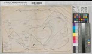
Irmgarteichen (Netphen) Municipalität (Ortsplan) (1809) 1 Stunde = 7,2 cm 29 x 34,5 kol. Zeichnung J. G. Weber, Feuersbach KSA Nr. 265
Ennepestraße (Emperstraße) (Gevelsberg - Hagen) Municipalität (Ortsplan) 1810 o.M. 35 x 45 kol. Skizze KSA Nr. 180
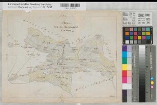
Freudenberg (Freudenberg) Municipalität (Ortsplan) (1809) 1 Stunde = 15,65 cm 41 x 48 Zeichnung KSA Nr. 230
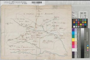
Kamen (Kamen) Kirchensprengel und Municipalität (Ortsplan) 1810 o.M. 31,5 x 42 kol. Zeichnung KSA Nr. 490
Hemer (Hemer) Municipalität (Ortsplan) mit Pfarrdistrikten (1810) 3 Stunden = 39 cm 30 x 46 Zeichnung KSA Nr. 759
Kamen (Kamen) Municipalität (Ortsplan) 1810 (1 : 35 000) 28,5 x 38,5 kol. Zeichnung Haupt KSA Nr. 159

Dortmund (Dortmund) Municipalität (Ortsplan) mit Pfarreinteilung 1810 o.M. 35 x 45,5 kol. Zeichnung Kemper KSA Nr. 485
Neuenrade (Neuenrade) Municipalität (Ortsplan) (1810) (1 : 38 000) 28 x 28,5 kol. Zeichnung L. Brenschede KSA Nr. 179
Iserlohn (Iserlohn) Municipalität (Ortsplan) und Kirchspiel Beschreibung 1810 J. C. Burghardt
Witten (Witten) Municipalität (Ortsplan) 1810 o.M. 48 x 58 kol. Zeichnung KSA Nr. 162
Sprockhövel (Sprockhövel) Municipalität (Ortsplan) (1810) (1 : 24 000) 25 x 32 kol. Zeichnung KSA Nr. 165
Hattingen (Hattingen) Municipalität (Ortsplan) (1810) (1 : 25 000) 31 x 39 kol. Zeichnung KSA Nr. 166
Irmgarteichen (Netphen) Municipalität (Ortsplan) (1809) 1 Stunde = 7,2 cm 29 x 34,5 kol. Zeichnung J. G. Weber, Feuersbach KSA Nr. 265
Ennepestraße (Emperstraße) (Gevelsberg - Hagen) Municipalität (Ortsplan) 1810 o.M. 35 x 45 kol. Skizze KSA Nr. 180
Freudenberg (Freudenberg) Municipalität (Ortsplan) (1809) 1 Stunde = 15,65 cm 41 x 48 Zeichnung KSA Nr. 230
Kamen (Kamen) Kirchensprengel und Municipalität (Ortsplan) 1810 o.M. 31,5 x 42 kol. Zeichnung KSA Nr. 490
Hemer (Hemer) Municipalität (Ortsplan) mit Pfarrdistrikten (1810) 3 Stunden = 39 cm 30 x 46 Zeichnung KSA Nr. 759
Kamen (Kamen) Municipalität (Ortsplan) 1810 (1 : 35 000) 28,5 x 38,5 kol. Zeichnung Haupt KSA Nr. 159
Dortmund (Dortmund) Municipalität (Ortsplan) mit Pfarreinteilung 1810 o.M. 35 x 45,5 kol. Zeichnung Kemper KSA Nr. 485
Neuenrade (Neuenrade) Municipalität (Ortsplan) (1810) (1 : 38 000) 28 x 28,5 kol. Zeichnung L. Brenschede KSA Nr. 179