
- Alternative title
-
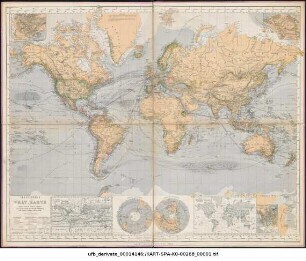
General Wind-Chart
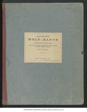
Allgemeine Welt-Karte
- Location
-
Forschungsbibliothek Gotha -- KART SPA C 000227
- Extent
-
1 Kt. auf 8 Bl., 145 x 88 cm
- Language
-
Englisch
- Notes
-
Nullmeridian: Greenwich. - Mit zahlr. Nebenkt. u.a.: General Wind-Chart. Linea of equal magnetic declination, Epoch 1858. The world of Polar-Pojection. - Mit Schifffahrtslinien, Meeresströmungen, Bergstrichen... - Titelkartusche links oben. - Amerika im Zentrum der Darstellung. - Mit 1 Blatt Erläuterung Karten
- Published
-
Gotha : Justus Perthes , 1886
- URN
-
urn:nbn:de:urmel-89ef8631-4e98-48a5-8283-41057401190d-000104823
- PURL
- Last update
-
14.04.2025, 12:54 PM CEST
Data provider
This object is provided by:
Forschungsbibliothek Gotha der Universität Erfurt. If you have any questions about the object, please contact the data provider.
Forschungsbibliothek Gotha der Universität Erfurt. If you have any questions about the object, please contact the data provider.
Object type
- Karte
Associated
Time of origin
- Gotha : Justus Perthes , 1886
Other Objects (12)
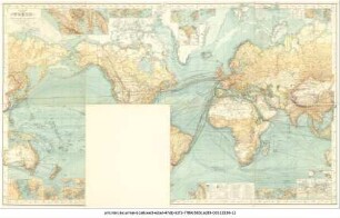
Chart of the World on Mercators Projection
Chart of the World on Mercators Projection
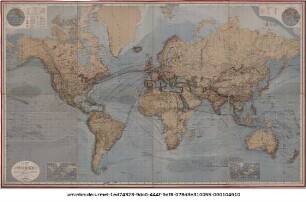
Chart of the World on Mercators Projection
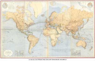
Chart of the World on Mercators Projection
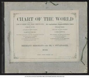
Chart of the World on Mercators Projection
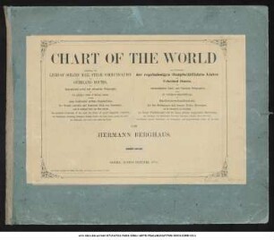
Chart of the World on Mercators Projection
Allgemeine Welt-Karte in Mercator's Projection, nach dem Stande der nautischen Aufnahmen im Jahre 1858
Allgemeine Welt-Karte in Mercator's Projection zur Uebersicht der grossen Verkehrs-Linien über Land und Meer und neuerer Reisen um die Erde
Allgemeine Welt-Karte in Mercator's Projection zur Uebersicht der Postschifffahrt und neuerer Reisen um die Erde
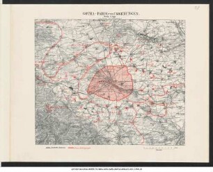
Gotha - Paris und Umgebungen : zum besten der Verwundeten
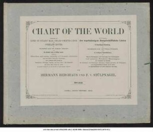
Chart of the World on Mercators Projection : ... zur Übersicht der regelmässigen Dampfschifffahrts-Linien und Ueberland-Routen ... ; mit 7 Nebenkarten zur Darstellung der Landengen von Tehuantepec, Nicaragua ...
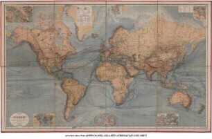
Chart of the World on Mercators Projection : ... zur Übersicht der regelmässigen Dampfschifffahrts-Linien und Ueberland-Routen ... ; mit 7 Nebenkarten zur Darstellung der Landengen von Tehuantepec, Nicaragua ...
Chart of the World on Mercators Projection
Chart of the World on Mercators Projection
Chart of the World on Mercators Projection
Chart of the World on Mercators Projection
Chart of the World on Mercators Projection
Chart of the World on Mercators Projection
Allgemeine Welt-Karte in Mercator's Projection, nach dem Stande der nautischen Aufnahmen im Jahre 1858
Allgemeine Welt-Karte in Mercator's Projection zur Uebersicht der grossen Verkehrs-Linien über Land und Meer und neuerer Reisen um die Erde
Allgemeine Welt-Karte in Mercator's Projection zur Uebersicht der Postschifffahrt und neuerer Reisen um die Erde
Gotha - Paris und Umgebungen : zum besten der Verwundeten
Chart of the World on Mercators Projection : ... zur Übersicht der regelmässigen Dampfschifffahrts-Linien und Ueberland-Routen ... ; mit 7 Nebenkarten zur Darstellung der Landengen von Tehuantepec, Nicaragua ...
Chart of the World on Mercators Projection : ... zur Übersicht der regelmässigen Dampfschifffahrts-Linien und Ueberland-Routen ... ; mit 7 Nebenkarten zur Darstellung der Landengen von Tehuantepec, Nicaragua ...
Chart of the World on Mercators Projection
Chart of the World on Mercators Projection
Chart of the World on Mercators Projection
Chart of the World on Mercators Projection
Chart of the World on Mercators Projection
Chart of the World on Mercators Projection
Allgemeine Welt-Karte in Mercator's Projection, nach dem Stande der nautischen Aufnahmen im Jahre 1858
Allgemeine Welt-Karte in Mercator's Projection zur Uebersicht der grossen Verkehrs-Linien über Land und Meer und neuerer Reisen um die Erde
Allgemeine Welt-Karte in Mercator's Projection zur Uebersicht der Postschifffahrt und neuerer Reisen um die Erde
Gotha - Paris und Umgebungen : zum besten der Verwundeten
Chart of the World on Mercators Projection : ... zur Übersicht der regelmässigen Dampfschifffahrts-Linien und Ueberland-Routen ... ; mit 7 Nebenkarten zur Darstellung der Landengen von Tehuantepec, Nicaragua ...