- Alternative title
-
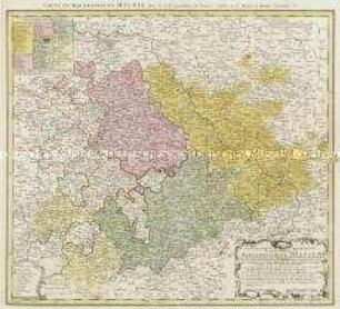
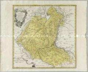
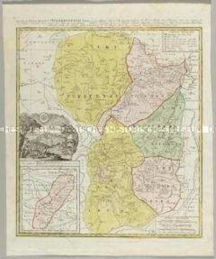
CHARTE / von dem Fürstenthum / OSTFRIESLAND / nach den trigonometrischen und
- Location
-
Deutsches Historisches Museum, Berlin
- Inventory number
-
Do 2006/1253
- Measurements
-
Höhe x Breite: 57,3 x 70 cm (Blatt)
Höhe x Breite: 43 x 53,5 cm (Karte)
Höhe x Breite: 47,8 x 57,5 cm (Platte)
- Material/Technique
-
Papier, Kupferstich, koloriert
- Classification
-
Kartografie (Gattung)
- Subject (what)
-
Ostfriesland
- Event
-
Herstellung
- (who)
-
Kartograf: Franz Ludwig Güssefeld
Verlag: Homannsche Erben
- (where)
-
Nürnberg, Deutschland
- (when)
-
1790
- Rights
-
Deutsches Historisches Museum
- Last update
-
24.03.2023, 9:30 AM CET
Data provider
This object is provided by:
Stiftung Deutsches Historisches Museum. If you have any questions about the object, please contact the data provider.
Stiftung Deutsches Historisches Museum. If you have any questions about the object, please contact the data provider.
Object type
- Ämterkarte
Associated
- Kartograf: Franz Ludwig Güssefeld
- Verlag: Homannsche Erben
Time of origin
- 1790
Other Objects (12)
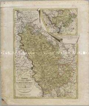
Geographische Abbildung des gantzen Umfangs der Marggrafschaft Meissen
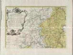
Landgrafiatus Hasso-Cassellanus
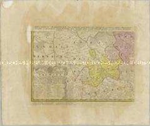
Besondere Land Karte des Herzogth. od. Churkreises Sachsen
Charte vom Laufe des Rheins von Coblenz bis Wesel. Mit einer Anschlusskarte: Charte den Lauf des Rheins von Coblenz bis Unkel... enthaltend

Chorographia Territorii Naumburgo-Citiensis
Chorographia Territorii Naumburgo-Citiensis
Comitatuum Oldenburg et Delmenhorst
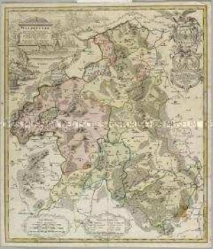
Waldecciae
Tabula geographica sistens Territorium Liberae Sacri Romani Imperii Civitatis Suevo-Hallensis
Karte der Gefürsteten Graffschaft Henneberg
Mappa Geographica Territorii Sacri Romani Imperii liberae Civitatis Norimbergensis. Mit einer Nebenkarte: Districtus Criminalis Praefecturae Norimbergensis Lichtenau, sub eadem Scala Milliarium
Territorii Episcopatus Osnabrugensis Tabula geographica. Mit einer Nebenkarte: Ditio Reckenbergensis
Geographische Abbildung des gantzen Umfangs der Marggrafschaft Meissen
Landgrafiatus Hasso-Cassellanus
Besondere Land Karte des Herzogth. od. Churkreises Sachsen
Charte vom Laufe des Rheins von Coblenz bis Wesel. Mit einer Anschlusskarte: Charte den Lauf des Rheins von Coblenz bis Unkel... enthaltend
Chorographia Territorii Naumburgo-Citiensis
Chorographia Territorii Naumburgo-Citiensis
Comitatuum Oldenburg et Delmenhorst
Waldecciae
Tabula geographica sistens Territorium Liberae Sacri Romani Imperii Civitatis Suevo-Hallensis
Karte der Gefürsteten Graffschaft Henneberg
Mappa Geographica Territorii Sacri Romani Imperii liberae Civitatis Norimbergensis. Mit einer Nebenkarte: Districtus Criminalis Praefecturae Norimbergensis Lichtenau, sub eadem Scala Milliarium