Karten und Pläne
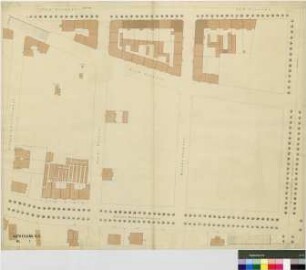
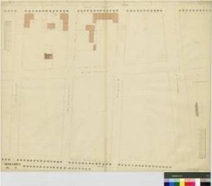
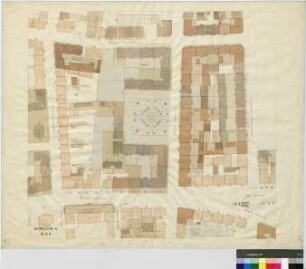
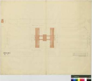
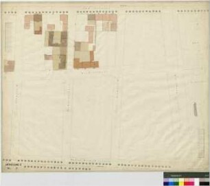
Abt. D und C, Bl. 1 S - Kaiser-Wilhelm-Straße, Arndtstraße, Moltkestraße, Schenkendorfstraße, Kochstraße, Südstraße, Kronprinzstraße
- Reference number
-
Stadtarchiv Leipzig, Stplan Kanitz Nr. 338
- Dimensions
-
91,5 x 75,0
- Further information
-
Herstellungsvermerk: Oskar von Bomsdorff geographisch-lithographische Anstalt Leipzig
- Context
-
1.2.2.18.2.1 Stadtplan Kanitz
- Holding
-
1.2.2.18.2.1 Stadtplan Kanitz
- Indexentry place
-
Kaiser-Wilhelm-Straße
Arndtstraße
Moltkestraße
Schenkendorfstraße
Kochstraße
Südstraße
Kronprinzstraße
- Date of creation
-
[1850-1892]
- Other object pages
- View digital item at providers-website
- Rights
-
Es gilt die Archivsatzung des Stadtarchivs Leipzig.
- Last update
-
22.02.2023, 3:29 PM CET
Data provider
This object is provided by:
Stadtarchiv Leipzig. If you have any questions about the object, please contact the data provider.
Stadtarchiv Leipzig. If you have any questions about the object, please contact the data provider.
Object type
- Karten und Pläne
Time of origin
- [1850-1892]
Other Objects (12)
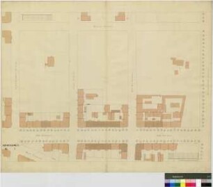
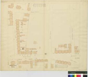
Abt. D und C, Bl. 1 - Schenkendorfstraße, Arndtstraße, Kochstraße, Moltkestraße, Kronprinzstraße, Südstraße, Kaiser-Wilhelm-Straße
Abt. E, Bl. 1 - Kochstraße, Südstraße, Arndtstraße, Schenkendorfstraße, Elisenstraße, Moltkestraße, Kronprinzstraße
Abt. E, Bl. 1 S - Überarbeitung zu Nr. 340 - Kochstraße, Südstraße, Arndtstraße, Schenkendorfstraße, Elisenstraße, Moltkestraße, Kronprinzstraße
Abt. B und C, Bl. 7 S - Zeitzer Straße, Südstraße, Kochstraße, Schenkendorfstraße, Körnerstraße, Lützowstraße, Braustraße, Brandstraße, Mahlmannstraße, Kaiser-Wilhelm-Straße

Abt. B und C, Bl. 7 S - Zeitzer Straße, Südstraße, Kochstraße, Lützowstraße, Körnerstraße, Schenkendorfstraße, Braustraße, Brandweg, Mahlmannstraße, Kaiser-Wilhelm-Straße
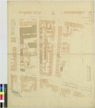
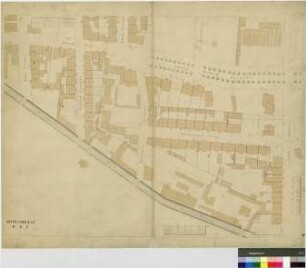
Abt. D, Bl. 3 - Kaiser-Wilhelm-Straße, Fichtestraße, Kochstraße, Südstraße
Abt. B, Bl. 8 S - Zeitzer Straße, Sophienstraße, Elisenstraße, Südstraße, Kochstraße, Körnerstraße, Schenkendorfstraße, Braustraße, Lützowstraße
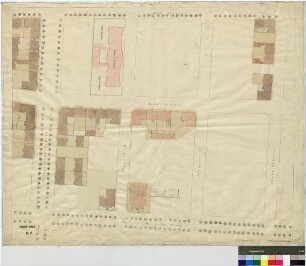
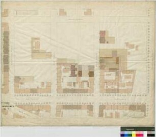
Abt. D, Bl. 2 - Kronprinzstraße, Kochstraße, Südstraße, Steinstraße, 8. Bezirksschule, Kaiser-Wilhelm-Straße
Abt. B und C, Bl. 6 S - Braustraße, Brandweg, Lützowstraße, Körnerstraße, Mahlmannstraße, Schenkendorfstraße, Arndtstraße, Brandvorwerkstraße, Kaiser-Wilhelm-Straße
Abt. B, Bl. 8 S - Überarbeitung zu Nr. 175 - Elisenstraße, Sophienstraße, Körnerstraße, Schenkendorfstraße, Südstraße, Kochstraße, Zeitzer Straße, Braustraße, Lützowstraße
Abt. E, Bl. 4 - Elisenstraße, Arndtstraße, Schenkendorfstraße, Bayersche Straße, Moltkestraße, Kronprinzstraße
Abt. D, Bl. 3 - Überarbeitung zu Nr. 333 - Steinstraße, Fichtestraße, Kantstraße, Kochstraße, Kaiser-Wilhelm-Straße, Südstraße, Kaiserin-Augusta-Straße
Abt. D und C, Bl. 1 - Schenkendorfstraße, Arndtstraße, Kochstraße, Moltkestraße, Kronprinzstraße, Südstraße, Kaiser-Wilhelm-Straße
Abt. E, Bl. 1 - Kochstraße, Südstraße, Arndtstraße, Schenkendorfstraße, Elisenstraße, Moltkestraße, Kronprinzstraße
Abt. E, Bl. 1 S - Überarbeitung zu Nr. 340 - Kochstraße, Südstraße, Arndtstraße, Schenkendorfstraße, Elisenstraße, Moltkestraße, Kronprinzstraße
Abt. B und C, Bl. 7 S - Zeitzer Straße, Südstraße, Kochstraße, Schenkendorfstraße, Körnerstraße, Lützowstraße, Braustraße, Brandstraße, Mahlmannstraße, Kaiser-Wilhelm-Straße
Abt. B und C, Bl. 7 S - Zeitzer Straße, Südstraße, Kochstraße, Lützowstraße, Körnerstraße, Schenkendorfstraße, Braustraße, Brandweg, Mahlmannstraße, Kaiser-Wilhelm-Straße
Abt. D, Bl. 3 - Kaiser-Wilhelm-Straße, Fichtestraße, Kochstraße, Südstraße
Abt. B, Bl. 8 S - Zeitzer Straße, Sophienstraße, Elisenstraße, Südstraße, Kochstraße, Körnerstraße, Schenkendorfstraße, Braustraße, Lützowstraße
Abt. D, Bl. 2 - Kronprinzstraße, Kochstraße, Südstraße, Steinstraße, 8. Bezirksschule, Kaiser-Wilhelm-Straße
Abt. B und C, Bl. 6 S - Braustraße, Brandweg, Lützowstraße, Körnerstraße, Mahlmannstraße, Schenkendorfstraße, Arndtstraße, Brandvorwerkstraße, Kaiser-Wilhelm-Straße
Abt. B, Bl. 8 S - Überarbeitung zu Nr. 175 - Elisenstraße, Sophienstraße, Körnerstraße, Schenkendorfstraße, Südstraße, Kochstraße, Zeitzer Straße, Braustraße, Lützowstraße
Abt. E, Bl. 4 - Elisenstraße, Arndtstraße, Schenkendorfstraße, Bayersche Straße, Moltkestraße, Kronprinzstraße