Karte / Plan
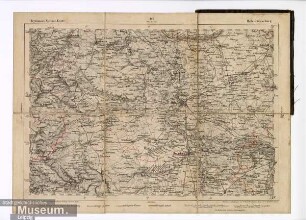
Reymanns topographische Spezial-Karte von Deutschland
Karte, Blatt 26,8 x 36,2 cm
- Archivaliensignatur
-
0002
- Alt-/Vorsignatur
-
I.A.3
- Maße
-
Bild 26,3 x 35,2 cm
- Kontext
-
Crull-Sammlung. Stiche, Lithographien, Karten, Bilder >> 01. I Karten und Pläne >> 01.01. 01.A. Wismar mit Umgebung
- Bestand
-
Abt. VIII. Rep. 1. B 1 Crull-Sammlung. Stiche, Lithographien, Karten, Bilder
- Laufzeit
-
1836
- Weitere Objektseiten
- Geliefert über
- Letzte Aktualisierung
-
29.10.2025, 11:28 MEZ
Datenpartner
Dieses Objekt wird bereitgestellt von:
Archiv der Hansestadt Wismar. Bei Fragen zum Objekt wenden Sie sich bitte an den Datenpartner.
Archiv der Hansestadt Wismar. Bei Fragen zum Objekt wenden Sie sich bitte an den Datenpartner.
Objekttyp
- Karten und Pläne
Entstanden
- 1836
Ähnliche Objekte (12)
Reymann's Spezial-Karte. 127 Halle - Merseburg

Reymann's Spezial - Karte Stuttgart
Reymann's Spezial - Karte Würzburg
Spezial-Karte (Tourenkarte)
Reymanns topographische Spezialkarte von Deutschland und Mitteleuropa
Reymanns topographische Spezialkarte von Deutschland und Mitteleuropa
Reymanns topographische Spezialkarte von Deutschland und Mitteleuropa
Topographische Spezial-Karte von Mitteleuropa, Reichsland Elsaß-Lothringen (Karte A)
Topographische Spezial-Karte von Mittel-Europa, Blatt 140: Kalwarja
Reymann's Spezialkarte: Heidelberg
Spezial-Karte von der Uckermark
Spezial-Karte Stadtforst Aaperwald, Waldzustand
Reymann's Spezial-Karte. 127 Halle - Merseburg
Reymann's Spezial - Karte Stuttgart
Reymann's Spezial - Karte Würzburg
Spezial-Karte (Tourenkarte)
Reymanns topographische Spezialkarte von Deutschland und Mitteleuropa
Reymanns topographische Spezialkarte von Deutschland und Mitteleuropa
Reymanns topographische Spezialkarte von Deutschland und Mitteleuropa
Topographische Spezial-Karte von Mitteleuropa, Reichsland Elsaß-Lothringen (Karte A)
Topographische Spezial-Karte von Mittel-Europa, Blatt 140: Kalwarja
Reymann's Spezialkarte: Heidelberg
Spezial-Karte von der Uckermark