- Alternative title
-
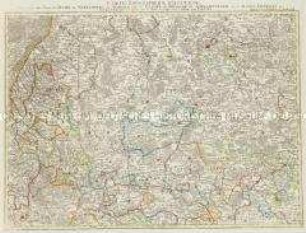
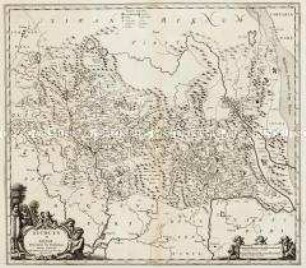
L'ALSACE / divisée en / HAUTE et BASSE / et
- Location
-
Deutsches Historisches Museum, Berlin
- Inventory number
-
Do 2006/51
- Measurements
-
Höhe x Breite: 55,5 x 79,3 cm (Blatt)
Höhe x Breite: 46,2 x 66,2 cm (Karte)
Höhe x Breite: 49,5 x 72 cm (Karte)
- Material/Technique
-
Druckfarbe, Papier, Kupferstich, grenzkoloriert
- Classification
-
Kartografie (Gattung)
- Subject (what)
-
Elsass
Sundgau
- Event
-
Herstellung
- (who)
-
Geograph, Kartograf, Verleger: Gilles Robert de Vaugondy
- (where)
-
Paris, Frankreich
- (when)
-
um 1700
- Rights
-
Deutsches Historisches Museum
- Last update
-
24.03.2023, 9:31 AM CET
Data provider
This object is provided by:
Stiftung Deutsches Historisches Museum. If you have any questions about the object, please contact the data provider.
Stiftung Deutsches Historisches Museum. If you have any questions about the object, please contact the data provider.
Object type
- Regionalkarte
Associated
- Geograph, Kartograf, Verleger: Gilles Robert de Vaugondy
Time of origin
- um 1700
Other Objects (12)

L'Alsace divisée en ses principales parties
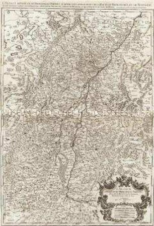
L'Alsace divisée en ses principales Parties.
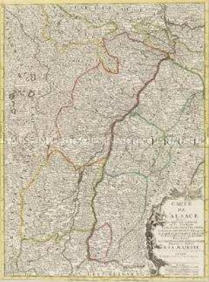
Carte de l'Alsace
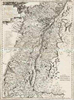
L'Alsace, ou Conquestes du Roy, en Allemagne, tant decà que delà le Rhein
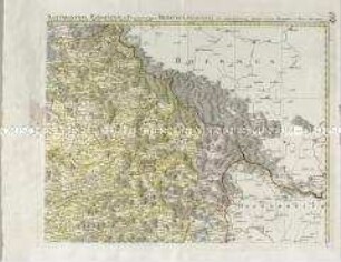
Grand Atlas . Bl. 57 (Elsass, Lothringen, Salm): Contenant le Margraviat de l'Alsace, une Partie du Duché de Lorraine, et le Principauté de Salm.
Grand Atlas . Bl. 58 (Württemberg, Baden, Breisgau, Schwarzwald, Elsass, Ortenau): Contenant une Partie du Duché de Wurtemberg, du Margraviat de Baaden, de Brisgaw, de Schwartzwald, de l'Alsace, Ortenau et et
Mappa Electoratus et Ducatus Bavariae Superioris et Inferioris
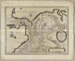
Terra Firma et Novum Regnum Granatense et Popayan
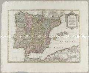
Portugal et Hispania
Suchuen, et Xensi
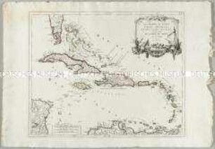
Les Grandes et Petites Isles Antilles et les Isles Lucayes
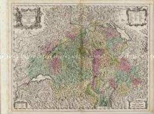
Helvetiae Rhetiae et Valesiae
L'Alsace divisée en ses principales parties
L'Alsace divisée en ses principales Parties.
Carte de l'Alsace
L'Alsace, ou Conquestes du Roy, en Allemagne, tant decà que delà le Rhein
Grand Atlas . Bl. 57 (Elsass, Lothringen, Salm): Contenant le Margraviat de l'Alsace, une Partie du Duché de Lorraine, et le Principauté de Salm.
Grand Atlas . Bl. 58 (Württemberg, Baden, Breisgau, Schwarzwald, Elsass, Ortenau): Contenant une Partie du Duché de Wurtemberg, du Margraviat de Baaden, de Brisgaw, de Schwartzwald, de l'Alsace, Ortenau et et
Mappa Electoratus et Ducatus Bavariae Superioris et Inferioris
Terra Firma et Novum Regnum Granatense et Popayan
Portugal et Hispania
Suchuen, et Xensi
Les Grandes et Petites Isles Antilles et les Isles Lucayes