Verzeichnung
"Böhmerwald-Karte", Anfang des 20. Jahrhunderts (Topografische Karte) Enthält: Deutsch-Tschechische Sprachengrenze Ausf.-Art: Druck Herst.: Franz Landspersky; Franz Strobach Format: 56 x 87 cm Maßstab: 1 : 150 000
- Reference number
-
NLA OS, K, 803 Nr. 46 H
- Former reference number
-
Organisations- und Aktenzeichen: Acc. 32/71 (Nachlass Marquardt)
- Context
-
Karten >> 8 Europa >> 8.1 Übersichten, Atlanten, Kartenwerke >> 8.1.4 Grenzkarten
- Holding
-
NLA OS, K Karten
- Indexentry person
-
Landspersky, Franz
Strobach, Franz
- Indexentry place
-
Böhmerwald
- Date of creation
-
- 1893
- Other object pages
- Last update
-
16.06.2025, 11:08 AM CEST
Data provider
This object is provided by:
Niedersächsisches Landesarchiv. If you have any questions about the object, please contact the data provider.
Niedersächsisches Landesarchiv. If you have any questions about the object, please contact the data provider.
Object type
- Verzeichnung
Time of origin
- - 1893
Other Objects (12)

"Böhmerwald-Karte", Anfang des 20. Jahrhunderts (Topografische Karte) Enthält: Deutsch-Tschechische Sprachengrenze Ausf.-Art: Druck Herst.: Franz Landspersky; Franz Strobach Format: 56 x 87 cm Maßstab: 1 : 150 000
Franz Strobach, Dresden (A 2728)
Entnazifizierung Franz Strobach , geb. 11.08.1876 (Kaufmann)
Entnazifizierung Franz Strobach , geb. 31.12.1882 (Schlosser)
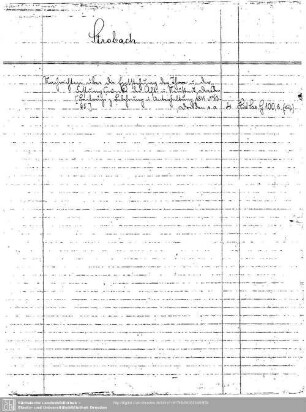
Strobach
Strobach
Strobach, Manfred
Strobach, Johann
Strobach, Adele
Strobach: Stadtsekretär
Personalakten Strobach
Strobach, Josef
"Böhmerwald-Karte", Anfang des 20. Jahrhunderts (Topografische Karte) Enthält: Deutsch-Tschechische Sprachengrenze Ausf.-Art: Druck Herst.: Franz Landspersky; Franz Strobach Format: 56 x 87 cm Maßstab: 1 : 150 000
Franz Strobach, Dresden (A 2728)
Entnazifizierung Franz Strobach , geb. 11.08.1876 (Kaufmann)
Entnazifizierung Franz Strobach , geb. 31.12.1882 (Schlosser)
Strobach
Strobach
Strobach, Manfred
Strobach, Johann
Strobach, Adele
Strobach: Stadtsekretär
Personalakten Strobach