Altkarte
Das Fürstenthum Glogau, in seine sechs landrähtlichen Kreise, Glogau, Fre ystadt, Guhrau, Sprottau, Grünberg und Schwibus getheilt, mit dem Fürstenthum Carolath
- Location
-
München, Bayerische Staatsbibliothek -- Mapp. X,133 v-13
- Dimensions
-
78 x 53 cm
- Extent
-
1 Kt.
- Notes
-
Kupferstich
Maßstab in graph. Form (Deutsche Meilen, Schlesische Meilen)
- Bibliographic citation
-
Homann, ...: [Atlas von Schlesien] ; 13
- Keyword
-
Verwaltungsgrenze
Herzogtum Glogau
- Event
-
Veröffentlichung
- (where)
-
Nürnberg
- (who)
-
Homanns Erben
- (when)
-
1808
- Contributor
- URN
-
urn:nbn:de:bvb:12-bsb00116226-7
- Last update
-
16.04.2025, 8:40 AM CEST
Data provider
This object is provided by:
Bayerische Staatsbibliothek. If you have any questions about the object, please contact the data provider.
Bayerische Staatsbibliothek. If you have any questions about the object, please contact the data provider.
Object type
- Altkarte
Associated
- Wieland, Johann F.
- Schubarth, Matthaeus von
- Sotzmann, Daniel Friedrich
- Homann, Johann Christoph
- Homanns Erben
Time of origin
- 1808
Other Objects (12)
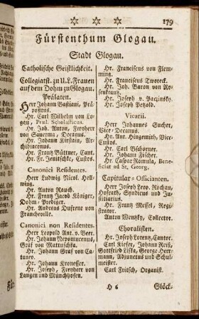
Fürstenthum Glogau.
Das Fürstenthum Glogau
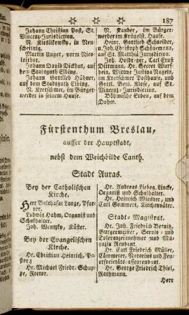
Fürstenthum Breslau, ausser der Hauptstadt, nebst dem Weichbilde Canth. - Fürstenthum Glogau.

Das achtzehende Capitel. Von dem Fürstenthum Glogau

Glogau Saganer Fürstentumslandschaft, Glogau
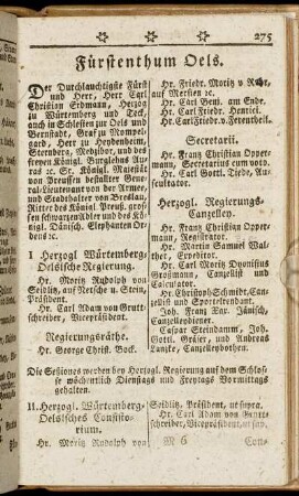
Fürstenthum Oels. - Fürstenthum Sagan.

Fürstenthum Schweidnitz. - Fürstenthum Wohlau.
Fürstenthum Jauer. - Fürstenthum Neiß.
Zuckerfabrik Glogau/Streitsache Stadt Glogau.- Glogau, Reg. Bez. Liegnitz
Landwirtschaftliche Handels-AG Glogau, Glogau
Glogau

Glogau
Fürstenthum Glogau.
Das Fürstenthum Glogau
Fürstenthum Breslau, ausser der Hauptstadt, nebst dem Weichbilde Canth. - Fürstenthum Glogau.
Das achtzehende Capitel. Von dem Fürstenthum Glogau
Glogau Saganer Fürstentumslandschaft, Glogau
Fürstenthum Oels. - Fürstenthum Sagan.
Fürstenthum Schweidnitz. - Fürstenthum Wohlau.
Fürstenthum Jauer. - Fürstenthum Neiß.
Zuckerfabrik Glogau/Streitsache Stadt Glogau.- Glogau, Reg. Bez. Liegnitz
Landwirtschaftliche Handels-AG Glogau, Glogau
Glogau
Glogau
Fürstenthum Glogau.
Das Fürstenthum Glogau
Fürstenthum Breslau, ausser der Hauptstadt, nebst dem Weichbilde Canth. - Fürstenthum Glogau.
Das achtzehende Capitel. Von dem Fürstenthum Glogau
Glogau Saganer Fürstentumslandschaft, Glogau
Fürstenthum Oels. - Fürstenthum Sagan.
Fürstenthum Schweidnitz. - Fürstenthum Wohlau.
Fürstenthum Jauer. - Fürstenthum Neiß.
Zuckerfabrik Glogau/Streitsache Stadt Glogau.- Glogau, Reg. Bez. Liegnitz
Landwirtschaftliche Handels-AG Glogau, Glogau
Glogau